- Saran district
-
Saran district
सारन जिला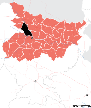
Location of Saran district in BiharState Bihar,  India
IndiaAdministrative division Saran Headquarters Chhapra Area 2,641 km2 (1,020 sq mi) Population 3,248,701 (2001) Population density 1,231 /km2 (3,190 /sq mi) Literacy 52.01 per cent[1] Sex ratio 966 Lok Sabha Constituencies Saran, Maharajganj Assembly Seats Ekma, Manjhi, Baniapur, Taraiya, Marhaura, Chapra, Garkha, Amnour, Parsa, Sonepur Major highways NH 28B, NH 85, NH 101, NH 102 Official website Saran District is one of the thirty-seven districts of Bihar state, India. The district, part of Saran Division, is also known as Chapra district after the headquarters of the district - Chapra. Hathwa Raj was a zamindari in the Saran Division of Bihar belonging to Bhumihar Brahmins which encompassed 1,365 villages, was inhabited by more than 391,000 people, and produced an annual rental of almost a million rupees.[2]
Contents
Geography
Saran district occupies an area of 2,641 square kilometres (1,020 sq mi),[3] comparatively equivalent to Canada's Moresby Island.[4]
Economy
In 2006 the Ministry of Panchayati Raj named Saran one of the country's 250 most backward districts (out of a total of 640).[5] It is one of the 36 districts in Bihar currently receiving funds from the Backward Regions Grant Fund Programme (BRGF).[5]
Demographics
According to the 2011 census Saran district has a population of 3,943,098 ,[6] roughly equal to the nation of Liberia[7] or the US state of Oregon.[8] This gives it a ranking of 60th in India (out of a total of 640).[6] The district has a population density of 1,493 inhabitants per square kilometre (3,870 /sq mi) .[6] Its population growth rate over the decade 2001-2011 was 21.37 %.[6] Saran has a sex ratio of 949 females for every 1000 males,[6] and a literacy rate of 68.57 %.[6]
- Population: Total: 2572980 Rural: 2338624 Urban: 234356
- S.C. Population: Total: 301306 Rural: 277217 Urban: 24089
- S.T. Population: Total: 3231 Rural: 2945 Urban: 286
Languages
Languages include Bhojpuri, a tongue in the Bihari language group with almost 40 000 000 speakers, written in both the Devanagari and Kaithi scripts.[9]
Divisions
- Sub Divisions: Chapra, Marhawrah, Sonepur
- Blocks: Chapra, Manjhi, Dighwara, Rivilganj, Parsa, Baniapur, Amnaur, Taraiya, Sonepur, Garkha, Ekma, Dariyapur, Jalalpur, Marhaura, Masarakh, Maker, Nagra, Panapur, Eisuapur, Lahladpur, Jantabazar
Culture
Notable personalities
- Jayaprakash Narayan Freedom fighter and politician
- Lalu Prasad Yadav [Former Chief-Minister]
- Rajiv Pratap Rudy [B.J.P Leader]
- Sanjay Singh [Actor & Producer]To know more about him please Google(actor sanjay singh or executive producer sanjay singh) has done schooling from Bajitpur high school and college from a n college patna.
References
- ^ "District-specific Literates and Literacy Rates, 2001". Registrar General, India, Ministry of Home Affairs. http://www.educationforallinindia.com/page157.html. Retrieved 2010-10-05.
- ^ Yang, Anand A. (1999). Bazaar India: Markets, Society, and the Colonial State in Bihar. University of California Press. pp. 305 (at page 69). ISBN 978-0520211001.
- ^ Srivastava, Dayawanti et al. (ed.) (2010). "States and Union Territories: Bihar: Government". India 2010: A Reference Annual (54th ed.). New Delhi, India: Additional Director General, Publications Division, Ministry of Information and Broadcasting (India), Government of India. pp. 1118-1119. ISBN 978-81-230-1617-7.
- ^ "Island Directory Tables: Islands by Land Area". United Nations Environment Program. 1998-02-18. http://islands.unep.ch/Tiarea.htm. Retrieved 2011-10-11. "Moresby Island 2,608km2"
- ^ a b Ministry of Panchayati Raj (September 8, 2009). "A Note on the Backward Regions Grant Fund Programme". National Institute of Rural Development. http://www.nird.org.in/brgf/doc/brgf_BackgroundNote.pdf. Retrieved September 27, 2011.
- ^ a b c d e f "District Census 2011". Census2011.co.in. 2011. http://www.census2011.co.in/district.php. Retrieved 2011-09-30.
- ^ US Directorate of Intelligence. "Country Comparison:Population". https://www.cia.gov/library/publications/the-world-factbook/rankorder/2119rank.html. Retrieved 2011-10-01. "Liberia 3,786,764 July 2011 est."
- ^ "2010 Resident Population Data". U. S. Census Bureau. http://2010.census.gov/2010census/data/apportionment-pop-text.php. Retrieved 2011-09-30. "Oregon 3,831,074"
- ^ M. Paul Lewis, ed (2009). "Bhojpuri: A language of India". Ethnologue: Languages of the World (16th edition ed.). Dallas, Texas: SIL International. http://www.ethnologue.com/show_language.asp?code=bho. Retrieved 2011-09-30.
External links

Siwan district Gopalganj district Muzaffarpur district Ballia district, Uttar Pradesh 
Vaishali district  Saran district

Bhojpur district Patna district Divisions and districts of Bihar, India Bhagalpur: Darbhanga: Kosi: Magadh: Munger: Patna: Purnia: Saran: Tirhut: Cities and towns in Saran Division Gopalganj district Saran district Siwan district See also Saran division topicsCities and towns
in other DivisionsSaran division topics General Hathwa RajDistricts Community development blocks Kuchaikote • ZiradeiRivers Transport Lok Sabha constituencies Vidhan Sabha constituencies Gopalganj Baikunthpur • Barauli • Gopalganj • Kuchaikote • Bhore • Hathua Siwan Siwan • Ziradei • Darauli • Raghunathpur • Daraunda • Barharia • Goriakothi • Maharajganj Saran Ekma • Manjhi • Baniapur • Taraiya • Marhaura • Chapra • Garkha • Amnour • Parsa • SonepurFormer Vidhan Sabha constituencies See also Cities and towns in Saran Division • Villages in Gopalganj district • Villages in Saran district • People from Siwan district • Bihar topicsOther Divisions Bhagalpur • Darbhanga • Kosi • Magadh • Munger • Patna • Purnia • TirhutCategories:

Wikimedia Foundation. 2010.