- Woolston, Southampton
-
This article is about Woolston, Southampton. For other places with the same name, see Woolston (disambiguation).
Coordinates: 50°53′35″N 1°22′35″W / 50.8931°N 1.3765°W
Woolston 
 Woolston
Woolston shown within SouthamptonUnitary authority Southampton Ceremonial county Hampshire Region South East Country England Sovereign state United Kingdom Post town SOUTHAMPTON Postcode district SO19 Dialling code 023 Police Hampshire Fire Hampshire Ambulance South Central EU Parliament South East England UK Parliament Southampton Itchen List of places: UK • England • Hampshire Woolston is a suburb of Southampton, Hampshire, located on the eastern bank of the River Itchen. It is bounded by the River Itchen, Hampshire, Sholing, Peartree Green, Itchen and Weston.
The area is rich in maritime and aviation history. The ancient hamlet grew as new industries, roads and railways came to the area in the Victorian era with Woolston being formally incorporated into the borough of Southampton in 1920.[1]
Contents
History
Main article: History of Woolston, SouthamptonWoolston is believed to originate from Olafs tun,[2] a fortified tun on the East bank of the River Itchen established by the Viking leader Olaf I of Norway in the 10th Century.
In the Domesday Book of 1086, the area is recorded as Olvestune.[2] The area now known as Woolston is certain to have received consignments of wool to be ferried across the River Itchen, Hampshire by the inhabitants of Itchen Ferry village. The evolution of Olvestune into "Woolston" is a result of that trade.
The ancient hamlet grew as new industries, roads and railways came to the area in the Victorian era with Woolston being formally incorporated into the borough of Southampton in 1920.[1]
Development of the Itchen Bridge in the 1970s, to link Woolston with the Southampton City Centre, required significant changes. Old terraces had to be demolished to make room for the new structure. However as the station that served passengers boarding and departing the Woolston ferry was no longer required, it was demolished and made way for many new townhouses to be built.
Now, at the start of the 21st century, Woolston is again experiencing a period of major change, with the closure of the Vosper Thorneycroft shipyard and the start of construction on Centenary Quay on the site.
Governance
Before 1920 Woolston was governed as part of the Itchen Urban District, from when it became part of Southampton, which later achieved city status and then became a unitary authority, governed by Southampton City Council.
Woolston is within the Woolston ward which also includes the neighbouring Weston. The ward elects three councillors to the city council, currently all Labour members: Carol Cunio; Warwick Payne and Richard Williams.[3]
The Woolston ward is within the Southampton Itchen parliamentary constituency, represented in the House of Commons by John Denham of the Labour Party since 1992.
The area is represented in the European Parliament within the South East England constituency.
Geography
Woolston is bounded by Sholing, Peartree Green and Weston; with the western boundary as the River Itchen. Its boundary with Weston is the stream that runs through Mayfield Park.[citation needed]
The nearest motorway is the M27; Woolston is closest to Junctions 7 and 8.
Demography
Economy
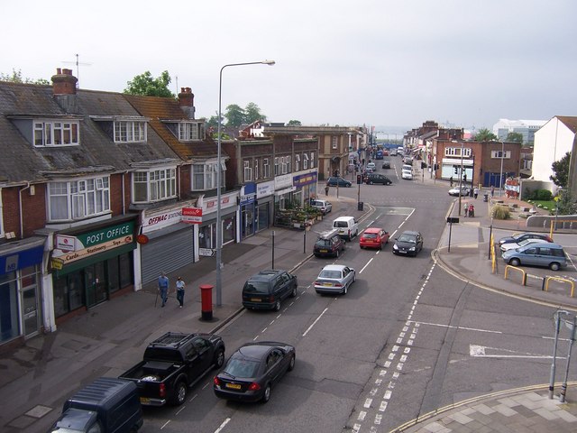
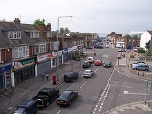 Bridge road shops
A busy shopping area centred around the Victoria Rd/Portsmouth Rd crossroads and by the Woolston Floating Bridge was bypassed by the Itchen Bridge, resulting in a loss of trade for the area.[citation needed]
There had been a shipbuilding site on Victoria Road since 1870, (from 1900 the Vosper Thorneycroft shipbuilding company) which was the major employer in Woolston until 31 March 2004 when Vosper Thorneycroft relocated its operations to Portsmouth.
A large 'supermarket style' Co-op was recently[when?] built on Victoria Road, to replace a smaller ageing shop on the same road. Woolston has several takeaways, along with the odd cafe and restaurant. The recession hit Victoria Road (Woolston's high street) hard, with many shops closing. On the 30th December 2008 Woolworths closed, and Adams (a children's clothing retailer) soon followed.
Woolston Riverside Regeneration
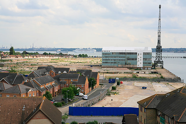
 The Site, May 2007
The Victoria Road shipyard site was acquired by the South East England Development Agency (SEEDA) in March 2003.[4] and finally vacated by Vosper Thorneycroft March 2004.[5]
The South East England Development Agency subsequently announced plans for the site, to be split into two sections:
- A residential and retail area, to be developed and delivered by Crest Nicholson under the brand name Centenary Quay.
- 8.2 hectares[5] for a marine employment quarter at the north of the site resulting in 820 employees - with plans developed by Dean and Dyball, but with SEEDA now responsible for the delivery of the site.[5] This sector will also include a 'upper tier budget hotel'.[5]
The marine and commercial section will include several quays for vessels:
Feature Description North Quay specialist working quay for repair and refit of vessels up to 75 m Centenary Quay main commercial quayside housing vessels up to 76 m. Central Basin working area focused around a large hoist dock or lift with associated pontoon berthing. South Quay new pier to accommodate feature vessels up to 65 m. The imminent redevelopment of that large waterside site seems likely to rejuvenate the shopping area, but the redevelopment has also been predicted to place extra burden on the Itchen Bridge and cause extra congestion in Woolston.[6] Developers of the residential site are reported to be considering the possibility of re-introducing a ferry service to Southampton.[7]
Work started on phase one of the Centenary Quay development July 2010. Phase one consists of creating family housing to the east of the site, as well as establishing a frontage to Victoria Road.
Houses have already been built on the land where the Royal Navy stores once stood. Clearing that brownfield site was a major exercise, complicated by old munitions, including Mustard Gas shells which had been buried in the ground and asbestos. The redevloped area is now in the district of Woolston [8]
Woolston is thus becoming more of a residential area, though it will still retain some marine industry with facilities to berth vessels of up to 76 m in length, including perhaps Tall ships.[9]
Landmarks
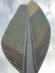 Millenium Feather
The Woolston Millennium Garden was created for the residents by a local group who wanted to give something back to the area and inject some pride into the area. Its focal point is a large metal feather intended to signify Woolston's history of flight and sail.
Transport
Woolston railway station is on the West Coastway Line, situated at the end of the Itchen Bridge and operated by South West Trains. The line from Southampton to Woolston was opened on 5 March 1866,[10] accessible from Bridge Road, with an extension opened in November 1967[10] to serve the Royal Victoria Military Hospital at Netley, where it originally terminated. The line was extended to Fareham on 2 September 1889,[10] whereupon it became possible to run through trains to Portsmouth via a separate line that had been built to link Eastleigh and Gosport in 1841.[10]
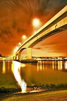 The Itchen Bridge
The Itchen Bridge is a toll bridge that crosses the River Itchen, from Woolston to the Chapel area of Southampton near Ocean Village and St. Mary's Stadium. The bridge was opened to traffic on 1 June 1977 and formally named on 13 June 1977 by Princess Alexandra.[11] Costing £5.7 million, the high-level concrete bridge spans 107 m between its central pillars and carries two lanes of traffic 24 m above the river, allowing large vessels to proceed further upstream to the wharfs and quays in Northam[clarification needed]. Tolls are charged for vehicles crossing the bridge, toll booths and a control room are situated at the Woolston end, however pedestrians and cyclists travel free. Nearly 600,000 vehicles a month use the bridge to cross the river.[citation needed] This is considerably more than were ever accommodated on the Woolston Floating Bridge, a cable ferry which served Woolston from 1938 until the opening of the bridge. Prior to the Floating Bridge, the Itchen ferry boats provided transport across the River Itchen.
There is a major bus stop on the Woolston link road (a separate entrance/exit to the Itchen Bridge not used by normal cars), with a number of (mostly First Group) buses running through the suburb.
Education
St. Mark's Infants school in Church Road, moved to new premises in Florence Road in 1974, becoming Woolston First School and now today is known as Woolston Infant School. Ludlow Infant School is situated on the same site as Ludlow Junior School, the largest Southampton primary school with 600 pupils[citation needed].
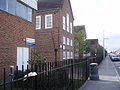
Woolston no longer provides education for pupils over the age of eleven, since Woolston School was controversially[12] closed in July 2008 to make way for Oasis Academy Mayfield.[13] The woolston school porchester road site is at present in the stages of being demolished to make way for new buildings (to be confirmed by the counsil). The former Key Stage 4 block has now been relocated to sholing Grove site as the new site has been completed as of July 2011. In february 2012 all students hope to start study at the newly built site Oasis Academy Mayfield- in Sholing.
City College Southampton operates a Marine Skills Centre on Hazel Road which runs vocational courses (usually for 16+ pupils).
Religious sites
Woolston has three Christian places of worship. St. Mark's Church, built in 1863[2] serves the Church of England community; St. Patrick's Church, built in 1884[2] serves the Roman Catholic community (the site also houses a catholic primary school) and there is a Kingdom Hall operated by Jehovah's Witnesses.
St. Mary's Presbyterian Church was built in 1876[2] but was demolished in 1972.[1][14]
Leisure and community
The Archery Grounds, bounded by Swift Road and Archery Road, consists of a large grass space, with a children's play area. There is a path leading through to Mayfield Park, a partially wooded, partially open recreational area situated on the border of Woolston and neighbouring Weston.
The building that was previously St. Mark's Infants School in Church Road is now Woolston Community Centre.
Public services
The fire station in Portsmouth Road was no longer required once the Itchen Bridge provided easy access for the fire crews at St Mary's on the Southampton side of the river. That old building is now a Doctors surgery.
Notable people
- Jack Ayles, scientist[citation needed]
Gallery
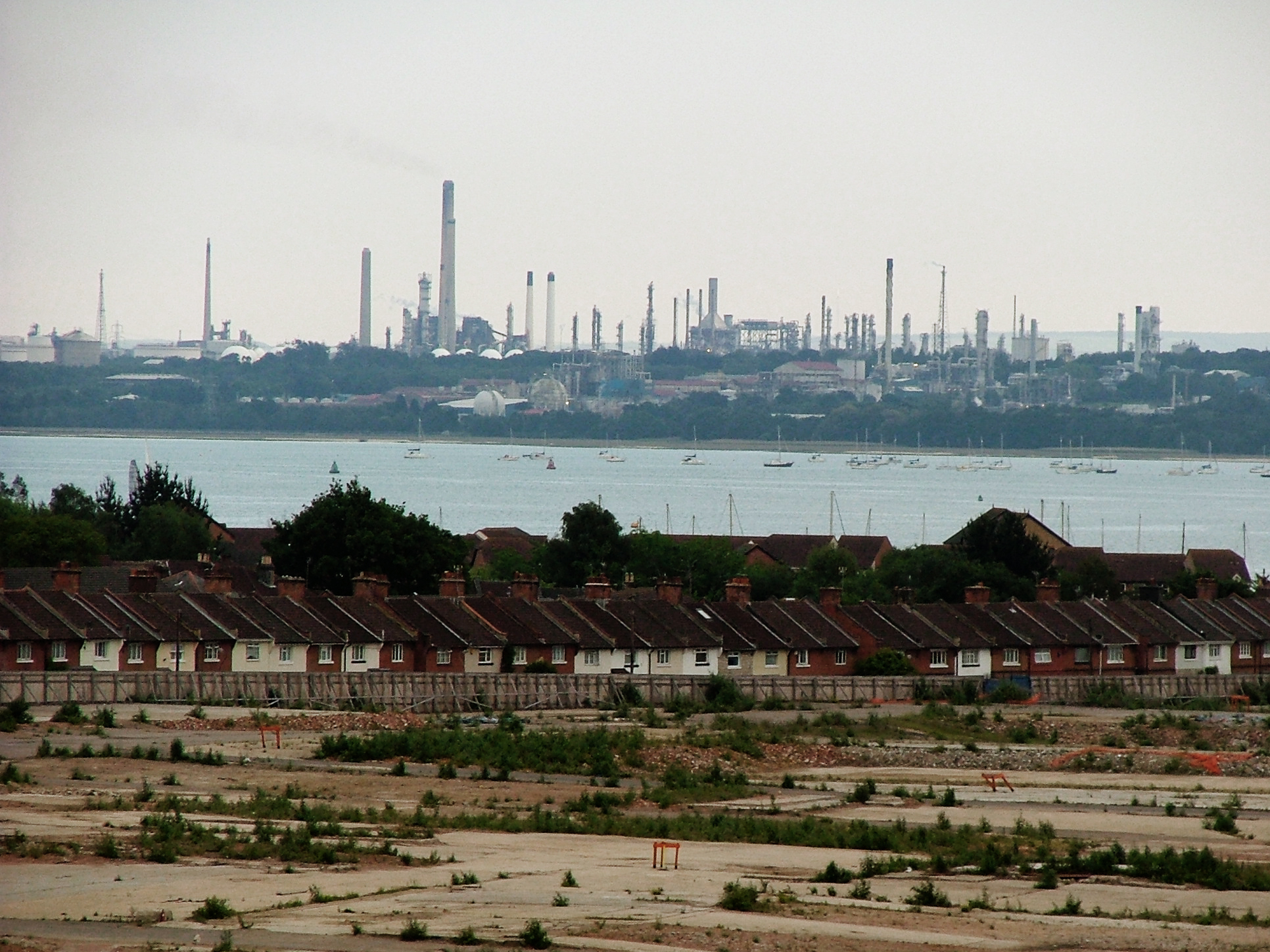
-
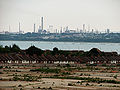
View over the site of the shipyard and Southampton Water to Fawley.
-
Woolston School, October 2007.
References
- ^ a b c Wyeth-Gadd, Eric (1979). Southampton in the twenties. ISBN 0-86146-003.
- ^ a b c d e Brown, Jim (September 2004). The Illustrated history of Southampton's Suburbs. Breedon Books Publishing Co Ltd. ISBN 1-85983-405-1.
- ^ Find your local Councillor
- ^ SEEDA Board meeting, 22 January 2004
- ^ a b c d "Centenary Quay Woolston: Planning Statement" (pdf) (Press release). Crest Nicholson. 2008-03. http://www.webcitation.org/5rcEOVF8T.
- ^ Southampton Daily Echo, 19 April 2008
- ^ Southampton Daily Echo. 19 April 2008
- ^ Southampton City Council. Southampton Online. Southampton Property search
- ^ Crest Nicholson, Woolston riverside website
- ^ a b c d Mitchell, Vic; Smith, Keith. South Coast Railways - Portsmouth to Southampton. ISBN 0-906520-31-2.
- ^ Southampton Echo, 13th June 1977
- ^ "Another schools protest is at the door, councillors". The Southern Daily Echo (Newsquest Media Group). 10:07am Thursday 8 June 2006. http://www.dailyecho.co.uk/search/787038.Another_schools_protest_is_at_the_door__councillors/. Retrieved 2009-01-02.
- ^ "Four schools will be axed". The Southern Daily Echo (Newsquest Media Group). 4:08pm Tuesday 3 July 2007. http://www.dailyecho.co.uk/search/1516605.Four_schools__will_be_axed/. Retrieved 2009-01-02.
- ^ Southampton. A pictorial peep into the past, Southern Newspapers Ltd, 1980
Areas and Suburbs of Southampton City of Southampton Electoral Wards (and their neighbourhoods) listed by Constituency — sources: 1 2.Southampton Itchen Bargate Ward (City Centre, Ocean Village, The Polygon, St Mary's) • Bitterne Ward (Bitterne, Thornhill) • Bitterne Park Ward (Bitterne Park, Bitterne Manor, Midanbury, Townhill Park) • Harefield Ward (Harefield) • Peartree Ward (Peartree Green) • Sholing Ward (Sholing) • Woolston Ward (Woolston, Weston)Southampton Test Bevois Ward (Bevois Valley, Nicholstown, Northam) • Coxford Ward (Lordshill, Lordswood) • Freemantle Ward (Freemantle) • Millbrook Ward (Millbrook, Regents Park) • Portswood Ward (Portswood, Highfield, St Denys) • Redbridge Ward (Redbridge, Maybush) • Shirley Ward (Shirley, Southampton Common)Romsey and Southampton North Areas of Greater Southampton outside the City boundary include Chartwell Green, Chilworth, Nursling, Rownhams, Eastleigh, Totton, and West End.Categories:- Districts of Southampton
- Southampton
- Electoral wards in Hampshire


Wikimedia Foundation. 2010.