- Chartwell Green
-
Coordinates: 50°56′N 1°21′W / 50.93°N 1.35°W
Chartwell Green / Townhill Farm 
 Chartwell Green / Townhill Farm
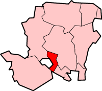
Chartwell Green / Townhill Farm shown within HampshireOS grid reference SU457147 Parish West End District Eastleigh Shire county Hampshire Region South East Country England Sovereign state United Kingdom Post town SOUTHAMPTON Postcode district SO18 3 Dialling code 023 Police Hampshire Fire Hampshire Ambulance South Central EU Parliament South East England UK Parliament Eastleigh List of places: UK • England • Hampshire Chartwell Green is a suburb of Southampton, England, although it falls outside of the formal city boundary. Instead, Chartwell Green is part of the West End parish, within the Borough of Eastleigh.
The main parade of shops in Chartwell Green is sometimes referred to as Townhill Farm, after the nearby Townhill Park House. The Townhill Farm Community Centre was built in 1991 and comprises an entrance foyer, toilets, a main hall with adjacent store room, a committee room and adjacent kitchen, and a café area overlooking a patio and garden.[1] The building is owned by Southampton City Council and is on a 125-year lease; until 2006, it was managed by Eastleigh Borough Council but then this task was transferred to West End Parish Council.[2]
The bulk of Chartwell Green was built in the late 1980s, and comes under the postal code of SO18 3xx.
References
- ^ Riddell, Jon; Helen Coleman (24 July 2006). "Report of the Area Co-ordinator in consultation with the". Hedge End, West End and Botley Local Area Committee. http://www.eastleigh.gov.uk/meetings/mgConvert2PDF.asp?ID=8056. Retrieved 2008-01-04.
- ^ Riddell, Jon (4 September 2006). "Report of the Area Co-ordinator in consultation with the Head of". Hedge End, West End and Botley Local Area Committee. http://www.eastleigh.gov.uk/meetings/mgConvert2PDF.asp?ID=8202. Retrieved 2008-01-04.
The Borough of Eastleigh 
Bishopstoke | Botley | Boyatt Wood | Bursledon | Chandler's Ford | Chartwell Green | Eastleigh | Fair Oak | Hamble-le-Rice | Hedge End | Hiltingbury | Horton Heath | Hound | Netley | North Stoneham | West End
Areas and Suburbs of Southampton City of Southampton Electoral Wards (and their neighbourhoods) listed by Constituency — sources: 1 2. Southampton Itchen Bargate Ward (City Centre, Ocean Village, The Polygon, St Mary's) • Bitterne Ward (Bitterne, Thornhill) • Bitterne Park Ward (Bitterne Park, Bitterne Manor, Midanbury, Townhill Park) • Harefield Ward (Harefield) • Peartree Ward (Peartree Green) • Sholing Ward (Sholing) • Woolston Ward (Woolston, Weston)Southampton Test Bevois Ward (Bevois Valley, Nicholstown, Northam) • Coxford Ward (Lordshill, Lordswood) • Freemantle Ward (Freemantle) • Millbrook Ward (Millbrook, Regents Park) • Portswood Ward (Portswood, Highfield, St Denys) • Redbridge Ward (Redbridge, Maybush) • Shirley Ward (Shirley, Southampton Common)Romsey and Southampton North Areas of Greater Southampton outside the City boundary include Chartwell Green, Chilworth, Nursling, Rownhams, Eastleigh, Totton, and West End. Categories:- Eastleigh
- Districts of Southampton
- Hampshire geography stubs

Wikimedia Foundation. 2010.