- Midanbury
-
Coordinates: 50°55′34″N 1°21′53″W / 50.926°N 1.3646°W
Midanbury 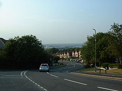
The view over the Itchen Valley from Midanbury
 Midanbury
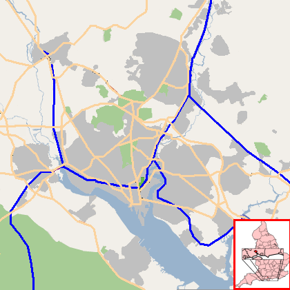
Midanbury shown within SouthamptonUnitary authority Southampton Ceremonial county Hampshire Region South East Country England Sovereign state United Kingdom Post town SOUTHAMPTON Postcode district SO18 Dialling code 023 Police Hampshire Fire Hampshire Ambulance South Central EU Parliament South East England UK Parliament Southampton Itchen List of places: UK • England • Hampshire Midanbury is a small suburb of Southampton, England, bordering Bitterne, Bitterne Park and Townhill Park.
Contents
History
It is named after the country house "Midanbury Lodge" which was situated on the summit of a hill to the east of Southampton. The house no longer stands, and the land was used for intense house building. The only clue to the existence of the house is the name of the pub in the area, "The Castle", which was named after the crenellated gates of the house. The remains of the cellars could clearly be seen in the 50's at the north end of Midanbury Crescent before it was developed from the original two bungalows. An odd thing about the address for Midanbury Crescent was that it was in Bitterne Park and not Midanbury.
Today
The boundaries of the suburb are not clearly defined, although the hub of Midanbury is the row of shops at the top of Witt's Hill, sometimes referred to as Midanbury Broadway, but more commonly called 'The Castle', in reference to The Castle pub situated at the end of the broadway.
Controversy
The shop "Alldays" (now a branch of the Co-Op) on Midanbury Broadway briefly made headlines in 2002, when it was revealed that store staff had caught a shoplifter and requested the police attend, but the police responded that they were too busy and asked the staff to make sure the shoplifter was caught on CCTV before letting him go. The incident was reported in most tabloid newspapers and was a source of embarrassment to Hampshire Constabulary.
External links
Around Southampton
Areas and Suburbs of Southampton City of Southampton Electoral Wards (and their neighbourhoods) listed by Constituency — sources: 1 2. Southampton Itchen Bargate Ward (City Centre, Ocean Village, The Polygon, St Mary's) • Bitterne Ward (Bitterne, Thornhill) • Bitterne Park Ward (Bitterne Park, Bitterne Manor, Midanbury, Townhill Park) • Harefield Ward (Harefield) • Peartree Ward (Peartree Green) • Sholing Ward (Sholing) • Woolston Ward (Woolston, Weston)Southampton Test Bevois Ward (Bevois Valley, Nicholstown, Northam) • Coxford Ward (Lordshill, Lordswood) • Freemantle Ward (Freemantle) • Millbrook Ward (Millbrook, Regents Park) • Portswood Ward (Portswood, Highfield, St Denys) • Redbridge Ward (Redbridge, Maybush) • Shirley Ward (Shirley, Southampton Common)Romsey and Southampton North Areas of Greater Southampton outside the City boundary include Chartwell Green, Chilworth, Nursling, Rownhams, Eastleigh, Totton, and West End. Categories:- Districts of Southampton
- Southampton

Wikimedia Foundation. 2010.