- Montvale (Worcester, Massachusetts)
-
Montvale

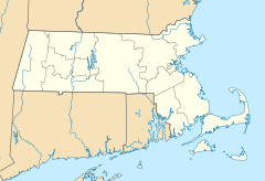
Location: Properties along Montvale, Monadnock, Sagamore, Waconah, and Whitman Rds., and Salisbury St., Worcester, Massachusetts Coordinates: 42°16′52″N 71°48′43″W / 42.28111°N 71.81194°WCoordinates: 42°16′52″N 71°48′43″W / 42.28111°N 71.81194°W Built: 1851 Architectural style: Colonial Revival, Greek Revival, Queen Anne Governing body: Private MPS: Worcester MRA NRHP Reference#: 80000521
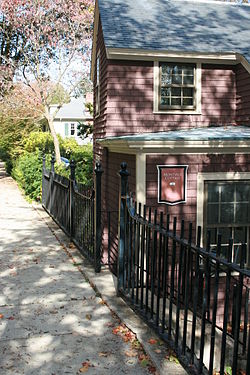
[1]Added to NRHP: March 05, 1980 Montvale is a historic district comprising properties along Montvale, Monadnock, Sagamore, Waconah, and Whitman Roads, and Salisbury Street in Worcester, Massachusetts.
It was built in 1851 and added to the National Register of Historic Places in 1980.
Most notable for the Frank C. Harrington house located on Monadnock Road.
References
- ^ "National Register Information System". National Register of Historic Places. National Park Service. 2008-04-15. http://nrhp.focus.nps.gov/natreg/docs/All_Data.html.
U.S. National Register of Historic Places Topics Lists by states Alabama • Alaska • Arizona • Arkansas • California • Colorado • Connecticut • Delaware • Florida • Georgia • Hawaii • Idaho • Illinois • Indiana • Iowa • Kansas • Kentucky • Louisiana • Maine • Maryland • Massachusetts • Michigan • Minnesota • Mississippi • Missouri • Montana • Nebraska • Nevada • New Hampshire • New Jersey • New Mexico • New York • North Carolina • North Dakota • Ohio • Oklahoma • Oregon • Pennsylvania • Rhode Island • South Carolina • South Dakota • Tennessee • Texas • Utah • Vermont • Virginia • Washington • West Virginia • Wisconsin • WyomingLists by territories Lists by associated states Other This article about a National Register of Historic Places listing in Worcester County, Massachusetts is a stub. You can help Wikipedia by expanding it.

