- Miranda railway station
-
 Miranda
Eastern Suburbs & Illawarra Line Station code MIJ Suburb South Miranda Street(s) Kiora Road Distance from Central Station 29.51 km Altitude (above sea level) ? m Types of stopping trains Suburban all stops Number of platforms 2 Number of tracks 2 Platform arrangement 1 Island Type of station Ground Ticket barriers No Transfers available Bus Disabled access 
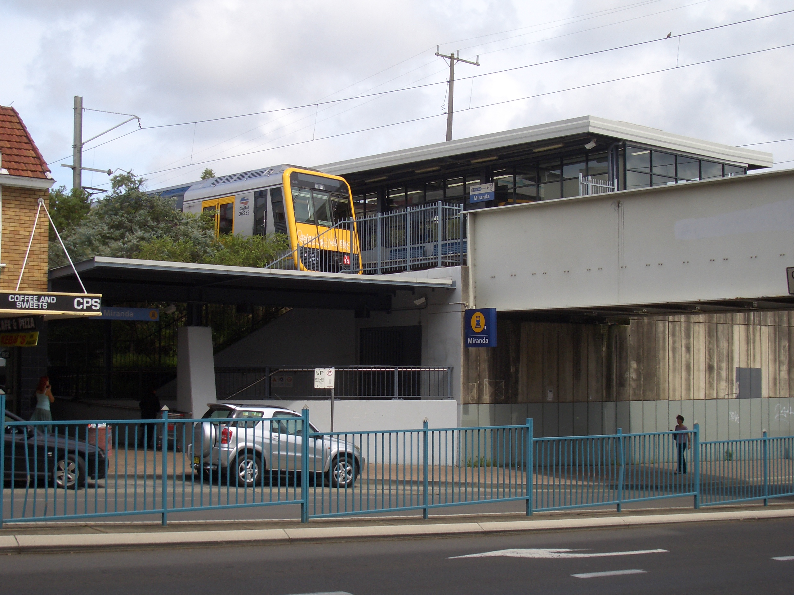
Yes Station facilities Link Miranda is a CityRail railway station on the Cronulla branch line of Sydney's Illawara line. Located in the Sydney suburb of Miranda, it serves a residential area and the Sutherland Shire's main shopping centre Westfield Shoppingtown Miranda (known locally as "Miranda Fair"). It has an island platform.
Contents
Platforms and services
The station is served by four trains per hour each way, with additional trains during weekday peak hours.
Platform Line Stopping Pattern Notes 
Eastern Suburbs & Illawarra Line all stations and limited stops services to Hurstville, Central and Bondi Junction via Central 
Eastern Suburbs & Illawarra Line all stations services to Cronulla Access
The station has stairs and lifts providing Easy Access for wheelchairs. In the past, Miranda station had a ramp connected to the streets on either side.
History
Miranda station opened in 1939, when the residential area was first being developed. The line through Miranda was single track at that time and was duplicated in 1985. Originally, the single-track platform was carried across Kiora Road by a separate girder bridge. The 1939 platform building is the last remaining feature of the original station.
Transport links
Miranda is the largest bus interchange in the Sutherland Shire. Buses operate to and from Miranda station from many bus bays at Westfield Miranda, which is next to the station.
Sydney Buses
- 474 - arrives from Ramsgate (AM) or Caringbah (PM) via Taren Point (school days only)
- 477 - to Rockdale station via Taren Point, Sans Souci, Ramsgate and Kogarah
- 478 - to Rockdale station via Taren Point, Dolls Point, Ramsgate, Monterey and Brighton-Le-Sands (Limited weekday off peak service)
- 961 - to Barden Ridge via Sutherland
- 962 - to Bankstown via Padstow, Menai and Sutherland
- 967 - to Como West via Oyster Bay and Jannali
- 968 - to Bonnet Bay via Kareela and Jannali
- 969 - to Sutherland via Kirrawee OR Cronulla via North Caringbah and Hospital
- 970 - to Hurstville via Sylvania Heights, Blakehurst and South Hurstville
- 971 - to Hurstville via Port Hacking Road, Southgate, Blakehurst and South HurstvilleOR Cronulla via [Sutherland Hospital] and Burraneer Bay Road
- 972 - to Southgate or Kangaroo Point via Sylvania Waters
- 973 - to Yowie Bay
- 974 - to Gymea Bay via Gymea
- 975 - to Grays Point (loop service)
- 986 - to Miranda North
Caringbah Buses runs two routes to Miranda:
- 977 - to Lilli Pilli via Caringbah
- 978 - to Port Hacking via Caringbah
Gallery
-

Staircase towards the platform
Neighbouring stations
Preceding station CityRail Following station Caringbahtowards CronullaEastern Suburbs & Illawarra Line
Cronulla BranchGymeatowards Bondi JunctionEastern Suburbs
& Illawarra Line- Bondi Junction
- Edgecliff
- Kings Cross
- Martin Place
- Town Hall
- Central
- Redfern
- Sydenham
- Tempe
- Wolli Creek
- Arncliffe
- Banksia
- Rockdale
- Kogarah
- Carlton
- Allawah
- Hurstville
- Penshurst
- Mortdale
- Oatley
- Como
- Jannali
- Sutherland
- Loftus
- Engadine
- Heathcote
- Waterfall
- Kirrawee
- Gymea
- Miranda
- Caringbah
- Woolooware
- Cronulla
(stations in italics are under planning or under construction)CityRail LinesSuburban - Eastern Suburbs & Illawarra
- Bankstown
- Inner West
- Airport & East Hills
- South
- Cumberland
- Western
- North Shore
- Carlingford
- Olympic Park
- Northern
Interurban and regional - South Coast
- Southern Highlands
- Blue Mountains
- Newcastle & Central Coast
- Hunter
Under construction or planning: South West Rail Link, North West Rail LinkCoordinates: 34°02′10″S 151°06′08″E / 34.036244°S 151.102121°E
Categories:- Railway stations in Sydney
- Railway stations opened in 1939


Wikimedia Foundation. 2010.