- Little Bay Islands
-
For other islands named Goat Island, see Goat Island.
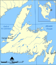
Little Bay Islands — Town — A dock in Little Bay Islands Location of Little Bay Islands in Newfoundland Coordinates: 49°38′39″N 55°47′26″W / 49.64417°N 55.79059°W Country  Canada
Province  Newfoundland and Labrador
Population – Total 150 Time zone Newfoundland Time (UTC-3:30) – Summer (DST) Newfoundland Daylight (UTC-2:30) Area code(s) 709 Little Bay Islands is a community in Newfoundland and Labrador, Canada. It consists of Little Bay Island, Macks Island, Goat Island, Harbour Island, and Boatswain Tickle Island. The highest mount is Campbell Hill, which is 125 m high.
It is located in Notre Dame Bay, near Springdale. A ferry serves the island several times daily.
The island has a population of about 100. There is a school used by only 2kid and there only teacher, fire station, two churches, a bed and breakfast, the only employment source, a crab processing plant, was closed not so long ago. leaving the community jobless.
For its size, Little Bay Islands attracts a fair amount of tourism. There are several trails for hiking and all terrain vehicles.
See also
 Subdivisions of Newfoundland and Labrador
Census divisions Cities Other communities Bishop's Falls · Bonavista · Botwood · Carbonear · Channel – Port aux Basques · Clarenville · Conception Bay South · Deer Lake · Ferryland · Fogo · Gander · Grand Bank · Grand Falls-Windsor · Happy Valley – Goose Bay · Harbour Grace · Hopedale · Labrador City · Marystown · Nain · Norris Arm · Pasadena · Peterview · Placentia · Red Bay · St. Anthony · Stephenville · Twillingate · Torbay · Woody Point · Makkovik Category:Newfoundland and Labrador ·
  Portal:Newfoundland and Labrador ·
  WikiProject:Newfoundland and Labrador
Coordinates: 49°38′41″N 55°47′55″W / 49.64477°N 55.79853°W
Categories:- Towns in Newfoundland and Labrador
- Islands of Newfoundland and Labrador
- Newfoundland and Labrador geography stubs
Wikimedia Foundation. 2010.


