- Butterworth–Kulim Expressway
-
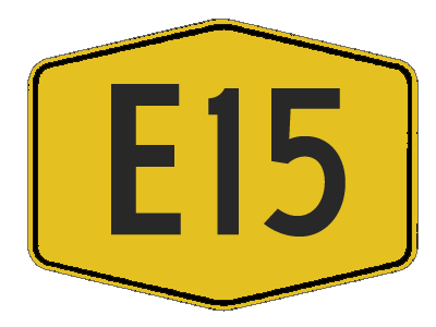
E15 Expressway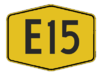
Butterworth-Kulim Expressway Route information Maintained by PLUS Expressway Berhad and Konsortium Lebuhraya Butterworth-Kulim (KLBK) Sdn Bhd Length: 17 km (10.6 mi) Existed: 1994 – present History: Completed in 1996, opened on 15 November 1996 Major junctions West end: Seberang Jaya, Penang 
 Butterworth Outer Ring Road
 AH2 North-South Expressway Northern route
 Federal Route 136
 Jalan Kulim Hi-Tech
 Federal Route 67
East end: Lunas, Kedah Location Primary
destinations:Butterworth, Seberang Jaya, Prai, Permatang Pauh, Lunas, Kulim, Baling Highway system Butterworth–Kulim Expressway, BKE
 (Malay: Lebuhraya Butterworth-Kulim) is an expressway in Malaysia. The 17 km (11 mi) expressway connects Butterworth, Penang in the west to Kulim, Kedah in the east. It is also a main route to East-West Highway (Federal route
  ) via Baling, Kedah and Gerik, Perak.
Contents
Route background
The Kilometre Zero of the expressway starts at Sungai Nyior junctions in Butterworth, Penang.
History
The construction of BKE started in December 1994 and completed in September 1996.
KLBK Sdn Bhd
Konsortium Lebuhraya Butterworth-Kulim (KLBK) Sdn Bhd, commercially known as Buterworth Kulim Expressway (BKE) a wholly owned subsidiary of PLUS Expressway Berhad ("PLUS Expressways") has been awarded the concession and contract to construct and operate the highway of dual two (2) lane carriageway with separate motorcycle tracks and related highway facilities for the 16.78 km highway. The concession period is for thirty-two (32) years (June 1994 to June 2026, including 2 years construction period), after which the highway will be transferred to the Government.
Features
- Geographically, the terrain between KM 5.00 (start point) and KM 11.00 is rather flat, passing through paddy field areas. From KM 11.00 to KM 19.00, the terrain is slightly undulating, where cut and fill slopes are common features. The terrain is again flat from KM 19.00 to KM 21.78 (end point), mainly passing through the estates and developing residential areas.
- Geometrically, there are four (4) grades separated interchanges and one (1) at grade interchange along BKE. Moreover, there are nine (9) reinforced concrete bridges (three (3) of those are river bridges, ie. Sungai Mengkuang, Sungai Kulim and Sungai Karangan, whereas the rest are bridges over local roads or railway track).
- Tuanku Bainun Teachers Training Institute (Institut Perguruan Tuanku Bainun) (IPTB)
- High speed limit 90 km/h
- Four-lane dual carriageway
- SOS Emergency phones
- Dedicated motorcycle lane
Toll rates
Class Type of vehicles Rate (in Malaysian Ringgit (RM)) 0 Motorcycles Free 1 Vehicles with 2 axles and 3 or 4 wheels excluding taxis RM 1.60 2 Vehicles with 2 axles and 5 or 6 wheels excluding buses RM 3.20 3 Vehicles with 3 or more axles RM 4.80 4 Taxis RM 0.80 5 Buses RM 0.80 List of interchange
km Exit Interchange To Remarks WEST
North Butterworth Container TerminalBUTTERWORTH  BUTTERWORTH OUTER RING ROAD
NORTH
Bagan Ajam
Sungai Dua
SOUTH
Pengkalan Sultan Abdul Halim
(Ferry Terminal = Ferry to Penang Island)
Perai
Bukit MertajamDiamond interchange Sungai Nyior NORTH
JALAN SIRAM
Bagan Ajam
SOUTH
JALAN SUNGAI NYIOR
Jalan Chain Ferry
(Ferry Terminal = Ferry to Penang Island)Junctions Sungai Perai Bridge JKR border limit BUTTERWORTH-KULIM EXPRESSWAY
Start/End of Expressway
PLUS Expressways border limit
0SEBERANG JAYA INTERCHANGE AH2 NORTH-SOUTH EXPRESSWAY NORTHERN ROUTE
NORTH
Bukit Kayu Hitam
Alor Setar
SOUTH
Kuala Lumpur
Ipoh
George TownMulti-level stacked roundabout interchange PERMATANG PAUH INTERCHANGE P7 Permatang Pauh
P7 Simpang EmpatDiamond interchange Kubang Semang Toll Plaza
KSTP
RM (Cash) TnG TAG TAG TnG RM (Cash)
Opened toll system
Pay tollP Kubang Semang Toll Plaza
KSTP
East bound Sungai Kubang Semang bridge PERMATANG NIBONG INTERCHANGE P3 Permatang Nibong
P188 Kubang Semang
P3 Bukit MertajamDiamond interchange Railway crossing bridge TASIK MENGKUANG INTERCHANGE P129 Penanti
P129 Berapit
P129 Empangan Tasik MengkuangDiamond interchange R&RPenanti Rest and Service Areas 


Both bound Penang
Seberang Perai Tengah district borderKedah-Penang border Kedah Darul Aman
Kulim district borderP Lunas toll plaza
LNSWest bound Lunas toll plaza
LNS
RM (Cash) TnG TAG TAG TnG RM (Cash)
Opened toll system
Pay tollSungai Kulim bridge LUNAS INTERCHANGE NORTH
P3 Kepala Batas
P119 Tasek Gelugor
Lunas Town Centre
SOUTH
Kelang Lama
KulimDiamond interchange SUNGAI SELUANG INTERCHANGE K811 Sungai Seluang
Sidam
Padang SeraiDiamond interchange BUTTERWORTH-KULIM EXPRESSWAY
Start/End of Expressway
PLUS Expressways border limitJKR border limit Kulim High Tech SOUTH
JALAN KULIM HI-TECH
Kulim Hi-Tech
Kulim
Karangan
SerdangInterchange Jalan Sungai Petani-Baling WEST
Sungai Petani
Kuala Ketil
EAST
Baling
Pengkalan Hulu
GerikT-junctions External links
PLUS Expressway Networks North-South Expressway Northern Route (including New Klang Valley Expressway) •  North-South Expressway Southern Route •
  Second Link Expressway •
  North-South Expressway Central Link (including Putrajaya Link) • Butterworth-Kulim Expressway •
  Seremban-Port Dickson Highway • Skudai Highway (until 1 March 2004) and Johor-Singapore Causeway •
  Federal Highway
Malaysian Expressway System History 
Interstate North–South Expressway Northern Route (including New Klang Valley Expressway) · North–South Expressway Southern Route · North–South Expressway Central Link (including Putrajaya Link) (NSECL/ELITE) ·  Kuala Lumpur-Karak Expressway and East Coast Expressway (LPT/ECE) · Butterworth–Kulim Expressway (BKE) ·
  Kajang–Seremban Highway (LEKAS/KASEH) ·
  ^ West Coast Expressway (LPB/WCE) ·
  ^ Paroi-Senawang-KLIA Expressway (PSKE) · ^ Central Spine Expressway (CSE/LRUT)
Greater Kuala Lumpur/Klang Valley
and Selangor New Klang Valley Expressway (part of the North–South Expressway Northern Route) ·  Shah Alam Expressway (SAE/KESAS) ·
  Cheras–Kajang Expressway (CKE/Grand Saga) ·
  Sungai Besi Expressway (SBE/BESRAYA) (including # Shamelin Expressway or Besraya Extension Expressway) ·
  New Pantai Expressway (NPE) ·
  Damansara-Puchong Expressway (LDP) ·
  Ampang – Kuala Lumpur Elevated Highway (AKLEH) ·
  Kemuning – Shah Alam Highway (LKSA) ·
  Kajang Dispersal Link Expressway (SILK) ·
  Maju Expressway (MEX) (Kuala Lumpur – Putrajaya Expressway (KLPE) and KL-KLIA Dedicated Expressway) ·
  Sprint Expressway (Kerinchi Link, Damansara Link and Penchala Link) ·
  Kuala Lumpur – Kuala Selangor Expressway (KLS) (Assam Jawa-Templer Park Highway (LATAR)) ·
  South Klang Valley Expressway (SKVE) ·
  New North Klang Straits Bypass (NNKSB) ·
  Duta – Ulu Klang Expressway (DUKE) ·
  Guthrie Corridor Expressway (GCE) ·
  East–West Link Expressway and Kuala Lumpur – Seremban Expressway ·
  Stormwater Management and Road Tunnel (SMART Tunnel) · ^ Kuala Lumpur Outer Ring Road (KLORR) · ^ Guthrie-Damansara Expressway (GDE) · ^ Kuala Lumpur Arah Serendah Expressway (KLAS) · ^ Serdang-Kinrara-Putrajaya Expressway (SKIP)
Iskandar Malaysia and Johor Second Link Expressway (Malaysia–Singapore Second Link) (MSSC/LINKEDUA) ·  # JB Eastern Dispersal Link ·
  Senai–Desaru Expressway (SDE)
Penang Butterworth Outer Ring Road (BORR) · # Penang Outer Ring Road (PORR) · # Penang Second Bridge ·  Penang Bridge · ^ Sungai Juru Expressway
Kedah and Perak  Ipoh–Lumut Expressway · ^ Jelas Expressway (Jelas) · ^ South Kedah Expressway (Lekas)
Others Categories:- Expressways in Malaysia
- North–South Expressway Networks, Malaysia
- Expressways and highways in Penang

Wikimedia Foundation. 2010.