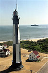
- Dutch Gap Canal Lights
-
Dutch Gap Canal Lights Location James River, Virginia Coordinates 37°22′35.7″N 77°21′34.3″W / 37.376583°N 77.359528°WCoordinates: 37°22′35.7″N 77°21′34.3″W / 37.376583°N 77.359528°W Year first constructed 1875 (first structures) Year first lit 1878 (replaced with posts) Deactivated 1910 Construction Wood frame Height 27 ft (8 m) Original lens Small oil lanterns Characteristic Fixed Fog signal none The Dutch Gap Canal Lights were built to mark the ends of Dutch Gap Canal, now called Dutch Gap Cutoff[2], which is a ¾ nm cut across the base of an oxbow in the James River between Hopewell and Richmond, Virginia. They were on Farrar's Island, on the south side of the river.[1][2] The ox-bow is actually just to the west of Dutch Gap,[2] which is now a conservation area.
The first two structures were small wood frame towers, together with a keeper's house, which were built in 1875. The second tower washed away in December 1878; the first had been lost earlier. Both were replaced by lights on posts. The keeper's house was threatened by erosion of the cliff and was moved inland in 1890.[1]
In 1910 the lights were replaced by fixed lights. Their function survives, in modern form, as lights on skeleton towers, both with the characteristic Quick Flashing Green, numbers "151" and "155", Light List numbers 2-12705 and 2-12735.[3] The coordinates shown are for light 151 which is actually in the river. The original light was on the bank to the south.
References
- ^ a b c "Historic Light Station Information and Photography: Virginia". United States Coast Guard Historian's Office. http://www.uscg.mil/history/weblighthouses/LHVA.asp.
- ^ a b c d NOAA Chart 12252 James River: Jordan Point to Richmond, 1/20,000 2004
- ^ (PDF) Light List, Volume II, Atlantic Coast, Shrewsbury River, New Jersey to Little River, South Carolina. Light List. United States Coast Guard. 2009. p. 125. http://www.navcen.uscg.gov/pdf/lightLists/LightList%20V2.pdf.
 Categories:
- Lighthouses in Virginia
- James River (Virginia)
- Buildings and structures completed in 1875
- 1910 disestablishments
- Chesterfield County, Virginia
Wikimedia Foundation. 2010.

