- Central Zone of São Paulo
-
Central Zone of São Paulo
Zona Central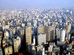 Location of Central Zone of São Paulo
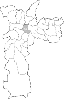
Country  Brazil
State  São Paulo
City  São Paulo
Subprefectures Central Zone- Sé
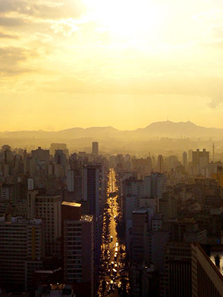
Area – Total 8.3 km2 (3.2 sq mi) The Central Zone is an Administrative Zone of São Paulo, Brazil. The Central Zone São Paulo (or Downtown Zone São Paulo, or simply Center São Paulo) is an Administrative Zone, Commercial District, and third major Central Business District of São Paulo.
The region is administered by Subprefecture of Sé encompassing the neighborhoods and districts Bela Vista, Bom Retiro, Cambuci, Consolação, Aclimação, Bras, Liberdade, República, Sé and Santa Cecília. Not to be confused with the region known as Downtown Expanded, used eventually by the city government in actions urban planning, which also includes parts of the subdistricts of the Mooca, Lapa, Pinheiros and Vila Mariana or with Historic Center São Paulo Which includes only the oldest part of the central region.
The region is since the 1970s one of the largest Financial Districts of South America and Latin America.
Contents
Limits
Officially, the central area is bounded by districts of Municipality Cathedral. However, the social perception of what is called "center of Sao Paulo" varies and may include other areas of city. Until the creation of the administrative office of the Cathedral, the notion of "center" was equivalent to the region of the former Administration Regional Office, who also included the districts of Bras and Pari - Currently covered by an Municipality of Mooca - Interpretation is also found today. The concept of a central area of São Paulo, however, is wider depending on the study is done about the region and may include items such as financial centers Paulista Avenue and Berrini.
Districts Population HDI Santa Cecília 71.179 hab. 0,930 Bela Vista 63.190 hab. 0,940 Liberdade 61.875 hab. 0,936 Consolação 54.522 hab. 0,950 República 47.718 hab. 0,901 Cambuci 28.717 hab. 0,903 Bom Retiro 26.598 hab. 0,864 Sé 20.115 hab. 0,858 To Villaça, called "area of concentration in the layers of high-income" region of the city that encompasses all centralities that are historically called" center "and whose images are from time to time ideologically linked to the very image of city. This region, which could be understood as the metropolitan center of São Paulo, is also called "vector-west" and concentrates most of income, The jobs and state action in the city.
Social Characteristics
The total population of the area that includes city hall, the Camara Municipal, or city representatives chamber, Bela Vista, Cerqueira Cesar, Republica, Santa Cecilia, Consolacao, Higienopolis, Campos Eliseos, Luz, Bom Retiro, Bras, Pari, Belem, Santa Ifigenia, Santa Cecilia, Higienopolis, 25 de Marco Street, Parque Dom Pedro, and the Cathedral region, is, according to the 2000 census, 374,002 inhabitants, with an average income of R$ 2335.54, and it is the least populated administrative region in the city, albeit one with a wider range of public facilities and jobs. According to IBGE and SEADE statistics, each year the central area of São Paulo has a rate negative of population growth that reaches 5% per year.[1][2] This factor contributed to what has been called degradation the region, as some experts in urban studies, with the removal of the São Paulo elite of the central areas, occurs along the removal of public stewardship, leading to a sense of abandonment. Despite showing an average income higher than that of other regions of city,it has many homeless individuals and pockets of poverty, as the region of Cracolândia—crackhead land—which has recently been undergoing a process of revitalization by the city. It has also been accused of promoting "social hygiene" through gentrification.
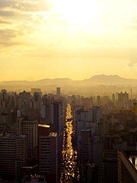
The point of intersection of the city's main thoroughfares, and also the region most well-served by public transportation in the city, being served by all subway lines, except for Line 5. It is also home to some of the major institutions of higher education in the city, as Mackenzie University, The Armando Alvares Penteado Foundation (FAAP) and units of the University of São Paulo (USP), like Law School, The University Center on Maria Antonia Street, and the headquarters of the USP Post-Graduate School of Architecture and Urban Affairs.

Key points
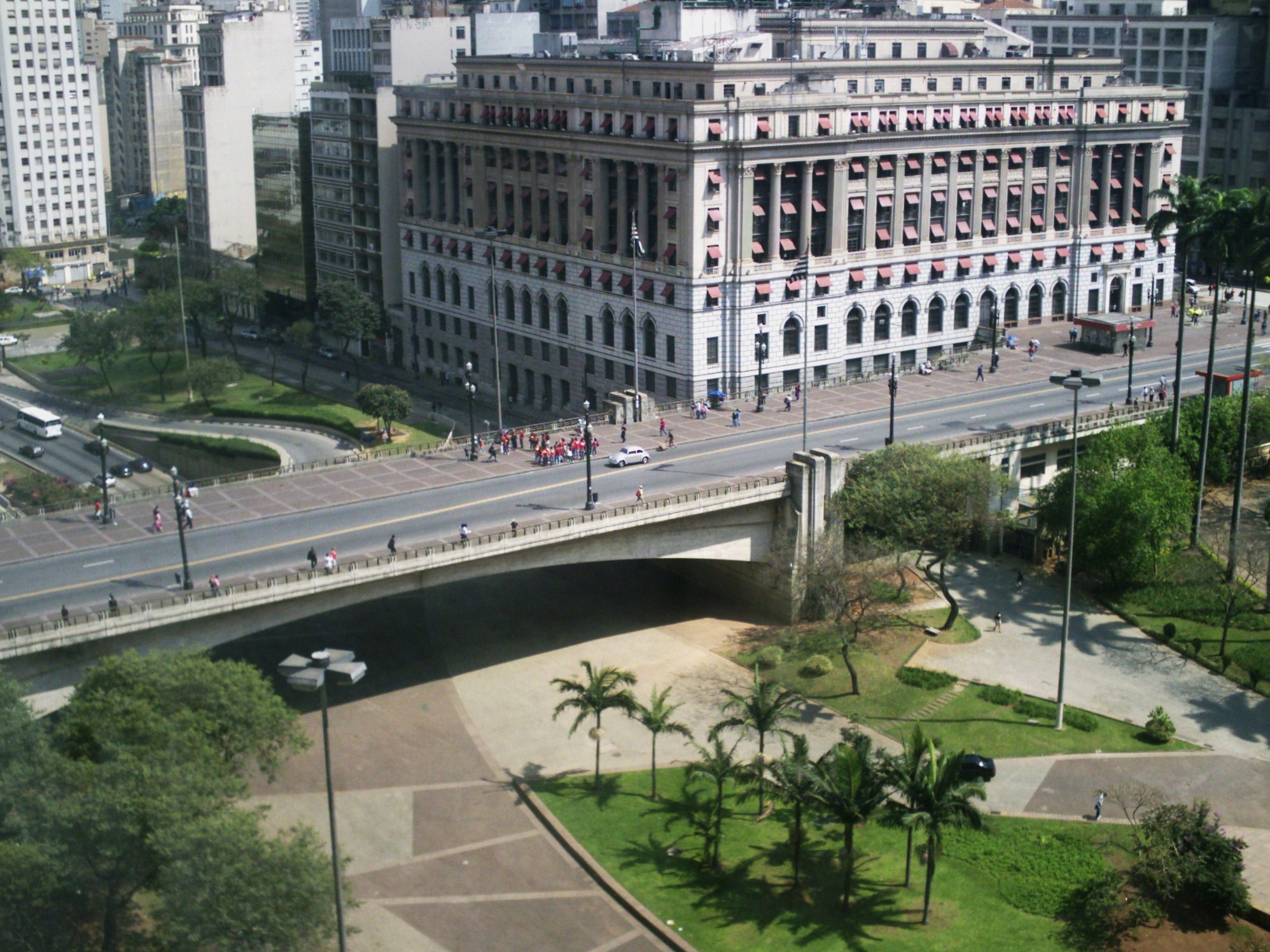
 Chá Viaduct and Shopping Light
 São João Avenue
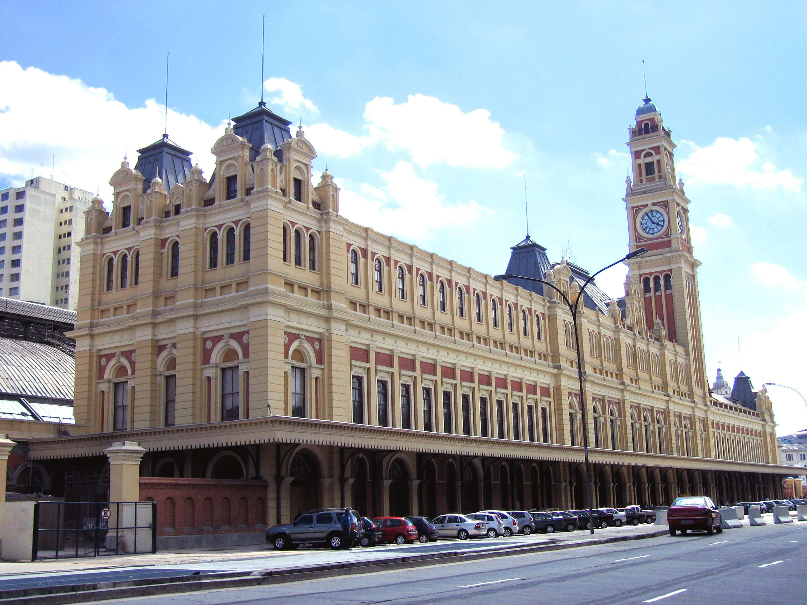
 Júlio Prestes Station
Viaducts
- Chá Viaduct
- Santa Ifigênia Viaduct
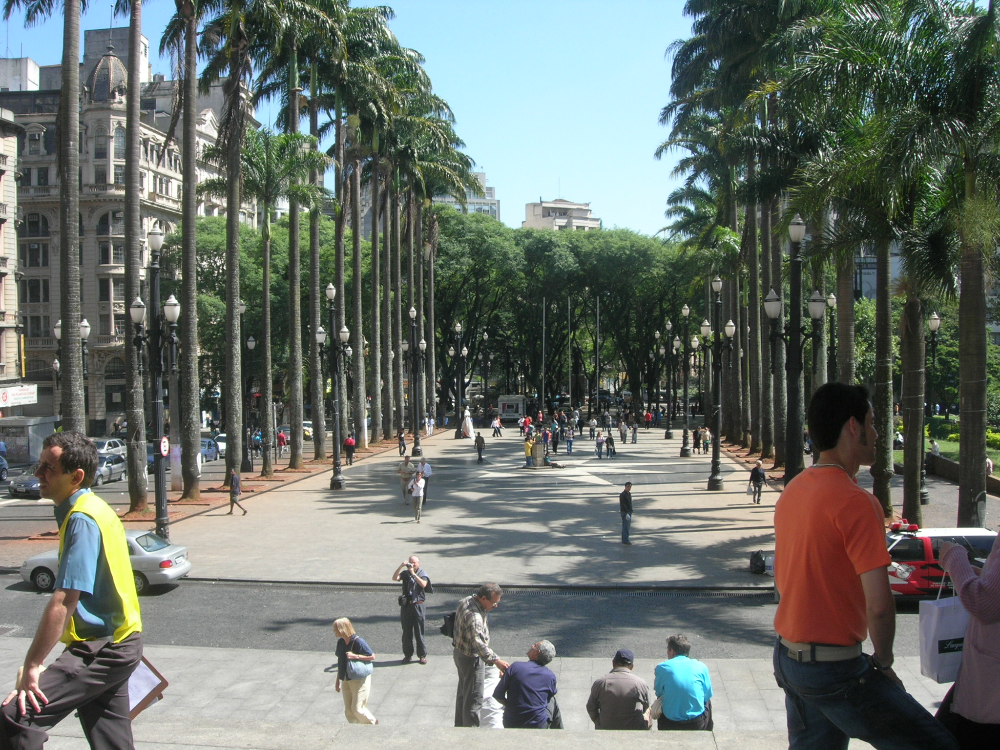
- Anhangabaú Square
Avenue and Streets
- Prestes Maia Avenue
- Tiradentes Avenue
- Brigadeiro Luís Antônio Avenue
- Liberdade Avenue
- Estado Avenue
- São João Avenue
- Ipiranga Avenue
- Rio Branco Avenue
- Vinte e Três de Maio Avenue
- 9 de Julho Avenue
- Angélica Avenue
- Paulista Avenue
- Conselheiro Furtado Street
- XV de Novembro Street
- Rua Vinte e Cinco de Março
- Porto Geral Alley
- Consolação Street
- Augusta Street
- Maria Antonia Street
- Dona Veridiana Street
- Higienópolis Avenue
- Carmo Street
- Vergueiro Street
Squares
- Praça da Sé
- Praça da República
- Praça Doutor João Mendes
- Praça Ramos de Azevedo
- Pátio do Colégio
- Largo do Arouche
- Largo São Bento
- Largo do Paiçandu
- Largo de São Francisco
- Largo da Misericórdia
Metro and commuter train stations
- Line 1 (Blue)
- Vergueiro
- São Joaquim
- Liberdade
- Sé
- São Bento
- Luz
- Tiradentes
- Armênia
- Line 2 (Green)
- Consolação
- Trianon-Masp
- Brigadeiro
- Line 3 (Red)
- Pedro II
- Sé
- Anhangabaú
- República
- Santa Cecília
- Marechal Deodoro
- Line 4 (Yellow)
- Luz
- República
- Higienópolis-Mackenzie
- Paulista
- CPTM commuter train stations
- Line 7 (Ruby), Line 10 (Turquoise) and Line 11 (Coral)
- Luz
- Line 8 (Diamond)
- Júlio Prestes
Major Shopping Centers
- Shopping Light
- Shopping Frei Caneca
- Shopping Paulista
- Shopping Pátio Higienópolis
Major Parks
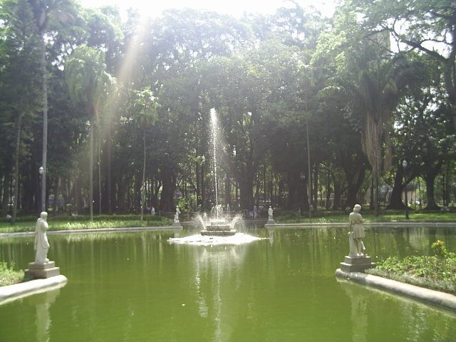
- Jardim da Luz
- Parque da Aclimação
- Parque Dom Pedro II
Colleges and universities
- Escola de Administração de Empresas de São Paulo - Fundação Getúlio Vargas (EAESP/FGV)
- Universidade Presbiteriana Mackenzie
- Faculdade de Direito da Universidade de São Paulo (FDUSP) - USP
- Faculdade de Ciências Médicas da Santa Casa de São Paulo (FCMSCSP)
- Centro de Ciências Exatas e Tecnologia - Pontifícia Universidade Católica de São Paulo - (CCET/PUC-SP)
- Fundação Armando Alvares Penteado (FAAP)
- Escola da Cidade (AEAUSP)
- Liceu de Artes e Ofícios de São Paulo (LAO-SP)
- Faculdade de Tecnologia de São Paulo (FATEC-SP)
- Conservatório Dramático e Musical de São Paulo (CDMSP)
- Universidade Livre de Música - Centro de Estudos Musicais Tom Jobim
Hospitals
- Hospital Samaritano
- Hospital Santa Catarina
- Irmandade da Santa Casa de Misericórdia de São Paulo (ISCMSP)
- Hospital Nove de Julho
- Hospital Sírio-Libanês
- Hospital Alemão Oswaldo Cruz
- Beneficência Portuguesa de São Paulo
Culture and Leisure
- Mário de Andrade Library
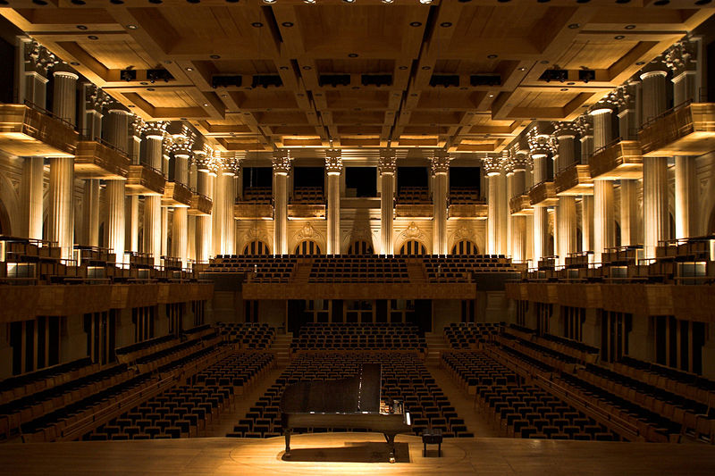
- Theatro Municipal
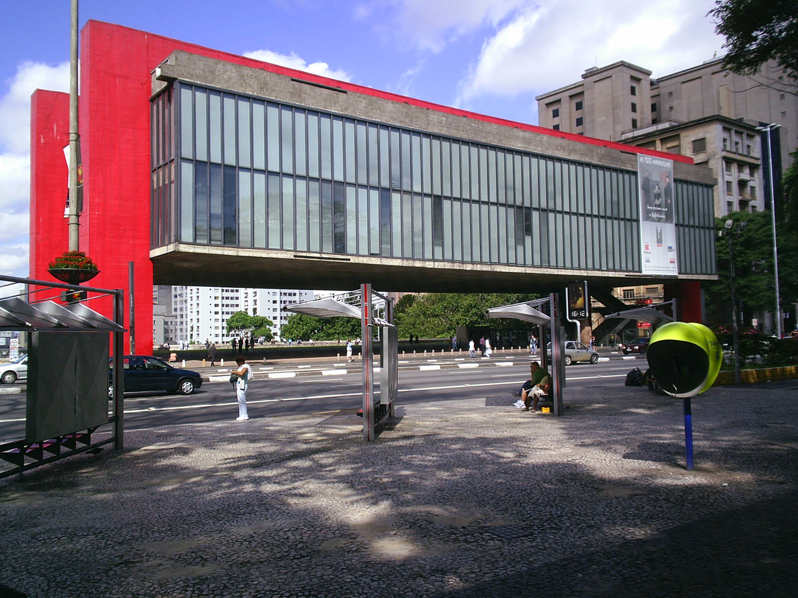
- São Paulo Museum of Art (MASP)
- Museum of the Portuguese Language
- Sala São Paulo
- Pinacoteca do Estado
- Museu de Arte Sacra
- Sociedade Brasileira de Cultura Japonesa
Rivers
- Tamanduateí River
- Tietê River
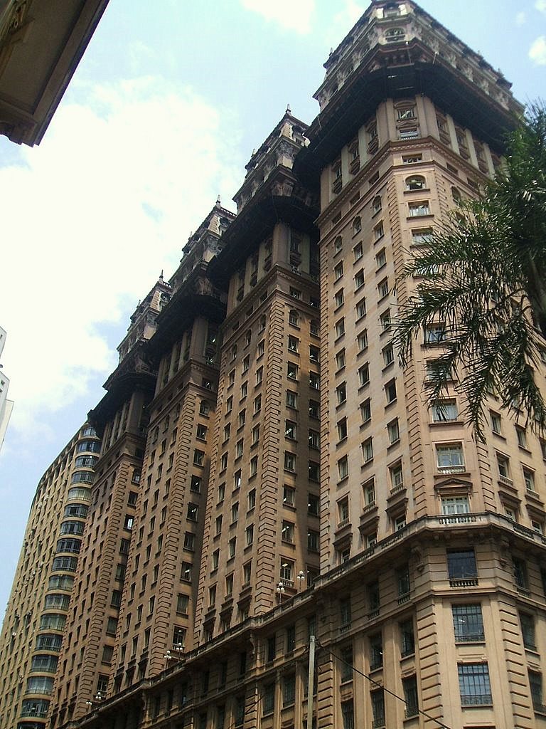
Buildings
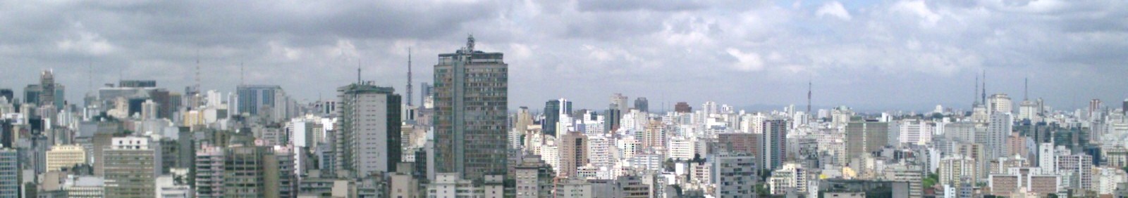
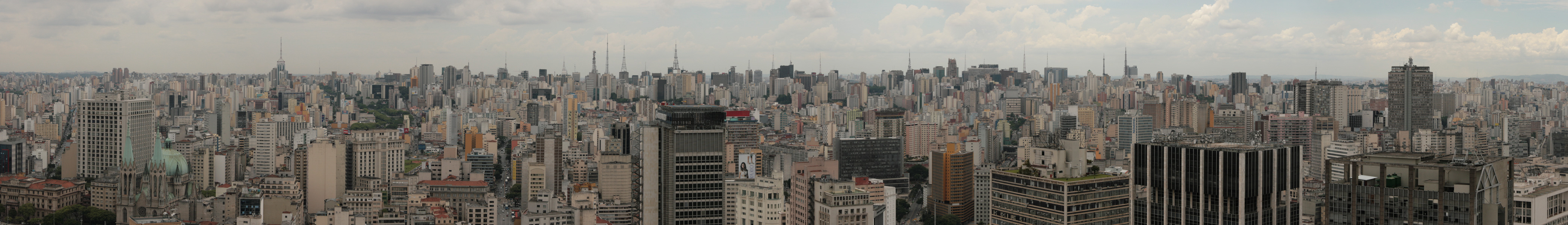
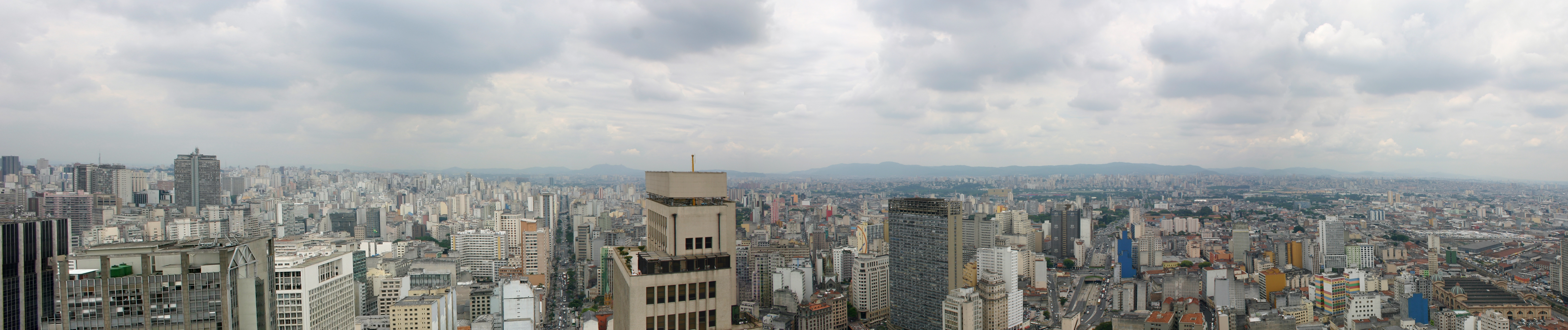
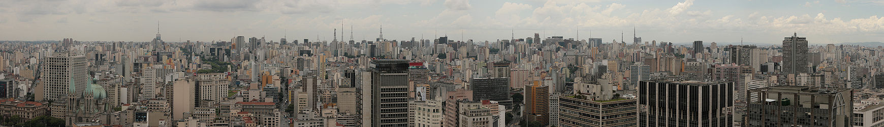 Panoramic of buildings in Central Zone São Paulo.
The Major Buildings in Central Zone São Paulo
Buildings that have been the first major structures of the regionRank Name Height
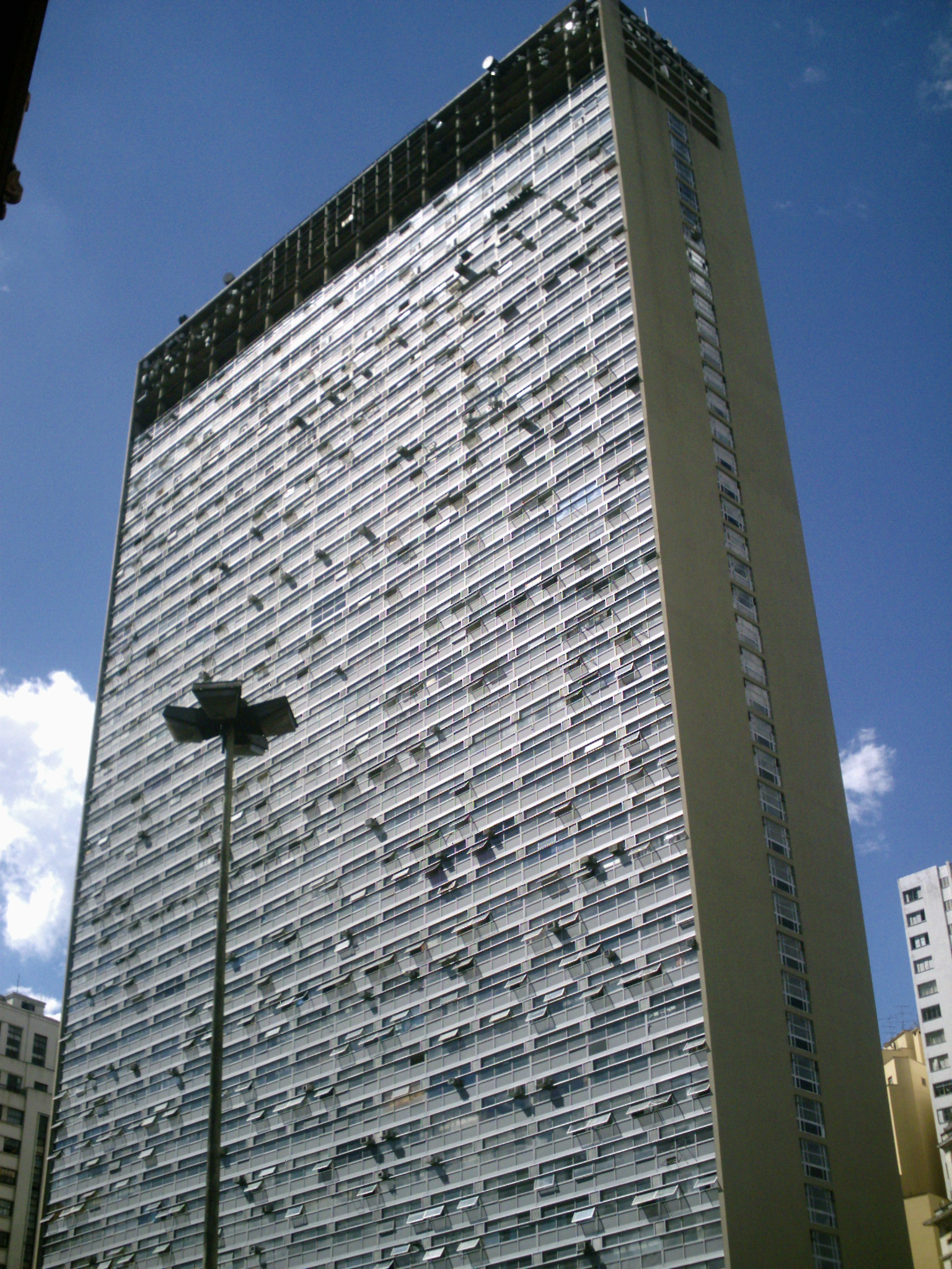
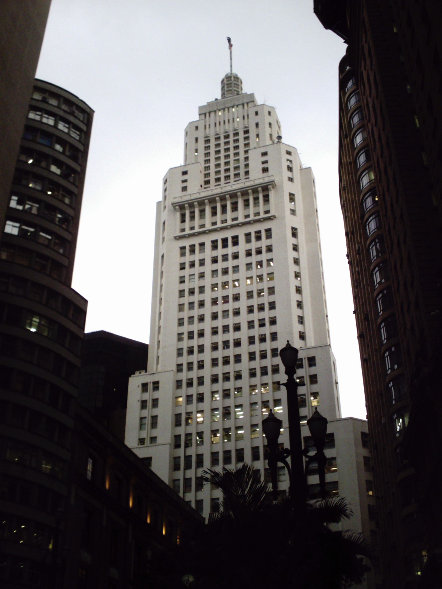
ft (m)Floors Year 1 Mirante do Vale 558/170 51 1960 2 Edifício Itália 556/168 45 1965 3 Altino Arantes Building 528/161 40 1947 4 Banco do Brasil Building 474/143 24 1955 5 Edifício Copan 460/140 45 1953 6 Barão de Iguape Building 445/133 37 1959 7 Ipiranga 165 440/130 36 1968 8 Martinelli Building 440/130 30 1929 9 Grande São Paulo Building 438/129 40 1971 10 Mercantil Finasa 438/129 35 1973 11 Andraus Building 390/115 32 1962 12 Conde de Prates Building 385/112 33 1955 13 CBI Esplanada 380/110 30 1948 Panoramic
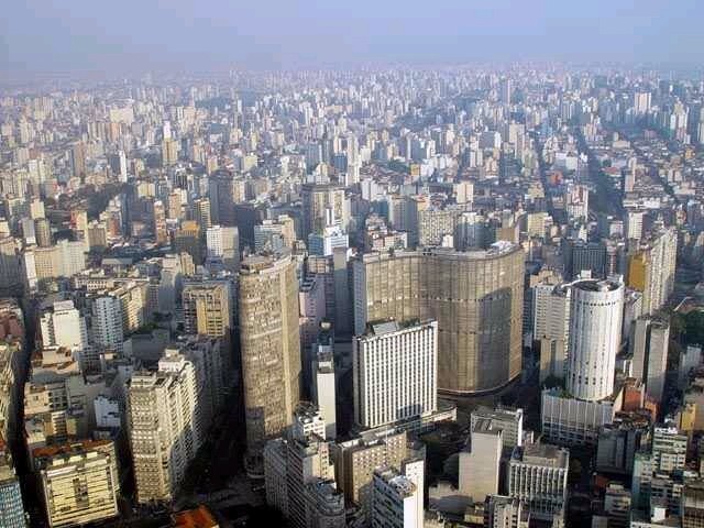
The panoramic view from Central Zone São Paulo, is undoubtedly the Torre Banespa located at Altino Arantes Building, where you can see the entire region, which attracts many visitors.
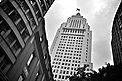
Torre Banespa
The Torre Banespa is one of the highlights of Altino Arantes Building and São Paulo. Situated on the highest point of the building, accessible from the 34th floor, it provides a privileged view of the city, with a range of up to 40 kilometers, making it possible to see other city landmarks such as the Mercado Municipal, the São Paulo Cathedral, and even the buildings Italia, and Copan Hilton. The Mirante do Vale completed in 1960, and although not well known, is still the tallest building in Brazil. In addition to several neighborhoods. This is all possible as well, although not the tallest, it's located in the topographically highest point of Central Zone São Paulo.

See also
- Central Business Districts
- List of central business districts
- São Paulo
References
- ^ Outskirts of São Paulo grows more than the center Retrieved on January 24, 2008
- ^ São Paulo has drop in population growth Retrieved on January 24, 2008
External links
- Subprefeitura Sé
- Mirante do Vale
- Visitation on the building, the site of Santander Banespa Bank
- Information about the bank and the Altino Arantes Building
- About the Building Banespa in Sampacentro Site
- Articles and information on the Edifício Itália site in Sampacentro Site
● Administrative Zones ● ●Subprefectures● Aricanduva • Butantã • Campo Limpo • Capela do Socorro • Casa Verde • Cidade Ademar • Cidade Tiradentes • Ermelino Matarazzo • Freguesia-Brasilândia • Guaianases • Ipiranga • Itaim Paulista • Itaquera • Jabaquara • Jaçanã-Tremembé • Lapa • M'Boi Mirim • Mooca • Parelheiros • Penha • Perus • Pinheiros • Pirituba-Jaraguá • Santana-Tucuruvi • Santo Amaro • São Mateus • São Miguel Paulista • Sé • Vila Maria-Vila Guilherme • Vila Mariana • Vila Prudente●Districts● Água Rasa · Alto de Pinheiros · Anhanguera · Aricanduva · Artur Alvim · Barra Funda · Bela Vista · Belém · Bom Retiro · Brasilândia · Brás · Butantã · Cachoeirinha · Cambuci · Campo Belo · Campo Grande · Campo Limpo · Cangaíba · Capão Redondo · Carrão · Casa Verde · Cidade Ademar · Cidade Dutra · Cidade Líder · Cidade Tiradentes · Consolação · Cursino · Ermelino Matarazzo · Freguesia do Ó · Grajaú · Guaianases · Iguatemi · Ipiranga · Itaim Bibi · Itaim Paulista · Itaquera · Jabaquara · Jaçanã · Jaguara · Jaguaré · Jaraguá · Jardim Helena · Jardim Paulista · Jardim São Luís · Jardim Ângela · José Bonifácio · Lajeado · Lapa · Liberdade · Limão · Mandaqui · Marsilac · Moema · Mooca · Morumbi · Parelheiros · Pari · Parque do Carmo · Pedreira · Penha · Perdizes · Perus · Pinheiros · Pirituba · Ponte Rasa · Raposo Tavares · República · Rio Pequeno · Sacomã · Santa Cecília · Santana · Santo Amaro · São Domingos · São Lucas · São Mateus · São Miguel Paulista · São Rafael · Saúde · Sapopemba · Sé · Socorro · Tatuapé · Tremembé · Tucuruvi · Vila Andrade · Vila Curuçá · Vila Formosa · Vila Guilherme · Vila Jacuí · Vila Leopoldina · Vila Maria · Vila Mariana · Vila Matilde · Vila Medeiros · Vila Prudente · Vila Sônia
São Paulo Museum of Art • São Paulo Cathedral • Edifício Itália • Paulista Avenue • Octávio Frias de Oliveira Bridge • Altino Arantes Building • Rua Oscar Freire • Praça da Sé • Central Zone São Paulo • Ibirapuera Park • Ibirapuera Auditorium • Liberdade • Obelisk of São Paulo • Anhembi Convention Center • Luz Station • Martinelli Building • Edifício Copan • Museu Paulista • Museum of the Portuguese Language • Pinacoteca do Estado de São Paulo • Estádio do Morumbi • Estádio do Pacaembu • Brooklin • Jardins • Vila Olímpia • Municipal Theatre of São Paulo
 Categories:
- Central Zone São Paulo
- Financial districts
- Central business districts


Wikimedia Foundation. 2010.