- Artur Alvim (district of São Paulo)
-
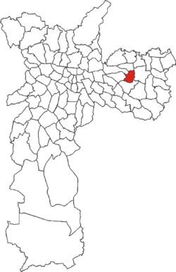
Artur Alvim Country Brazil State São Paulo City São Paulo Government – Type Subprefecture – Subprefect Cássio Freire Loschiavo Area – Total 6.6 km2 (2.5 sq mi) Population (2000) – Total 111,210 – Density 16.850/km2 (43.6/sq mi) HDI 0.783–medium Website Subprefecture of Penha Artur Alvim is a district in the subprefecture of Penha in the city of São Paulo, placed in the eastern suburban area of the city. It constitutes in a medium-low income neighbourhood, with a mixed space occupied by residences and local commerce. It is served by the Artur Alvim station of the São Paulo metro.
Coordinates: 23°32′00″S 46°30′00″W / 23.533333°S 46.500000°W
City Districts of São Paulo 
Água Rasa · Alto de Pinheiros · Anhanguera · Aricanduva · Artur Alvim · Barra Funda · Bela Vista · Belém · Bom Retiro · Brasilândia · Brás · Butantã · Cachoeirinha · Cambuci · Campo Belo · Campo Grande · Campo Limpo · Cangaíba · Capão Redondo · Carrão · Casa Verde · Cidade Ademar · Cidade Dutra · Cidade Líder · Cidade Tiradentes · Consolação · Cursino · Ermelino Matarazzo · Freguesia do Ó · Grajaú · Guaianases · Iguatemi · Ipiranga · Itaim Bibi · Itaim Paulista · Itaquera · Jabaquara · Jaçanã · Jaguara · Jaguaré · Jaraguá · Jardim Helena · Jardim Paulista · Jardim São Luís · Jardim Ângela · José Bonifácio · Lajeado · Lapa · Liberdade · Limão · Mandaqui · Marsilac · Moema · Mooca · Morumbi · Parelheiros · Pari · Parque do Carmo · Pedreira · Penha · Perdizes · Perus · Pinheiros · Pirituba · Ponte Rasa · Raposo Tavares · República · Rio Pequeno · Sacomã · Santa Cecília · Santana · Santo Amaro · São Domingos · São Lucas · São Mateus · São Miguel Paulista · São Rafael · Saúde · Sapopemba · Sé · Socorro · Tatuapé · Tremembé · Tucuruvi · Vila Andrade · Vila Curuçá · Vila Formosa · Vila Guilherme · Vila Jacuí · Vila Leopoldina · Vila Maria · Vila Mariana · Vila Matilde · Vila Medeiros · Vila Prudente · Vila Sônia
Categories:- Districts of São Paulo
- São Paulo (state) geography stubs
Wikimedia Foundation. 2010.

