- Morumbi (district of São Paulo)
-
Morumbi The location of Morumbi district in São Paulo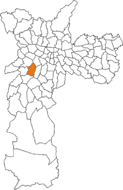

Country Brazil State São Paulo City São Paulo Government - Type Subprefecture - Subprefect Regis Gehlen de Oliveira Area - Total 11.4 km2 (4.4 sq mi) Population (2010) - Total 32,281 - Density 28.32/km2 (73.3/sq mi) HDI 0.938 –high Website Subprefecture of Butantã Morumbi (Portuguese pronunciation: [moɾũbi]) is a district of the city of São Paulo belonging to the subprefecture of Butantã, in the southwestern part of the city. A common folk etymology attributes its name to the mixed Portuguese and Tupi phrase morro obi, which would mean "green hill", but this is disputed.
Morumbi is between 9 and 15 km away from São Paulo's downtown. It has boundaries with the districts of Vila Sônia, Campo Limpo, Vila Andrade, Itaim Bibi, Pinheiros, and Butantã. Within Morumbi, the neighborhoods of Vila Progredior, Caxingüi, Jardim Guedala, Cidade Jardim, Real Parque, Vila Morumbi, Paineiras do Morumbi, Jardim Panorama, Jardim Sílvia, Vila Tramontano and Paraisópolis are found.
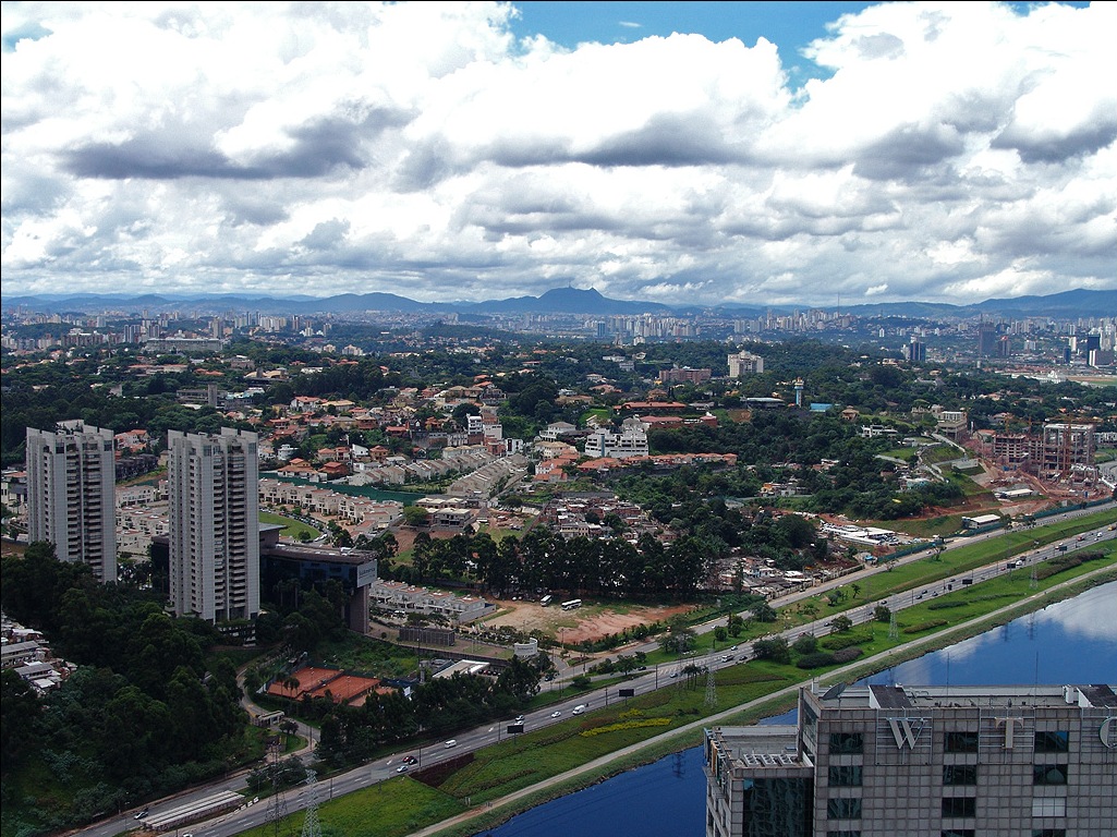
Ranked first by many years in real estate launches, it was always considered by the citizens of São Paulo as sophisticated and as one of the wealthiest neighborhoods of the city, despite the existence of the Paraisópolis favela.
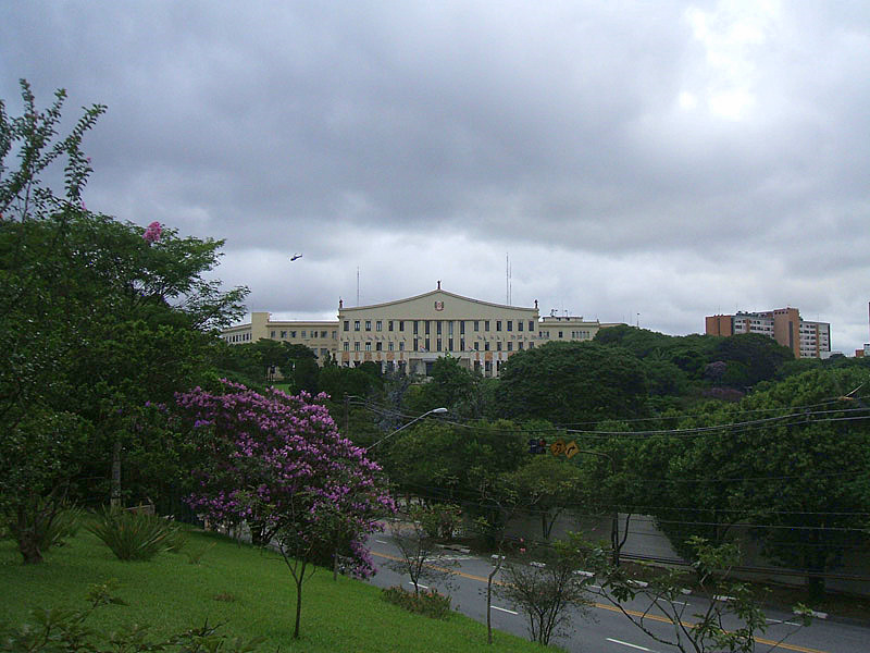
Within the boundaries of Morumbi one may find Hospital Israelita Albert Einstein, one of the most important private hospitals of the city, Palácio dos Bandeirantes, seat of the São Paulo state government, the American School (Graded School), the Colégio Visconde de Porto Seguro Unidade 1 and Estádio do Morumbi, home to São Paulo Futebol Clube.
A large shopping mall located in the south of the city (albeit in Santo Amaro, which is not in the Morumbi neighborhood) carries the name Shopping Morumbi.
Morumbi cemetery is the final resting place of triple Formula One World Champion Ayrton Senna and singer Elis Regina.
 Palácio dos Bandeirantes - seat of the São Paulo state government
Coordinates: 23°46′S 54°06′W / 23.767°S 54.1°W
City Districts of São Paulo 
Água Rasa · Alto de Pinheiros · Anhanguera · Aricanduva · Artur Alvim · Barra Funda · Bela Vista · Belém · Bom Retiro · Brasilândia · Brás · Butantã · Cachoeirinha · Cambuci · Campo Belo · Campo Grande · Campo Limpo · Cangaíba · Capão Redondo · Carrão · Casa Verde · Cidade Ademar · Cidade Dutra · Cidade Líder · Cidade Tiradentes · Consolação · Cursino · Ermelino Matarazzo · Freguesia do Ó · Grajaú · Guaianases · Iguatemi · Ipiranga · Itaim Bibi · Itaim Paulista · Itaquera · Jabaquara · Jaçanã · Jaguara · Jaguaré · Jaraguá · Jardim Helena · Jardim Paulista · Jardim São Luís · Jardim Ângela · José Bonifácio · Lajeado · Lapa · Liberdade · Limão · Mandaqui · Marsilac · Moema · Mooca · Morumbi · Parelheiros · Pari · Parque do Carmo · Pedreira · Penha · Perdizes · Perus · Pinheiros · Pirituba · Ponte Rasa · Raposo Tavares · República · Rio Pequeno · Sacomã · Santa Cecília · Santana · Santo Amaro · São Domingos · São Lucas · São Mateus · São Miguel Paulista · São Rafael · Saúde · Sapopemba · Sé · Socorro · Tatuapé · Tremembé · Tucuruvi · Vila Andrade · Vila Curuçá · Vila Formosa · Vila Guilherme · Vila Jacuí · Vila Leopoldina · Vila Maria · Vila Mariana · Vila Matilde · Vila Medeiros · Vila Prudente · Vila Sônia
Categories:- Districts of São Paulo
- São Paulo (state) geography stubs


Wikimedia Foundation. 2010.