- D1 road (Croatia)
-
D1 state road
Route information Part of 
Length: 415.8 km (258.4 mi) Major junctions From:  Macelj border crossing to Slovenia
 Slovenian G9 road
 D508 near Trakošćan
 A2 in several interchanges
 D207 in Đurmanec
 D206 in Krapina
 D35 in Sveti Križ Začretje
 D24 in Zabok
 D205 near Zabok
 D307 near Zabok
 D225 in Zaprešić interchange
 A3 in a section where D1 and A3 are concurrent
 A1 in Lučko, Karlovac and Dugopolje interchanges.
 D310 in Jastrebarsko
 D3 in Karlovac
 D6 in Karlovac and in Brezova Glava
 D36 in Karlovac
 D217 in Grabovac
 D42 in Selište Drežničko
 D504 in Prijeboj
 D52 near Prijeboj
 D25 in Korenica
 D522 near Udbina
 D506 near Udbina
 D27 in Gračac
 D218 near Gračac
 D59 near Knin
 D33 in Knin
 D219 in Sinj
 D60 in Brnaze
 D56 near Klis
To:  D8 in Split
Location Counties: Krapina-Zagorje, Zagreb County, City of Zagreb, Karlovac, Lika-Senj, Zadar, Šibenik-Knin, Split-Dalmatia Major cities: Krapina, Zagreb, Karlovac, Slunj, Gračac, Knin, Sinj Highway system State roads in Croatia
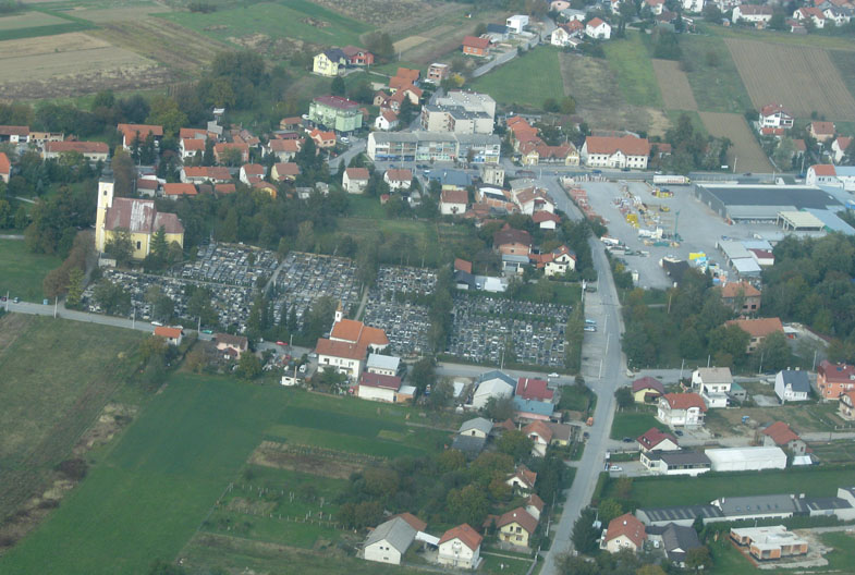
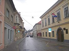 Krapina, on the D1 route
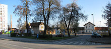 Zabok, on the D1 route
 Lučko, on the D1 route
 Jastrebarsko, on the D1 route
 Karlovac, on the D1 route
 Road bridge north of Slunj, carrying the D1 road
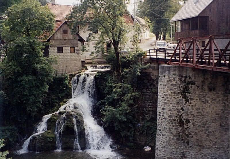
 Rastoke, on the D1 route
 Slunj, on the D1 route
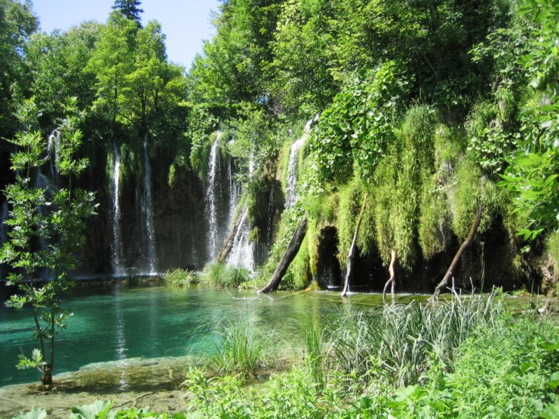
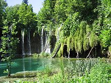 Plitvice Lakes National Park, next to the D1 route
 The D1 road near Knin
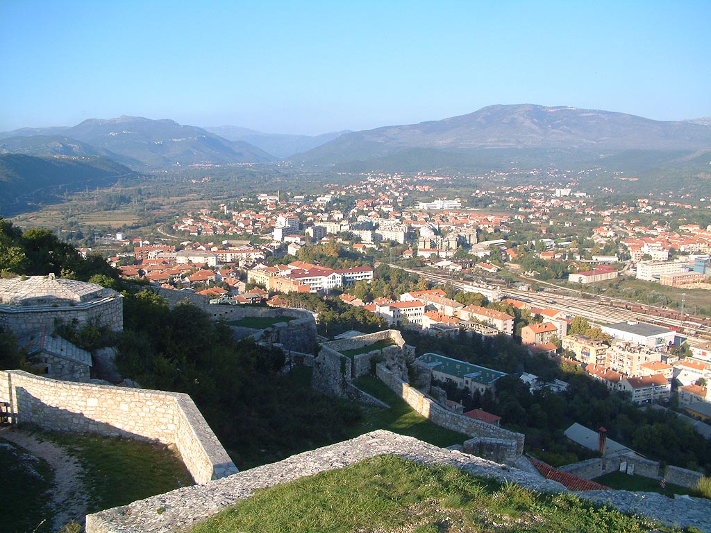
 Knin, on the D1 route
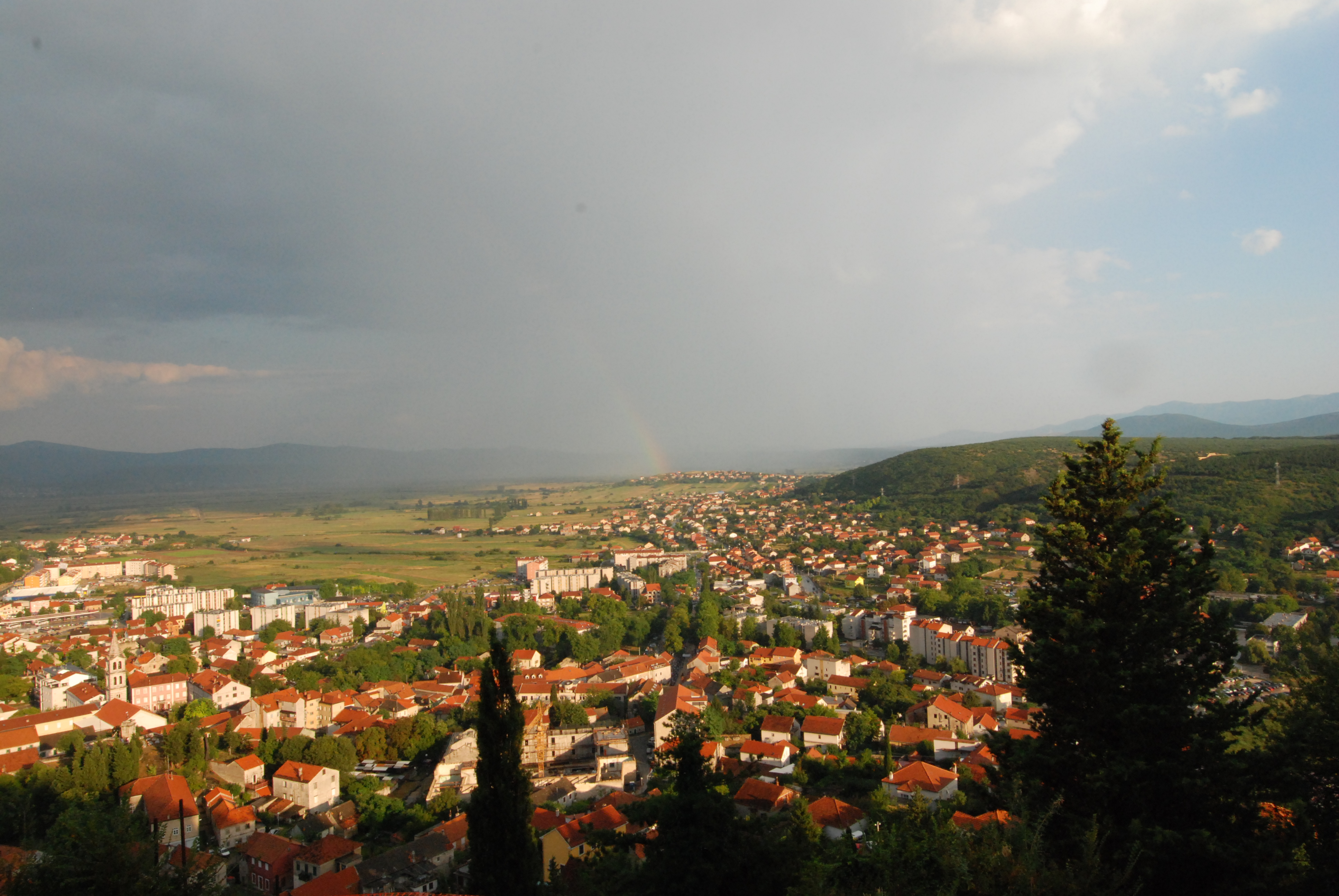
 Sinj, on the D1 route
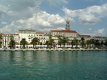 Split, at the D1 road terminus
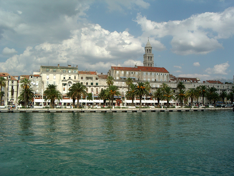
The state road D1 (Croatian: Državna cesta D1) is a national highway in Croatia. It is a one-lane highway that spans from Macelj border crossing in the north via Krapina, Zagreb, Karlovac, Slunj, Gračac, Knin, Sinj, ending in Split. It is 415.8 kilometres (258.4 mi) long overall.[1]
Before the A1 and A2 dual carriage motorways have been completed (in 2005 and 2007 respectively), the D1 was probably the busiest road during the summer in Croatia as it connected the northern border as well as the city of Zagreb with the tourist resorts at the Adriatic Sea. Since then, the traffic has waned significantly, but the D1 remains relevant as an alternative to the tolled highways.
Contents
Route description
North of Zagreb the D1 is mostly parallel to the A2 motorway up to the Krapina interchange, connecting to a number of the A2 interchanges directly or via connector roads.[2] It also runs parallel with railway tracks in some sections running through hilly terrain.
A part of the D1 state road is concurrent with other routes: the A2 motorway between Zaprešić and Jankomir interchanges, the A3 motorway between Jankomir and Lučko interchanges, the D3 state road between the A3 motorway Lučko interchange and Karlovac, the D6 state road in Karlovac, the D33 state road in Knin and the D219 state road in Sinj.[1][2]
Parts of the D1 have been upgraded to expressway (brza cesta) status. Currently two sections of the D1 are considered as such, since they comprise dual carriageways or are currently expanded to four traffic lanes:
- an urban expressway in Karlovac, between the A1 motorway Karlovac interchange[2] and Mostanje
- an expressway in and near Split, between the A1 motorway Dugopolje interchange[2] and Bilice roundabout in Split itself[3]
The northern part of the D1 in Karlovac is actually a slightly lower road category because there are several intersections with traffic lights which slow the traffic down.
Parts of the road in Lika have climbing lanes.
The road, as well as all other state roads in Croatia, is managed and maintained by Hrvatske ceste, a state-owned company.[4]
Traffic volume
Traffic is regularly counted and reported by Hrvatske ceste, operator of the road.[5] The D1 AADT and ASDT (average summer daily traffic) figure variations observed south of Karlovac are attributed to tourist traffic to various regions of Adriatic Sea coast in Dalmatia region of Croatia.
D1 traffic volume Road Counting site AADT ASDT Notes  D1
D11104 Đurmanec 2,908 n/a Between the D207 and Ž2098 junctions. Average daily traffic figure is provided instead of AADT. No ASDT data available. D11122 Čveki 3,813 3,876 Between the D35 and Ž2158 junctions. D11927 Veliko Trgovišće 10,035 10,491 Between the D307 and Ž2217 junctions. D11928 Izimje 7,187 8,387 Adjacent to the Ž3102 junction. The AADT figure estimated by Hrvatske ceste. D13101 Tušilović 8,968 12,457 Adjacent to the Ž3188 junction. D13105 Blagaj 5,087 8,797 Adjacent to the L34120 junction. D13106 Slunj 5,842 9,790 Adjacent to the Ž3258 junction. D13107 Slušnica 8,968 12,457 Adjacent to the L34152 junction. D14302 Prijeboj 5,283 9,210 Adjacent to the D504 junction. D14304 Jošan 3,639 7,954 Adjacent to the Ž5195 junction. D14901 Mutilić (Udbina) 2,200 4,350 Adjacent to the L59101 junction. Estimated by Hrvatske ceste. D14907 Gračac 1,986 3,130 Adjacent to the D27 junction. D15002 Pađene 1,714 2,799 Adjacent to the D59 junction. D15418 Kijevo 1,513 n/a Between the Ž6058 and Ž6083 junctions. Average daily traffic figure is provided instead of AADT. No ASDT data available. D15504 Brnaze 9,316 10,787 Adjacent to the D60 junction. Road junctions and populated areas
D1 major junctions/populated areas Type Slip roads/Notes 
Macelj border crossing to Slovenia[6]
Slovenian G9 road to Ptuj and Maribor.
The northern terminus of the road. D508 to Trakošćan and Lepoglava (to the east) and A2 motorway Trakošćan interchange (to the west).
Donji Macelj  A2 Đurmanec interchange (reached via a short connecting road).
Đurmanec
D207 to Lupinjak and Hum na Sutli (D206).Krapina
D206 to Pregrada and Hum na Sutli.
Ž2122 to Trški Vrh and Radoboj.
Ž2123 to Jazvine and Radoboj. A2 Krapina interchange (reached via a short connecting road).Velika Ves Lepajci
Ž2155 to Gornja Pačetina and Krapinske Toplice.
Ž2240 to D35.Galovec Začretski Švaljkovec
D35 to Lepoglava (D508) and Varaždin (D2).
Ž2160 to Sveti Križ Začretje, Štrucljevo and Zabok. A2 Sveti Križ Začretje interchange.Ciglenica Zagorska
Ž2162 to Brestovec Orehovički.Mirkovec
Ž2166 to Bedekovčina (D24).Brezova Grdenci Hum Zabočki
D24 to Zlatar Bistrica (D29), Novi Marof (D3), Varaždinske Toplice (D526) and Ludbreg (D2) (to the east).
The D1 and D24 state roads are concurrent to the south of the junction to Zabok.Zabok
D24 to Zlatar Bistrica (D29), Novi Marof (D3), Varaždinske Toplice (D526) and Ludbreg (D2).
The D1 and D24 state roads are concurrent to the north of the junction to Hum Zabočki.
Ž2195 to Pavlovec Zabočki, Gubaševo, Veliko Trgovišće, Luka and Pojatno. D205 to Gubaševo, Klanjec and Kumrovec (to the west).
D307 to A2 motorway Zabok interchange Oroslavje, Donja Stubica and Marija Bistrica (D29) (to the east). A2 Zaprešić interchange to Krapina (to the north) and to A3 motorway Jankomir interchange (to the south).
D225 to Zagreb via Aleja Bologne and Ilica and to Zaprešić.
To the south, the D1 road and the A2 motorway are concurrent. Northbound D1 traffic leaves the A2 motorway at the interchange.
Jankomir interchange
A2 to Krapina to the north. Northbound D1 traffic follows the A2 to the north.
A3 to Samobor and Bregana border crossing to Slovenia to the west.[6] Southbound D1 traffic follows the A3 to the east.
Ž1035 to Zagreb via Ljubljanska Avenue.
The D1 road is concurrent with the A2 motorway to the north and with the A3 motorway to the east.Lučko interchange
A1 to Karlovac, Rijeka, Zadar and Split to the south.
A3 to eastern parts of Zagreb, Velika Gorica, Bjelovar, Varaždin and Slavonski Brod to the east.
Ž1040 to Zagreb via Jadranska Avenue.
The D1 road is concurrent with the A3 motorway to the west. Southbound D1 traffic leaves the interchange in direction of Lučko.Lučko
Ž1041 to Hrvatski Leskovac.
Ž3064 to Rakitje.Gornji Stupnik
Ž3067 to Stupnik.Ž3061 to Kalinovica, Brezje Samoborsko and Sveta Nedjelja. Rakov Potok
Ž1047 to Horvati and Mokrice.Ž3055 to Rude, Gajeva and Samobor. Ž3057 to Pavučnjak, Kladje and Samobor. Klinča Sela
Ž3106 to Kupinec and Pisarovina (D36).Ž3105 to Stankovo. Jastrebarsko
D310 to A1 motorway Jastrebarsko interchange.Novaki Petrovinski
Ž3102 to Draga Svetojanska and Hrastje Plešivičko.
Ž3103 to Domagović.Čeglje Ž3101 to Guci Draganički and Brezarić. Draganić
Ž3150 to Lazina.Lug
Ž3150 to Tuškani and Mahično. A1 Karlovac interchange to Zagreb (to the north) and to Rijeka, Zadar and Split (to the south). The interchange is accessed via a short connector.
The northern terminus of dual carriageway expressway through Karlovac. Karlovac
D3 to Duga Resa (D23) and Delnice (to the south). The D1 and D3 roads are concurrent to the north of Karlovac.
D6 to Netretić. the D1 and D6 roads are concurrent south and east of Karlovac.
D36 to Pokupsko, Sisak and A3 motorway Popovača interchange.
Ž3185 to Barilović, Perjasica and Generalski Stol.
Ž3297 to Ozalj, Krašić, Bregana and A3 motorway Bobovica interchange.The southern terminus of dual carriageway expressway through Karlovac. Mostanje
Ž3148 to Selce (D36).Turanj
Ž3186 to Skakavac, Gvozd and Perna.Cerovac Vukmanički
Ž3187 to Vukmanić and Skakavac.
Ž3188 to Ladvenjak.Tušilović Brezova Glava
D6 to Vojnić, Glina and Dvor (to the east). The D1 and D6 roads to the north and west are concurrent.Krnjak
Ž3189 to Barilović.
Ž3290 to Kolarić (connection to D216, D6).Brebornica Donje Taborište Rastoke Slunj
Ž3256 to Gornje Primišlje, Kamenica Skradnička and D23.
Ž3257 to Taborište and Obrovci.
Ž3258 to Batnoga, Cetingrad and Pašin Potok.
Ž3266 to Donji Furjan, Bogovolja and Cetingrad.Broćanac Oštarski Stanovi 
Slunj Bridge - 141.6 m (465 ft) long, spanning Korana River.[7] Rakovica
Ž3269 to Grabovac Drežnički.Grabovac
D217 to Ličko Petrovo Selo border crossing to Bosnia and Herzegovina.[6]Selište Drežničko
D42 to Plaški, Josipdol and Ogulin.to Plitvice Lakes National Park Ž5150 to Jezerce and D52. Prijeboj
D504 to Ličko Petrovo Selo (D217). D52 to Otočac (D50).Vranovača Korenica
D25 to Lički Osik and Gospić (D50).Gradina Korenička Bjelopolje
Ž5169 to Donji Lapac (D218).Ž5164 to Krbava and Podlapača. Jošan Ž5195 to Udbina. The road forms another intersection with the D1 road south of Udbina. D522 to A1 motorway Gornja Ploča interchange.Ž5195 to Udbina. D506 to Mazin, Dobroselo and D218.Gračac
D27 to Obrovac and Benkovac. D218 to Donji Lapac and Užljebić border crossing to Bosnia and Herzegovina.[6]Otrić
Ž6033 to Pribudić and Pađene. The road forms another intersection with the D1 road near Pađene.Ž6025 to Kom, Ervenik, Kaštel Žegarski and Obrovac (D218). Ž6033 to Pađene. D59 to Kistanje and Pirovac.Knin
D33 to Šibenik and Drniš (to the south). The D1 and D33 roads are concurrent to the south of the D1 route. D33 to Strmica border crossing to Bosnia and Herzegovina (to the north).[6] The D1 and D33 roads are concurrent to the north of the D1 route.Ž6080 to Kninsko Polje. Kovačić
Ž6057 to Slap Kovačić.Ž6058 to Biskupija, Orlić, Riđane and Zvjerinac. Kijevo
Ž6083 to Milaši and Cetina.Vrlika Podosoje Ž6101 to Otišić. Maljkovo Ž6102 to Potravlje. Ž6103 to Satrić. Hrvace
Ž6105 to Rumin.Karakašica
Ž6117 to Lučane.
Ž6118 to Čitluk and Jasensko.Sinj
D219 to Muć (D56) (to the south) and Bili Brig border crossing to Bosnia and Herzegovina (to the north).[6]Brnaze
D60 to Trilj and Imotski.Ž6116 to Sičane and Neorić. Ž6120 to Kraj. Dicmo Ž6121 to Prisoje. The northern terminus of the urban expressway through Split.[3] Podi interchange
A1 Dugopolje interchange to Zagreb and Zadar (to the north) and to Vrgorac interchange (to the south). The interchange is accessed via a short connector.Grlo interchange
D56 to Muć and Klis.
Bilice interchange
D8 to Split and also further on to Trogir (to the west) and Stobreč to the east. The D8 state road forms numerous intersections in the city of Split itself.
The D8 within the city of Split is also executed as an urban expressway.
The southern terminus of the urban expressway through Split[3] and the southern terminus of the road.Sources
- ^ a b "Decision on categorization of public roads as state roads, county roads and local roads" (in Croatian). Narodne novine. February 17, 2010. http://narodne-novine.nn.hr/clanci/sluzbeni/2010_02_17_410.html.
- ^ a b c d "Regulation on motorway markings, chainage, interchange/exit/rest area numbers and names" (in Croatian). Narodne novine. May 6, 2003. http://narodne-novine.nn.hr/clanci/sluzbeni/305463.html.
- ^ a b c "PM Sanader opens a section of Solin-Klis-Sinj expressway" (in Croatian). Ministry of Sea, Transport and Infrastructure (Croatia). July 8, 2006. http://www.mmpi.hr/default.aspx?ID=2277.
- ^ "Public Roads Act" (in Croatian). Narodne novine. December 14, 2004. http://narodne-novine.nn.hr/clanci/sluzbeni/2004_12_180_3130.html.
- ^ "Traffic counting on the roadways of Croatia in 2009 - digest". Hrvatske ceste. May 1, 2010. http://www.hrvatske-ceste.hr/WEB%20-%20Legislativa/brojenje-prometa/CroDig2009.pdf.
- ^ a b c d e f "Map of border crossings and customs office areas" (in Croatian). Customs Administration of the Republic of Croatia. March 6, 2008. http://www.carina.hr/CURH/Dokumenti/Globalni/Karta_Carinarnica_RH.pdf.
- ^ "Slunj bridges" (in Croatian). Građevinar. January 15, 1999. http://www.casopis-gradjevinar.hr/hrv/clanak.asp?s=199901&r=7&j=h.
See also
- A1 motorway
- A2 motorway
- A3 motorway
- State roads in Croatia
- Hrvatske ceste
Categories:- State roads in Croatia
- Karlovac County
- Krapina-Zagorje County
- Lika-Senj County
- Split-Dalmatia County
- Šibenik-Knin County
- Zadar County
- Zagreb County
- Roads in Zagreb


Wikimedia Foundation. 2010.