- D20 road (Croatia)
-
D20 state road
Route information Length: 46.6 km (29.0 mi) Major junctions From:  D3 near Čakovec
 A4 in Čakovec interchange
To:  D41 in Drnje
Location Counties: Međimurje, Koprivnica-Križevci Major cities: Čakovec Highway system State roads in Croatia
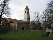 Čakovec, at the western terminus of the D20 road
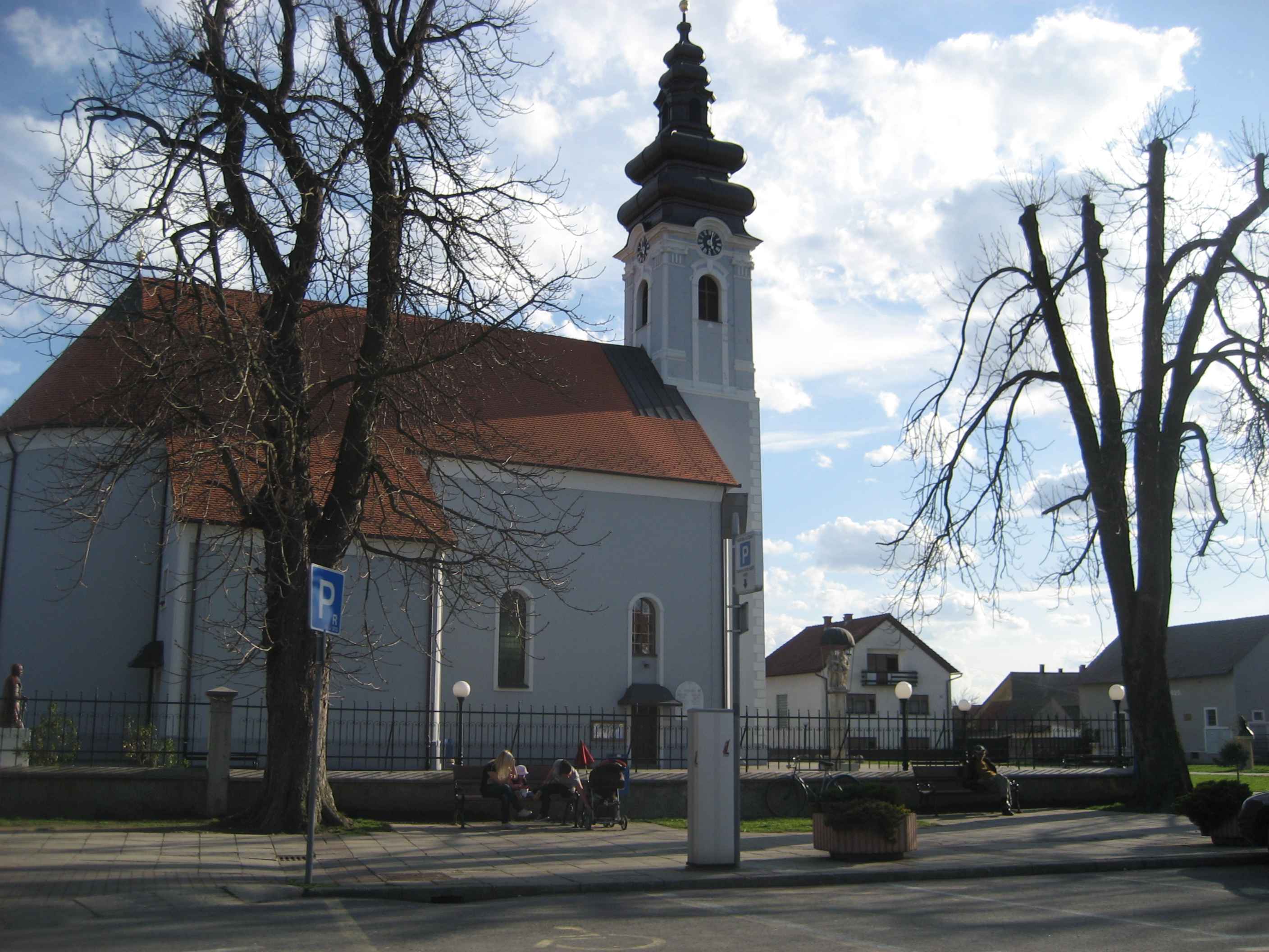
 Prelog, on the D20 road route
D20 is a state road in Međimurje and Podravina regions of Croatia connecting Drnje and nearby Gola border crossing to Hungary[1] to the D3 state road near Čakovec, and the road also serves as a connecting road to the A4 motorway as it forms a junction with the A4 Čakovec interchange.[2] The road is 46.6 km (29.0 mi) long.[3]
The road, as well as all other state roads in Croatia, is managed and maintained by Hrvatske ceste, state owned company.[4]
Contents
Traffic volume
Traffic is regularly counted and reported by Hrvatske ceste, operator of the road.[5]
D20 traffic volume Road Counting site AADT ASDT Notes  D20
D201305 Prelog 4,190 4,185 Adjacent to the Ž2033 junction. Road junctions and populated areas
D20 junctions/populated areas Type Slip roads/Notes  D3 to Čakovec (D209) and Varaždin (D2) (to the south) and to Goričan border crossing to Hungary[1] (to the north).
The western terminus of the road.Ž2031 to Ivanovec. Ž2022 to Mala Subotica and Orehovica.  A4 Čakovec interchange[2] to Varaždin and Zagreb (to the south) and to Goričan border crossing to Hungary[1] (to the north).
Ž2038 to Sveti Križ and Podbrest. 
Prelog
Ž2026 to Donji Kraljevec and Goričan.
Ž2033 to Sveti Juraj u Trnju (D3) and Otok.Cirkovljan Draškovec
Ž2034 to Donji Kraljevec.
Ž2039 to Oporovec.Donji Mihaljevec Sveta Marija Ž2040 to Donji Vidovec and Kotoriba. Donja Dubrava
Ž2041 to the Ž2040 county road.
Drava Bridge - 175 m (574 ft) long. Ž2076 to Selnica Podravska, Slokovec and Sigetec Ludbreški (D2). Ž2081 to Zablatje, Kuzminec and Rasinja. Ž2078 to Legrad. The western D20/Ž2078 intersection.
The Ž2078 road loops from the D20 to Legrad and back forming 2 intersections with the latter.Ž2078 to Legrad. The eastern D20/Ž2078 intersection. Đelekovec
Ž2082 to Imbriovec.
Ž2090 to Koprivnica (D41).Torčec Drnje
D41 to Gola border crossing to Hungary[1] and the D210 state road junction (to the north) and to Koprivnica (D2) (to the south).
The eastern terminus of the road.Sources
- ^ a b c d "Map of border crossings and customs office areas" (in Croatian). Customs Administration of the Republic of Croatia. March 6, 2008. http://www.carina.hr/CURH/Dokumenti/Globalni/Karta_Carinarnica_RH.pdf.
- ^ a b "Regulation on motorway markings, chainage, interchange/exit/rest area numbers and names" (in Croatian). Narodne novine. April 24, 2003. http://www.mmpi.hr/UserDocsImages/nn-73-03-Pravilnik-oznacav-ac.htm.
- ^ "Decision on categorization of public roads as state roads, county roads and local roads" (in Croatian). Narodne novine. February 17, 2010. http://narodne-novine.nn.hr/clanci/sluzbeni/2010_02_17_410.html.
- ^ "Public Roads Act" (in Croatian). Narodne novine. December 14, 2004. http://narodne-novine.nn.hr/clanci/sluzbeni/2004_12_180_3130.html.
- ^ "Traffic counting on the roadways of Croatia in 2009 - digest" (in English). Hrvatske ceste. May 1, 2010. http://www.hrvatske-ceste.hr/WEB%20-%20Legislativa/brojenje-prometa/CroDig2009.pdf.
See also
- State roads in Croatia
- Hrvatske ceste
Categories:- State roads in Croatia
- Koprivnica-Križevci County
- Međimurje County


Wikimedia Foundation. 2010.