- D41 road (Croatia)
-
D41 state road
Route information Length: 82.9 km (51.5 mi) Major junctions From:  D28 and
 A12 in Vrbovec 1 interchange
 D22 in Križevci
 D2 in Koprivnica
 D20 in Drnje
 D210 in Gola
To:  Gola border crossing to Hungary
Location Counties: Koprivnica-Križevci, Zagreb County Major cities: Vrbovec, Križevci, Koprivnica Highway system State roads in Croatia
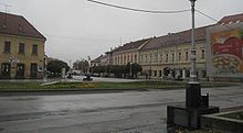
 Vrbovec, near the southern terminus of the D41 road
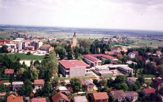
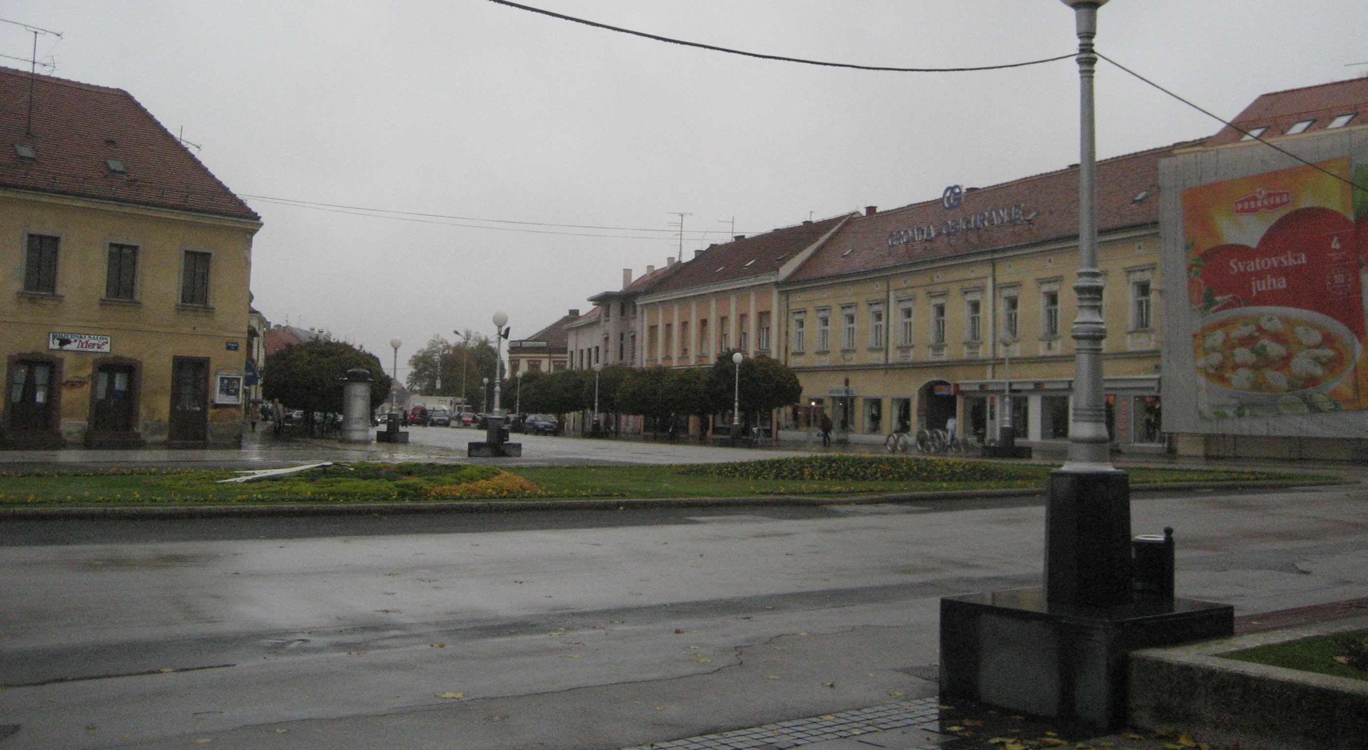
 Koprivnica, on the D41 road route
D41 is a state road in the central Croatia connecting the D28 expressway or A12 motorway in Vrbovec 1 interchange[1][2] to Križevci, Koprivnica and Gola border crossing to Hungary.[3] The road is 82.9 km (51.5 mi) long.[4]
The road, as well as all other state roads in Croatia, is managed and maintained by Hrvatske ceste, a state-owned company.[5]
Contents
Traffic volume
Traffic is regularly counted and reported by Hrvatske ceste, one of the operators of the road.[6]
D41 traffic volume Road Counting site AADT ASDT Notes  D41
D411401 Gola 813 846 Adjacent to the Ž2116 junction. D411310 Petranec 2,314 2,406 Adjacent to the Ž2114 junction. D411311 Sokolovec 3,834 n/a Adjacent to the L20006 junction.
Average daily traffic figure is supplied instead of AADT. D412006 Vrbovečki Pavlovac 5,642 5,879 Adjacent to the Ž3052 junction. Road junctions and populated areas
D41 junctions/populated areas Type Slip roads/Notes 
Gola border crossing[3]
The route extends to Berzence, Hungary.
The northern terminus of the road.
Gola
D210 to Virje (D2).
Ž2116 to Novačka and Repaš (D20).
Ž2115 to Otočka. Gotalovo 
Drava Bridge Ž2091 to Šoderica. Botovo Drnje
D20 to Čakovec (D3).
Ž2114 to Hlebine and Molve (D210).Peteranec
Ž2113 to Ž2114 county road.Koprivnica
D2 to the A4 motorway Ludbreg interchange and Varaždin (D3) to the west and to Virovitica (D5) to the east.
Ž2090 to Đelekovec (D20).
Ž2141 within the city.
Ž2142 to Herešin.
Ž2144 within the city.
Ž2147 to Miklinovec and Hlebine.Reka Velika Mučna
L26006 to Domaji and Duga Rijeka.Sokolovac
Ž2181 to Srijem.Ž2139 to Mali Grabičani. Carevdar Ž2238 to Kloštar Vojakovački. Ž2180 to Vojakovac. Majurec
Ž2212 to Sveti Petar Čvrstec and Zrinski Topolovac.Križevci
D22 to Novi Marof (D3) and Sveti Ivan Žabno (D28).
Ž3002 to Gregurovec, Zaistovec and Komin (D3).Donja Brckovina Bojnikovec Mali Raven Veliki Raven
Ž2208 to Gregurovec.Ž3018 to Gornji Tkalec, Kraljev Vrh and Hudovo. Donji Tkalec Gostović Kućari Banovo Vrbovečki Pavlovec Vrbovec
Ž3052 to Cugovec (D28).Martinska Ves Luka  A12 and
D28 to the A4 motorway Sveta Helena interchange (to the west) and to Sveti Ivan Žabno (D22) and Bjelovar (D43) (to the east).
Ž3034 to Dugo Selo.
The A12 motorway and the D28 expressway are concurrent at this junction.
The southern terminus of the road.Sources
- ^ "Regulation on motorway markings, chainage, interchange/exit/rest area numbers and names" (in Croatian). Narodne novine. April 24, 2003. http://www.mmpi.hr/UserDocsImages/nn-73-03-Pravilnik-oznacav-ac.htm.
- ^ "Decision on amendments and additions to the Decision on classification of public roads as motorways" (in Croatian). Narodne Novine. January 23, 2009. http://narodne-novine.nn.hr/clanci/sluzbeni/2009_01_13_296.html.
- ^ a b "Map of border crossings and customs office areas" (in Croatian). Customs Administration of the Republic of Croatia. March 6, 2008. http://www.carina.hr/CURH/Dokumenti/Globalni/Karta_Carinarnica_RH.pdf.
- ^ "Decision on categorization of public roads as state roads, county roads and local roads" (in Croatian). Narodne novine. February 17, 2010. http://narodne-novine.nn.hr/clanci/sluzbeni/2010_02_17_410.html.
- ^ "Public Roads Act" (in Croatian). Narodne novine. December 14, 2004. http://narodne-novine.nn.hr/clanci/sluzbeni/2004_12_180_3130.html.
- ^ "Traffic counting on the roadways of Croatia in 2009 - digest". Hrvatske ceste. May 1, 2010. http://www.hrvatske-ceste.hr/WEB%20-%20Legislativa/brojenje-prometa/CroDig2009.pdf.
See also
- State roads in Croatia
- Hrvatske ceste
Categories:- State roads in Croatia
- Koprivnica-Križevci County
- Zagreb County

Wikimedia Foundation. 2010.