- D28 road (Croatia)
-
D28 state road
Route information Length: 92.2 km (57.3 mi) Major junctions From:  A4 in Sveta Helena interchange
 D41 near Vrbovec
 D26 near Vrbovec
 D22 in Sveti Ivan Žabno
 D524 in Predavac
 D43 in Bjelovar
To:  D5 in Veliki Zdenci
Location Counties: Bjelovar-Bilogora, Koprivnica-Križevci, Zagreb County Major cities: Vrbovec, Bjelovar Highway system State roads in Croatia
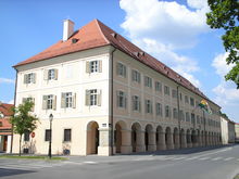
 Vrbovec, near the western terminus of the D28 road
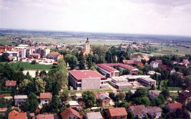
 Bjelovar, on the D28 road route
D28 is a state road in the central Croatia connecting the D5 in Veliki Zdenci to the A4 motorway in Sveta Helena interchange[1] near Vrbovec. The road is 92.2 km (57.3 mi) long.[2]
The road, as well as all other state roads in Croatia, is managed and maintained by Hrvatske ceste, a state-owned company.[3]
Contents
Expressway section
The westernmost section of the D28 road is executed as a four lane expressway, which is also concurrent with the first section of the planned A12 motorway.[4]
The expressway section is separately managed and maintained by Croatian Motorways Ltd, pursuant to an agreement on transfer of the section from Hrvatske ceste to the former.[5][6][7]
Traffic volume
Traffic is regularly counted and reported by Hrvatske ceste, one of the operators of the road.[8]
D28 traffic volume Road Counting site AADT ASDT Notes  D28
D282030 Vrbovec bypass 7,008 7,272 Adjacent to the D41 junction. D282103 Sveti Ivan Žabno 7,789 8,031 Adjacent to the Ž3041 junction. D282102 Predavac 9,227 9,219 Adjacent to the D524 junction. D282106 Prespa 5,314 4,769 Adjacent to the Ž3048 junction. D282110 Bulinac 2,399 2,495 Adjacent to the Ž3090 junction. Road junctions and populated areas
D28 junctions/populated areas Type Slip roads/Notes 

Sveta Helena interchange
A4 to Zagreb and Varaždin.
 A12 start of A12/D28 concurrency.
Ž3013 to Sveta Helena, Rakovec and Donja Zelina (D3).
The western terminus of the road and of the four lane expressway.
Vrbovec 1 interchange
D41 to Vrbovec, Križevci (D22) and Koprivnica (D41).
Ž3034 to Dugo Selo.Prilesje interchange
Ž3079 to Vrbovec via Savska Cesta.Dubrava interchange
D26 to Čazma (D43) and Garešnica (D45).
Ž3288 to Vrbovec.Vrbovec 2 interchange
 A13 - the interchange is completed but left unused, until the first section of the A13 motorway is completed. A12 the eastern terminus of the A12/D28 concurrency and of the four lane expressway.
Cugovec
Ž3052 to Vrbovec (D41).Haganj
Ž3041 to Dubrava, Ivanić Grad, Veleševec, Novo Čiče and the D30 state road.Škrinjari Sveti Ivan Žabno
D22 to Križevci (D41) and Novi Marof (D3).
Ž2229 to Brezovljani.
Ž2230 to Cirkvena.Kuštani Kenđelovec
Ž2231 to Cirkvena, Farkaševac and the D43 state road.Markovac Križevački Rovišće
Ž3003 to Kraljevac.
Ž3020 to Tuk.Predavac
D524 - northern Bjelovar bypass road to the north of Bjelovar and the D43 state road.
Ž3021 to Žabljak.
Ž3022 to Diebali.
Ž3023 to Klokočevac.Bjelovar
D43 to Đurđevac (D2 state road) and the A3 motorway Ivanić Grad interchange.
Ž2143 to Novi Skucani and Zrinski Topolovac.
Ž3044 within the city.
Ž3043 to Stare Plavnice.
Ž3045 to Galovac and Nevinac.
Ž3046 to Novoseljani.
Ž3047 to Ždralovi.
Ž3048 to Tomaš. Prespa Ž3088 to Ciglena. Severin Ž3090 to Nova Rača, Velika Trnovitica, Veliki Pašijan (D26). Bulinac
Ž2232 to Šandrovac, Suha Katalena and Budančevica (D2).Drljanovac
Ž3280 to Nova Rača.Ž4002 to Velika Pisanica, Velika Črešnjevica and Pitomača (D2). Veliki Grđevac
Ž3092 to Donja Kovačica, Slovinska Kovačica and Orlovac.
Ž3093 to Gornja Kovačica and Velika Barna.
Ž3094 to Grubišno Polje (D5).Pavlovac
Ž3133 to Ladislav and to (D45).Veliki Zdenci
D5 to Daruvar, Pakrac (D38) and the A3 motorway Okučani interchange (to the south) and to Virovitica (D2) (to the north).
The eastern terminus of the road.See also
- State roads in Croatia
- Hrvatske ceste
Sources
- ^ "Regulation on motorway markings, chainage, interchange/exit/rest area numbers and names" (in Croatian). Narodne novine. April 24, 2003. http://www.mmpi.hr/UserDocsImages/nn-73-03-Pravilnik-oznacav-ac.htm.
- ^ "Decision on categorization of public roads as state roads, county roads and local roads" (in Croatian). Narodne novine. February 17, 2010. http://narodne-novine.nn.hr/clanci/sluzbeni/2010_02_17_410.html.
- ^ "Public Roads Act" (in Croatian). Narodne novine. December 14, 2004. http://narodne-novine.nn.hr/clanci/sluzbeni/2004_12_180_3130.html.
- ^ "Decision on amendments and additions to the Decision on classification of public roads as motorways" (in Croatian). Narodne Novine. January 23, 2009. http://narodne-novine.nn.hr/clanci/sluzbeni/2009_01_13_296.html.
- ^ "A12 motorway brochure" (in Croatian). Croatian Motorways Ltd. April 27, 2009. http://www.hac.hr/docs/brosure/A12-brosura.pdf.
- ^ "Croatian Motorways Ltd - Podravina Y (p.3)" (in Croatian). HUKA. March 1, 2009. http://www.huka.hr/objekti/publikacije/hr/2009_16.pdf.
- ^ "On sections of the Podravina Y - A12 and A13" (in Croatian). Croatian Motorways Ltd. April 24, 2009. http://www.hac.hr/index.php?task=med&stask=1&idNews=00000002249&page=.
- ^ "Traffic counting on the roadways of Croatia in 2009 - digest". Hrvatske ceste. May 1, 2010. http://www.hrvatske-ceste.hr/WEB%20-%20Legislativa/brojenje-prometa/CroDig2009.pdf.
Categories:- State roads in Croatia
- Bjelovar-Bilogora County
- Koprivnica-Križevci County
- Zagreb County


Wikimedia Foundation. 2010.