- Gotthard Pass
-
Gotthard Pass Passo del San Gottardo 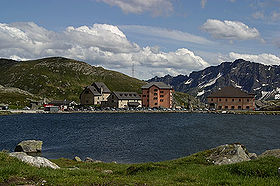
Gotthard's Hospice and MuseumElevation 2,106 m (6,909 ft) Traversed by Road Location Location in Switzerland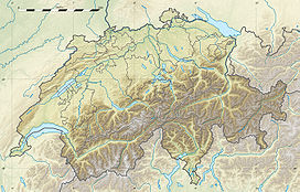

Location Ticino,  Switzerland
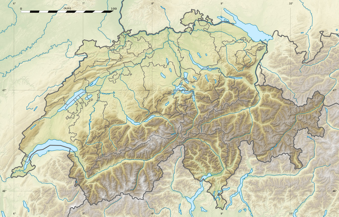
Range Lepontine Alps Coordinates 46°33′33″N 8°33′41″E / 46.55917°N 8.56139°ECoordinates: 46°33′33″N 8°33′41″E / 46.55917°N 8.56139°E The Gotthard Pass or St. Gotthard Pass (Italian: Passo del San Gottardo) (el. 2106 m) is a high mountain pass in Switzerland between Airolo in the canton of Ticino, and Göschenen in the canton of Uri, connecting the northern German-speaking part of Switzerland with the Italian-speaking part, along the route onwards to Milan.
Though the pass was locally known in antiquity, it was not generally used until the early 13th century because it involved fording the turbulent Reuss, swollen with snowmelt during the early summer, in the narrow steep-sided Schöllenen Gorge (the Schöllenenschlucht), below Andermatt. As early as 1236, it was dedicated to the Bavarian Saint Gotthard of Hildesheim.
Contents
Geography
The Gotthard Pass connects the cantons of Uri (north) and Ticino (south). The pass itself is located within the latter canton, about 2 km south of the border with Uri, between the massifs of Pizzo Lucendro (west) and Pizzo Centrale (east). The pass lies on the most important route between the southern canton of Ticino and central Switzerland as well as most of the northern part of the country. It is the most direct link between Zürich and Lugano and also between some regions of Germany and Italy. The nearest towns are Hospental (7 km north) near Andermatt and Airolo (4 km south), respectively in the valleys of Urseren and Leventina. The region of Andermatt lies at the foot of the Furka and Oberalp passes connecting the Rhone and Rhine valleys thus making the Gotthard area a strategic place for transports and military (the Swiss Réduit for instance).
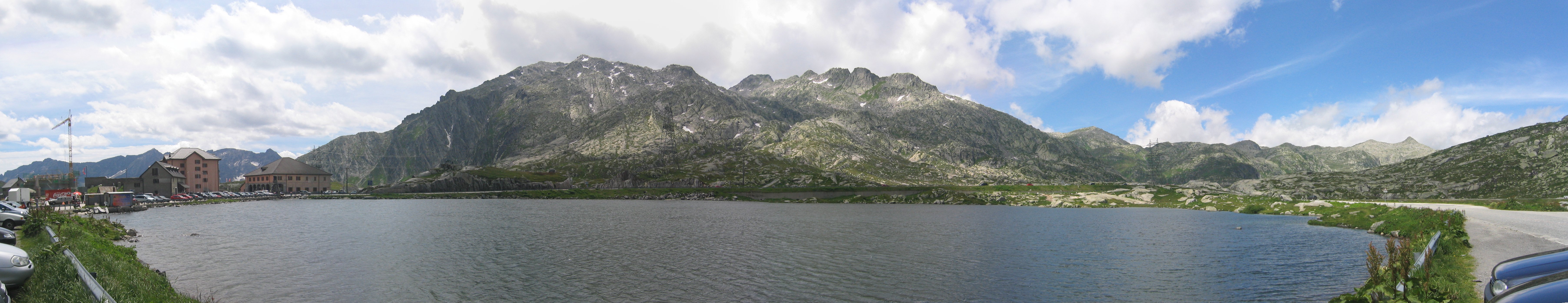
The hospice (Italian: Ospizio) is located south of the pass at 2,091 m, near the Lago della Piazza and other small lakes. Lago di Lucendro and Lago Sella are larger reservoir lakes accessible from the pass.
The Devil's Bridge
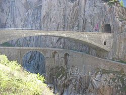
The pass can be reached by crossing the Schöllenenschlucht and several bridges have been built across the River Reuss in order to facilitate this. According to the oral histories of the nearby villages, seasonal deaths resulting from drowning reached a peak in April–May of most years and thus a safer crossing was required[citation needed]. The original bridge (the Teufelsbrücke) built under these challenging conditions was one of so many "devil's bridges" that the legends about them form a category in the Aarne-Thompson classification system for folktales (number 1191).
The legend of this particular bridge states that the Reuss was so difficult to ford that a Swiss herdsman wished the devil would make a bridge. The Devil appeared, but required that the soul of the first to cross would be given to him. The mountaineer agreed, but drove a goat across ahead of him, fooling his adversary. Angered by this sham, the devil fetched a rock with the intention of smashing the bridge, but an old woman drew a cross on the rock so the devil couldn't lift it anymore. The rock is still there and, in 1977, 300,000 Swiss francs were spent to move the 220 ton rock by 127 m in order to make room for the new Gotthard road tunnel.
The bridge permitted traffic to follow the Reuss to its headwaters and over the saddle at the top—a continental divide between the Rhine, which flows into the North Sea and the Ticino River towards Milan, which after leaving Switzerland flows into the Po River and ultimately into the Mediterranean Sea. It carried only foot traffic and pack animals until 1775, when the first carriage made the journey on an improved road.
Tunnels through the Pass
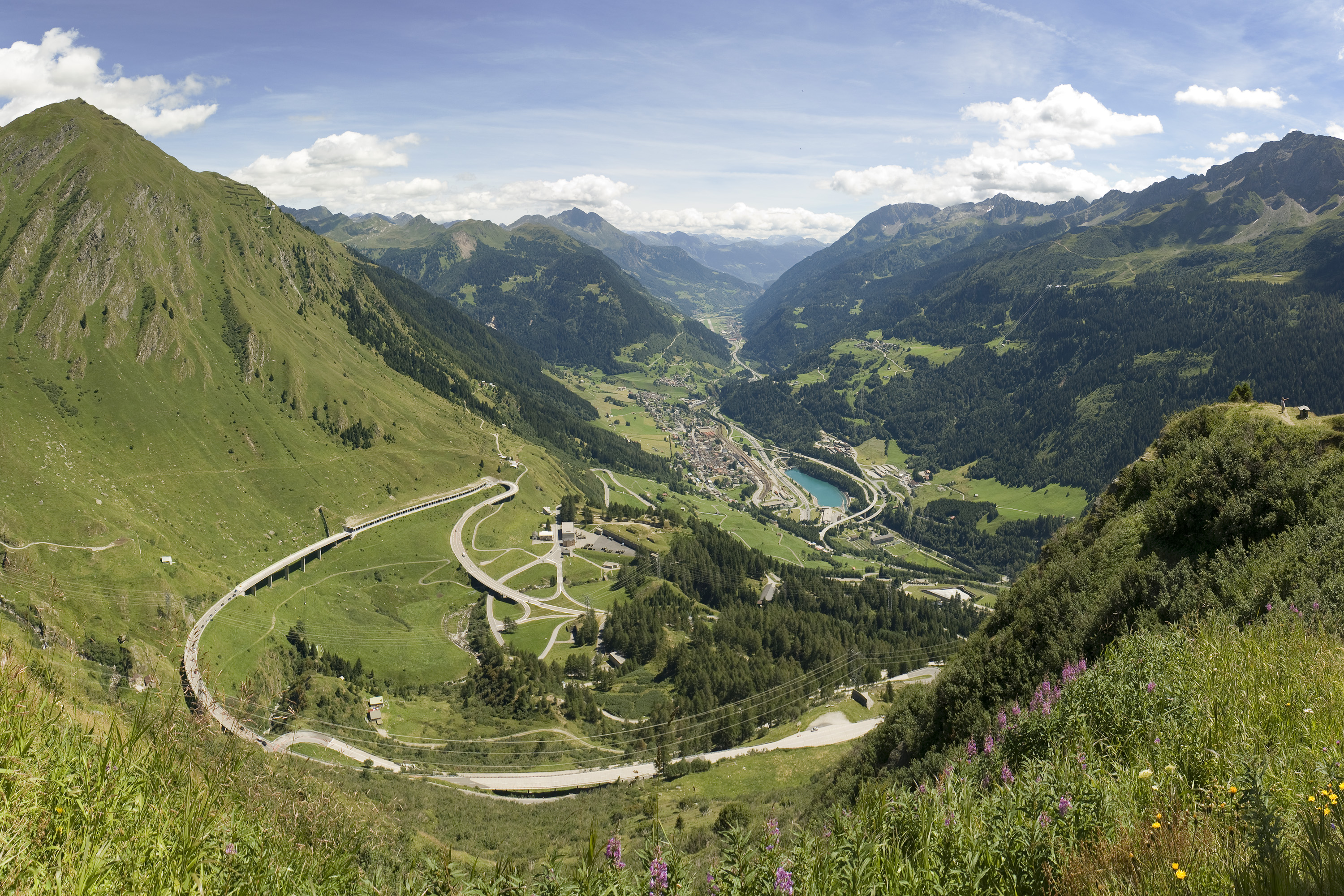
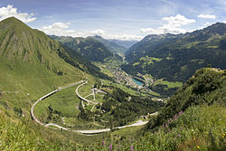 View of Airolo from Gotthard Pass
Several tunnels provide access through the pass. The 15 km Gotthard Rail Tunnel was the first and opened in 1882 for railway traffic at a cost of around 200 workers' lives (there is uncertainty as to the exact toll). It replaced the pass road, connecting Göschenen with Airolo.[1]
A 17 km motorway tunnel, the Gotthard Road Tunnel opened in 1980. It was closed for two months in 2001 following a fatal fire.
A second rail tunnel through the pass, the Gotthard Base Tunnel, is currently under construction. When completed, it will be the longest rail tunnel in the world at 57 km. This tunnel, combined with two shorter tunnels planned near Zürich and Lugano as part of the AlpTransit initiative, will reduce the 3 hour 40 min rail journey from Zürich to Milan by one hour, while increasing the size and number of trains that can operate along the route because the line is nearly level, compared with the spirals of the older tunnel.
The tunnel is expected to have an elevator station for exit at Sedrun.
Paintings of the pass
 Lake on Gotthard Pass
A number of international artists have been inspired by the dramatic scenery of the St. Gotthard Pass, the Schöllenen Gorge and the Teufelsbrücke.
-
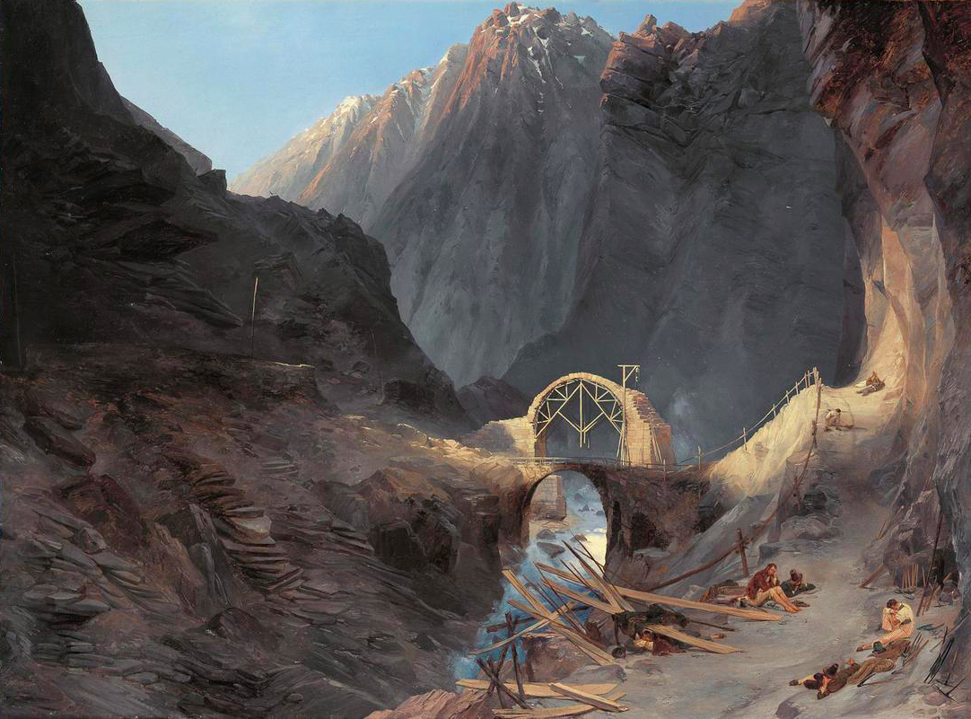
Construction of the Devil's Bridge, Carl Blechen, c. 1833
-

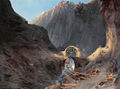
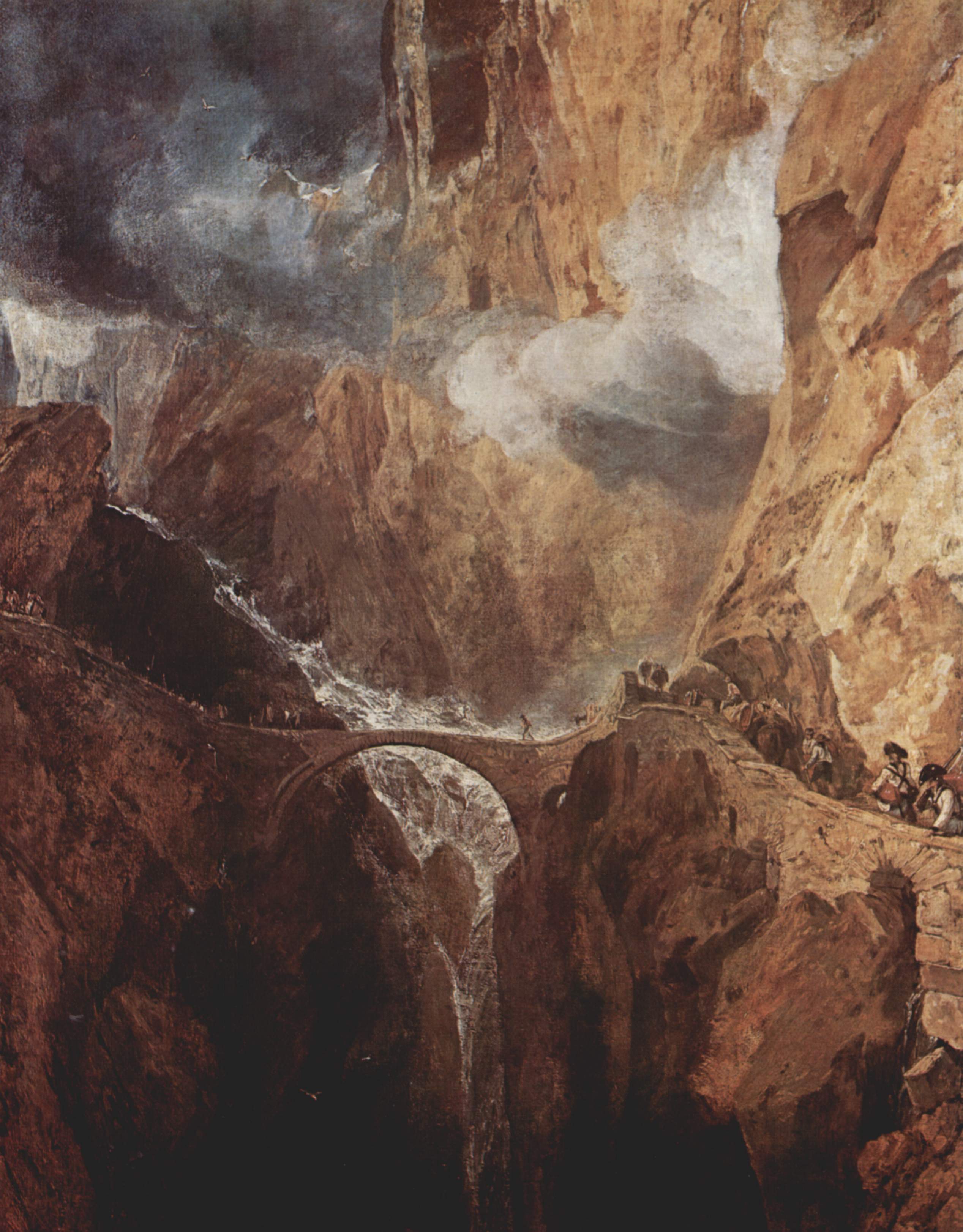
The Teufelsbrücke, St. Gotthard by J.M.W. Turner c. 1803.
-
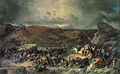
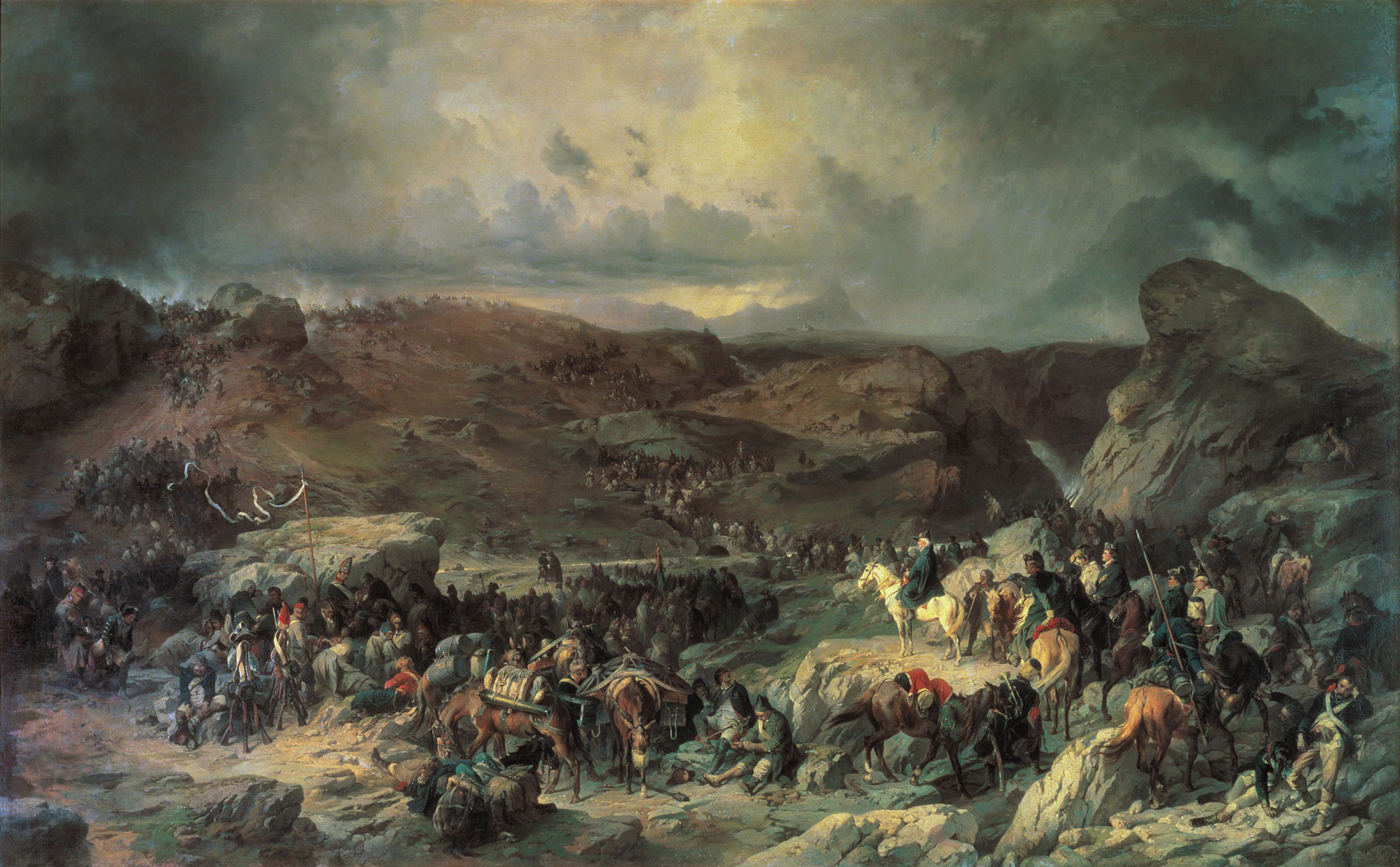
Field Marshal Alexander Suvorov Crossing St. Gotthard Pass, by Alexander Kotzebue.
See also
- List of highest paved roads in Europe
- List of mountain passes
- List of the highest Swiss passes
References
- ^ Hans-Peter Bärtschi: Gotthardbahn in German, French and Italian in the online Historical Dictionary of Switzerland. Version of 2004-07-29.
External links
Categories:- Mountain passes of Ticino
- Mountain passes of the Alps
- Uri
- Visitor attractions in Switzerland
-


Wikimedia Foundation. 2010.