- Col du Soulor
-
Col du Soulor 
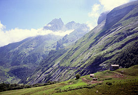
Road from Col d'Aubisque to Col du Soulor.Elevation 1474 m Location Pyrénées-Atlantiques,  France
Hautes-Pyrénées, France
Range Pyrenees Coordinates 42°57′38″N 0°15′40″W / 42.96056°N 0.26111°WCoordinates: 42°57′38″N 0°15′40″W / 42.96056°N 0.26111°W Col du Soulor (el. 1474 m.) is a high mountain pass in the Pyrenees in France, linking Argelès-Gazost with Arthez-d'Asson. It connects the Ouzom and Arens valleys.
The road is occasionally used in the Tour de France cycling race.
Contents
Tour de France
Col du Soulor was first used in the 1912 Tour de France and was last featured in the 17th stage of the 2010 Tour de France.[1]
See also
- List of highest paved roads in Europe
- List of mountain passes
External links
- Col du Soulor profile from Argelès-Gazost at climbbybike.com
- Col du Soulor profile from Arthez d'Asson at climbbybike.com
References
Categories:- Climbs in cycle racing
- Mountain passes of the Pyrenees
- Mountain passes of France
- Pyrénées-Atlantiques
- Hautes-Pyrénées
- Pyrénées-Atlantiques geography stubs
- Hautes-Pyrénées geography stubs
- Cycling stubs
Wikimedia Foundation. 2010.

