- Col d'Aubisque
-
Col d'Aubisque 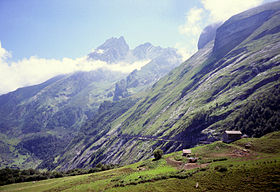
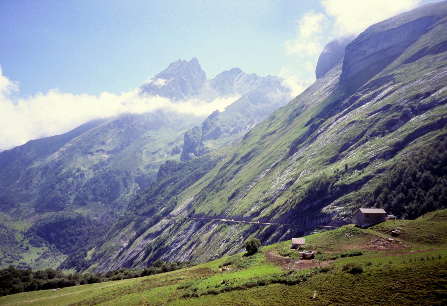
The Gave de Pau valley and the road seen in the background leading to Col d'AubisqueElevation 1,709 m (5,607 ft) Traversed by D918 Location Location of Col d'Aubisque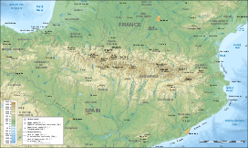

Location Pyrénées-Atlantiques,  France
Range Pyrenees Coordinates 42°58′36″N 0°20′23″W / 42.97667°N 0.33972°WCoordinates: 42°58′36″N 0°20′23″W / 42.97667°N 0.33972°W The Col d'Aubisque (1,709 m.; Occitan: Còth d'Aubisca) is a mountain pass in the Pyrenees 30 km south of Tarbes and Pau in the department of the Pyrénées-Atlantiques (64), in the Aquitaine region of France.[1]
The pass is on the northern slopes of the Pic de Ger (2,613m.) and connects Laruns, in the valley of the Gave d'Ossau, via Eaux-Bonnes (west) to Argelès-Gazost, in the valley of the Gave de Pau, via the Col du Soulor (east). The road crosses the Cirque du Litor, in the upper part of the Ouzom valley. It is generally closed from December to June.
The pass is starting point of excursions and a centre for winter sports. In summer, it is popular with cyclists. It is regularly part of the Tour de France, rated an hors catégorie climb.
Contents
Tour de France
 The Aubisque in 1910.
The Col d'Aubisque appeared in the Tour de France in 1910, crossed by François Lafourcade. It has appeared frequently since then, more than once every two years. It was included at the insistence of Alphone Steinès, a colleague of Henri Desgrange at the Tour de France. Steinès visited the man responsible for local roads, the ingénieur des ponts-et-chaussées, who said: "Take the riders up the Aubisque? You're completely crazy in Paris." [2] Steinès agreed that the Tour would pay 5,000 francs to clear the pass. Desgrange knocked the price down to 2,000.[3]
In 1951, Wim van Est was in the yellow jersey – the first Dutchman to wear it[4] and chasing the leaders towards the Soulor when he slipped on gravel and fell into a ravine. He said:
- That first bend was wet, slippery from the snow. And there were sharp stones on the road that the cars had kicked up, and my front wheel hit them and I went over. Well, there was a drop of 20m.[5] They've built a barrier there now but then there was nothing to stop you going over. I fell 20 metres, rolling and rolling and rolling. My feet had come out of the straps, my bike had disappeared, and there was a little flat area, the only one that's there, no bigger than the seat of a chair, and I landed on my backside. A metre left or right and I'd have dropped on to solid stone, six or seven hundred metres down. My ankles were all hurt, my elbows were kaput. I was all bruised and shaken up and I didn't know where I was, but nothing was broken.
The team's manager, Kees Pellenaars, took a tow rope from the Dutch team's car. It was too short to reach van Est and so to it he tied 40 racing tyres. It was like that that he was pulled out. Van Est said: "It was all the tyres that Pellenaars had for the team. By the time they'd tugged me up, they were all stretched and they wouldn't stay on the wheels any more! Forty tyres! I wanted to get back on my bike and start racing again. But I couldn't. Pellenaars stopped the whole team."
Van Est told journalists: "I had the feeling that I was taking that bend badly but I so much wanted to keep the yellow jersey, so I went flat out and off I flew.[6] A monument spot 50 years later, on July 17, 2001, says: "Here on 17 July 1951 the cyclist Wim van Est fell 70 metres. He survived but lost the yellow jersey."[7] A newspaper advertisement in Holland showed van Est displaying the watch that he'd worn, with the legend: "My heart stopped, but not my Pontiac."
Details of the climb
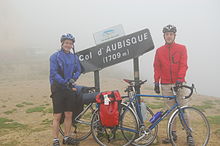 The sign at the col
On the west, the climb to the Aubisque starts in Laruns. From there, the Aubisque is 16.6 km and rises 1,190m, an average of 7.2%. The first kilometres, to the spa resort of Eaux-Bonnes, are fairly easy. After the Cascade de Valentin comes a section at 13 per cent. From there to the top, the climb is 8 km at eight per cent average, passing the ski resort of Gourette at 1,400m.
The east side is climbed after the Col de Soulor (1474 m). Starting from Argelès Gazost, the Soulor is 19.48 km. It rises 1,019m, an average 5.2 per cent. It gets tough after Arrens with 10 per cent and more. From the Soulor, the climb is 10.6 km, gaining a further 235m. The road from the Soulor runs along cliffs in the Cirque du Litor, where there are two short, narrow tunnels. From the Cirque du Litor, the climb is 7.5 km at 4.6 per cent, a height gain of 350m. Gilbert Duclos-Lasalle said:
- The Aubisque is one of those hors catégorie cols that make the legend of the Tour. The climb is in three parts. The first is fairly easy. The road is good and the specialists use 39 × 19 or 53 × 21. Then, at Eaux-Bonnes, you turn left and get to the real climb. This part, as far as Gourette, is a lot more difficult. The hardest part swings between eight and ten per cent from the seventh kilometre until Pont-du-Goua at the ninth kilometre and you need 39 × 21. Then, after 300m of flat in Gourette, a hairpin goes up to the Hôtel des Crêtes Blanches. Riders use 39 × 17 over four kilometres before going into 39 × 16 in the last two kilometres.[8]
Tour de France stage finishes
Stage 16 of the 2007 Tour de France finished at the summit of the Aubisque. There has been one previous finish at the summit (in 1985). In 1971, stage 16a finished at Gourette on the western approaches to Aubisque.[9]
Year Stage Start of stage Distance (km) Category of climb Stage winner Yellow jersey 2007 16 Orthez 218.5 HC Michael Rasmussen Michael Rasmussen 1985 18a Luz-Saint-Sauveur 52.5 1 Stephen Roche Bernard Hinault 1971 16a Bagnères-de-Luchon 145 1 Bernard Labourdette Eddy Merckx Rasmussen won stage 16 in 2007, confirming himself as favourite for victory in Paris, but that evening was sacked by his team and thrown off the race.
Passages in the Tour de France (since 1947)
There have been 42 passages over the summit since 1947, making it the second most visited mountain in the race’s history.[9]
See also
- List of highest paved roads in Europe
- List of mountain passes
References
- ^ Chany, Pierre (1988), La Fabuleuse Histoire du Tour de France, La Martinière, France, p112
- ^ Chany, Pierre (1988), La Fabuleuse Histoire du Tour de France, La Martinière, France, p112
- ^ Chany, Pierre (1988), La Fabuleuse Histoire du Tour de France, La Martinière, France, p112
- ^ Vélo, France, April 2005
- ^ Other reports put the fall at 70m
- ^ Vélo, France, April 2005
- ^ Vélo, France, April 2005
- ^ Vélo, France, March 2005
- ^ a b "Le col d'Aubisque dans le Tour de France de 1947 à 2012" (in French). le dico du tour. http://ledicodutour.perso.sfr.fr/montagnes/cols__a/aubisque.htm. Retrieved 19 November 2011.
External links
- Aubisque bicycle climb description excerpt from "Best Cycling Routes of the Pyrenees"
- Profile from the west on climbbybike.com
- Profile from the east on climbbybike.com
- Profile of the Col de Soulor on climbbybike.com
- Cycling Col d'Ausbique and the History of the Tour de France photos, video and report.
- Details of climbs
- le col d'Aubisque dans le Tour de France (French)
- Gourette dans le Tour de France (French)
- Complete list of Tour de France appearances
Categories:- Mountain passes of France
- Mountain passes of the Pyrenees
- Climbs in cycle racing
- 2007 Tour de France
- 2011 Tour de France


Wikimedia Foundation. 2010.