- Oberalp Pass
-
Oberalp Pass 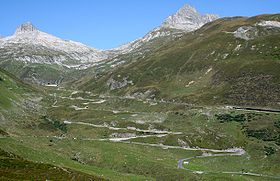
Elevation 2,044 m (6,706 ft) Traversed by Road Location Location of Oberalp Pass
 Oberalp Pass
Location  Switzerland
Range Alps Coordinates 46°39.54′N 08°40.26′E / 46.659°N 8.671°ECoordinates: 46°39.54′N 08°40.26′E / 46.659°N 8.671°E Oberalp Pass (Romansh: Alpsu or Cuolm d'Ursera, German: Oberalppass) (el. 2044 m.) is a high mountain pass in the Swiss Alps connecting the cantons of Graubünden and Uri between Disentis and Andermatt.
Contents
Winter closure
The public road that crosses the pass is being closed in winter, whereas the railway line of former Furka-Oberalp Bahn, now called Matterhorn-Gotthard-Bahn runs year round and provides a limited shuttle for cars in winter as well (reservation required). The closure depends on snowfall and differs therefore between end of October to beginning of December. Its opening in spring can be expected by the end of April but may also be happen by mid May.[1]
In Winter a ski area is stretching to the Graubünden side, connecting the pass well into the Tujetsch territory to Dieni, near Rueras.[2]
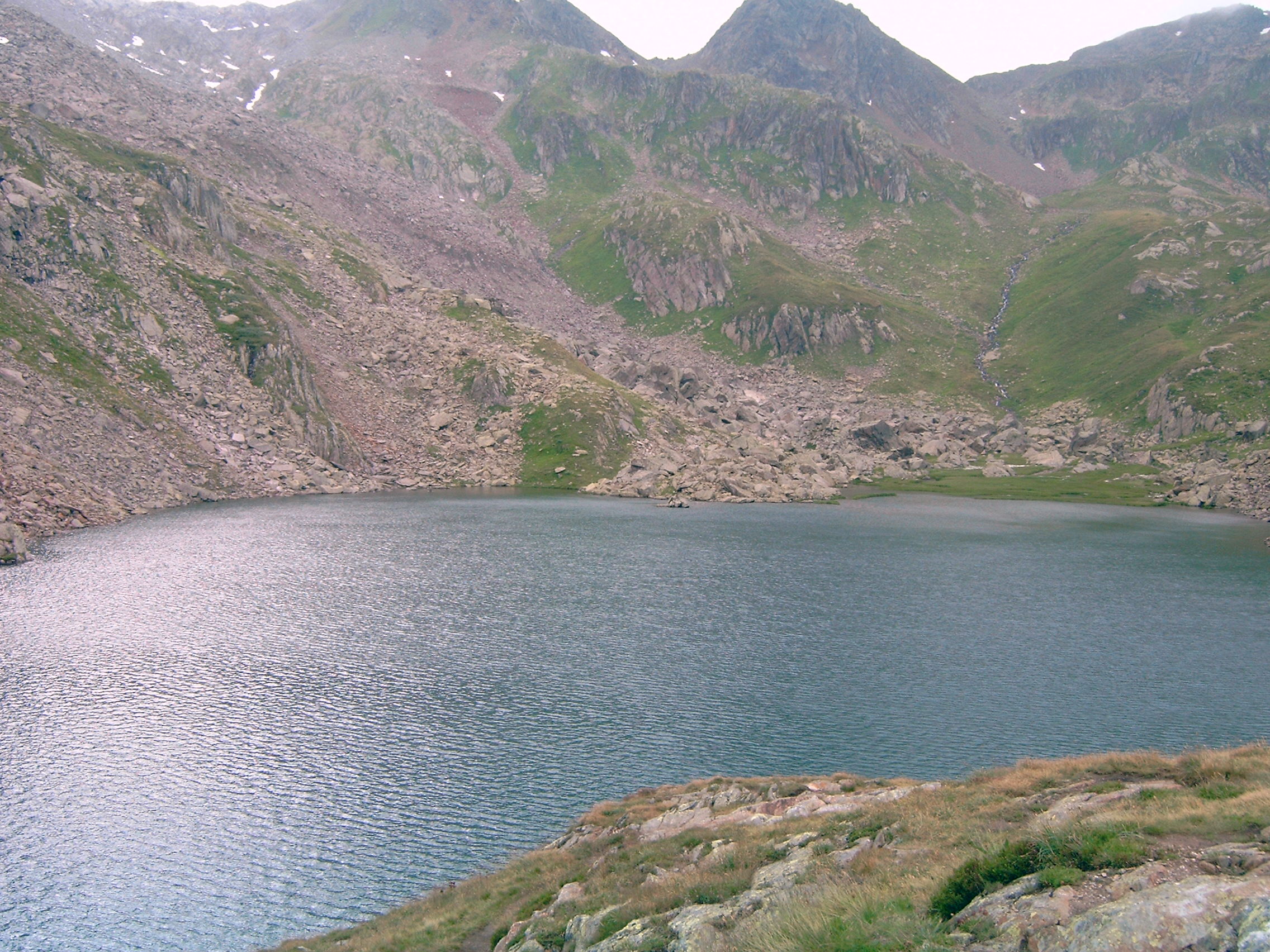
Source of the Rhine river
The Rhine springs from a source nearby (Tomasee), which is marked by a working lighthouse. A multiday trekking route is signposted across Oberalp pass and along the young Rhine called Senda Sursilvana.[3]
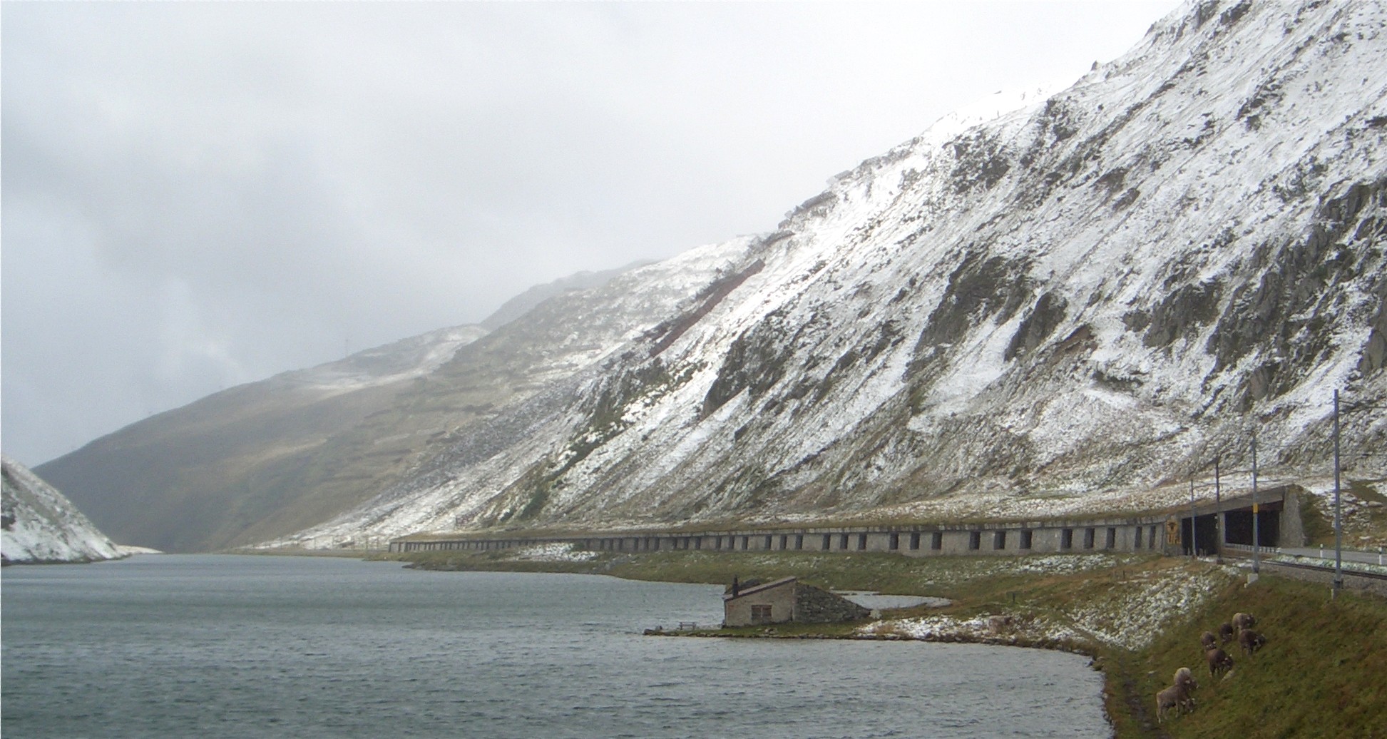
Oberalpsee is located 20 m below, in the direction of Andermatt.
Railway Station
The Oberalppass railway station is located just below the Oberalp ski area. It has 3 platforms, and is owned and run by the Matterhorn Gotthard Bahn.
Ski Area
Main article: Gotthard Oberalp ArenaThe Oberalppass passes the Oberalp ski area, which is part of the Gotthard Oberalp Arena.
There are currently plans for the ski area to be linked up with Naetschen, the neighbouring mountain, which is also part of the Gotthard Oberalp Arena.
See also
- List of highest paved roads in Europe
- List of mountain passes
- List of the highest Swiss passes
- Gotthard Oberalp Arena
-

Oberalp Pass
-

Oberalpsee and railway/road protection tunnel
-

Summit of the road (railway uses short tunnel)
-

winter activity
References
- ^ Statistic opening period of the pass (german)
- ^ Swiss Ski resort Oberalp Pass and Sedrun(English)
- ^ [(English)Hiking Switzerland on Senda Sursilvana across the pass]
External links
Categories:- Mountain passes of Switzerland
- Mountain passes of the Alps
- Mountain passes of Graubünden
- Uri
- Ski areas and resorts in Switzerland
- Matterhorn Gotthard Bahn Stations
- Switzerland geography stubs
- Graubünden geography stubs


Wikimedia Foundation. 2010.