- Coacalco de Berriozábal
-
Coacalco de Berriozabal
At the house of the snake.
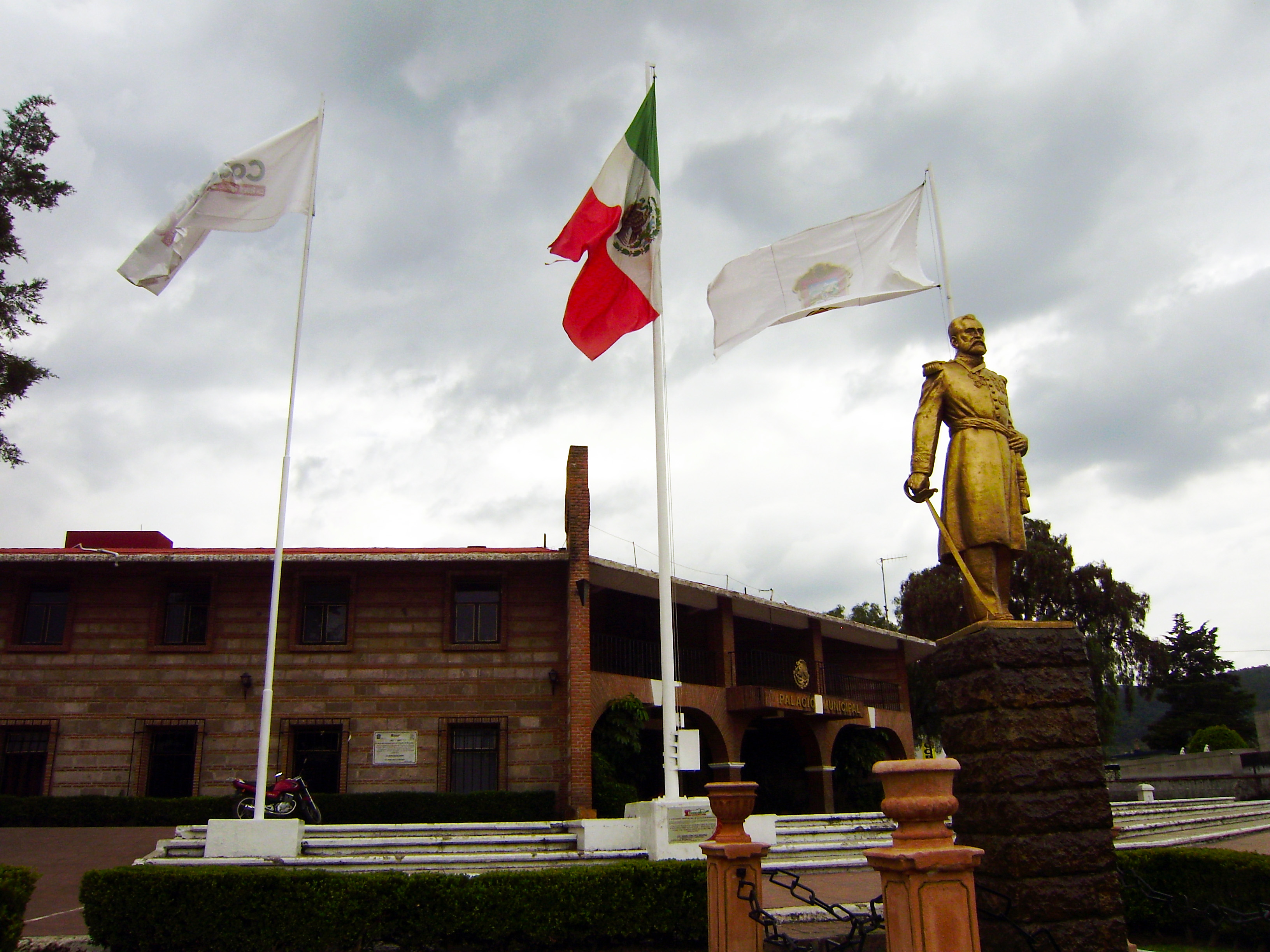
Coacalco— Town & Municipality — Coacalco City Hall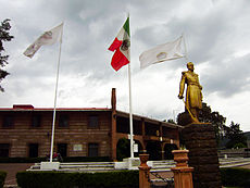

Seal
Coat of armsNickname(s): Coacalco Motto: Respect, responsibility and modernity 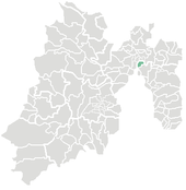
Country  Mexico
State Mexico Municipality Founded 850 Municipal Status 1862 Government - Municipal President Roberto Ruiz Moronatti (2009-2012) Area - Municipality 35.5 km2 (13.7 sq mi) - Land 31.95 km2 (12.3 sq mi) - Water 3.55 km2 (1.4 sq mi) Elevationof seat 2,257 m (7,405 ft) Population (2010) - Municipality 278,064 - Seat 277,959 - Demonym Coacalquense Time zone CST (UTC-6) - Summer (DST) EST (UTC-5) Postal code (of seat) 55700 Area code(s) 55 Website http://www.coacalco.gob.mx/ Coacalco de Berriozábal (better known as Coacalco) is a city and municipality located in State of Mexico, Mexico. Its name comes from the Nahuatl, Coa-coatl (snake), cal-calli (home) and -co (at), meaning "at the house of the snake", and was first recorded in 1320.[1] The municipality lies in the Greater Mexico City conurbation and it is located next to the northern tip of the Mexico City. The official name of its municipal seat is San Francisco Coacalco.
Contents
History
Coacalco is part of the Valley of Mexico. It is located the site of what was once the city-state Xaltocan. Between 850 and 1521, the municipality was inhabited by the Toltec people.[1] In the 18th and 19th centuries, the principal economic activities were agriculture, husbandry and salt collection. On February 12, 1862, the then-governor of the state, General Felipe de Berriozábal signed the order declaring the city to be an independent municipality, ending 343 years of dependency on the municipality Ecatepec.[1]
Economy
Coacalco's economy has changed in the last thirty years. It switched from being primarily agricultural and rural to an urban industrial area. At present, the municipality is one of the principal commercial districts of the north of the Metropolitan Area. Coacalco has raised the quality of life of the population including health, education and entertainment services.
Population
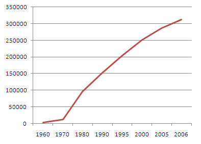
 Increase in the Population of Coacalco as 2006.
Located next to Mexico City, Coacalco's population has increased by more than 100,000 in the last decade. In 2005, the city had a population of 252,555 people.[2] According to the Human Development Index (HDI) in Mexico, Coacalco was ranked ten in the best places to live in the country, in 2005.[3] The 2010 census reported a municipal population of 278,064 inhabitants.[4]
Towns and villages
Localities (cities, towns, and villages) are:[5]
Name 2010 Census Population San Francisco Coacalco 277,959 Basurero Municipal (La Aurora) 99 Bosques de Coacalco 3 Propiedad Díaz 3 Total Municipality 278,064 References
- ^ a b c "Enciclopedia de los Municipios de Mexico Estado de Mexico Coacalco" (in Spanish). Instituto Nacional para el Federalismo y el Desarrollo Municipal. http://e-local.gob.mx/work/templates/enciclo/EMM15mexico/municipios/15020a.html. Retrieved April 20, 2010.
- ^ "Población total, edad, edad mediana e índice de masculinidad" (in Spanish). Instituto Nacional de Estadística, Geografía e Informática. 2005. http://www.inegi.org.mx/sistemas/tabuladosbasicos/tabulados/cpv2000/15po04.pdf. Retrieved 20 April 2010.
- ^ "Los 10 mejores lugares para vivir [The 10 best places to live]" (in Spanish). CNN. 30 July 2008. http://www.cnnexpansion.com/actualidad/2008/07/30/los-10-mejores-municipios-para-vivir. Retrieved 7 October 2011.
- ^ "División municipal. Estado de México [Municipal division. State of Mexico]" (in Spanish). INEGI. 2010. http://cuentame.inegi.org.mx/monografias/informacion/mex/territorio/div_municipal.aspx?tema=me&e=15. Retrieved 7 October 2011.
- ^ 2010 census tables: INEGI
External links
- Ayuntamiento de Coacalco de Berriozábal Official website of the Municipality of Coacalco de Berriozábal
 State of Mexico
Toluca (capital) Municipalities Acambay · Acolman de Nezahualcóyotl · Aculco · Almoloya de Alquisiras · Almoloya de Juárez · Almoloya del Río · Amanalco · Amatepec · Amecameca · Apaxco · San Salvador Atenco · Santa Cruz Atizapán · Ciudad López Mateos · Atlacomulco · Atlautla · Axapusco · Ayapango · Buenavista · Calimaya · Capulhuac · Chalco de Díaz Covarrubias · Chapa de Mota · Chapultepec · Chiautla · Chicoloapan · Chiconcuac · Chimalhuacán · Coacalco de Berriozábal · Coatepec Harinas · Cocotitlán · Coyotepec · Cuautitlán · Cuautitlán Izcalli · Donato Guerra · Ecatepec de Morelos · Ecatzingo · El Oro · Huehuetoca · Hueypoxtla · Huixquilucan · Ixtapaluca · Ixtapan de la Sal · Ixtapan del Oro · Ixtlahuaca · Jaltenco · Jilotepec · Jilotzingo · Jiquipilco · Jocotitlán · Joquicingo · Juchitepec · Los Reyes Acaquilpan · Lerma · Luvianos · Malinalco · Melchor Ocampo · Metepec · Mexicaltzingo · Morelos · Naucalpan · Nextlalpan · Nezahualcóyotl · Ciudad Nicolás Romero · Nopaltepec · Ocoyoacac · Ocuilán · Otumba · Otzoloapan · Otzolotepec · Ozumba · Papalotla · Polotitlán · San Antonio la Isla · San Felipe del Progreso · San Martín de las Pirámides · San Mateo Atenco · San Simón de Guerrero · Santo Tomás de los Plátanos · Soyaniquilpan · Sultepec · Tecámac · Tejupilco · Temamatla · Temascalapa · Temascalcingo · Temascaltepec · Temoaya · Tenancingo de Degollado · Tenango del Aire · Tenango del Valle · Teoloyucan · Teotihuacán de Arista · Tepetlaoxtoc · Tepetlixpa · Tepotzotlán · Tequixquiac · Texcaltitlán · Texcalyacac · Texcoco de Mora · Tezoyuca · Tianguistenco · Timilpan · Tlalmanalco · Tlalnepantla · Tlatlaya · Toluca · Tonatico · Tonanitla · Tultepec · Tultitlán · Valle de Bravo · Xico · Villa de Allende · Villa del Carbón · Villa Guerrero · Villa Victoria · Xalatlaco · Xonacatlán · Zacazonapan · Zacualpan · Zinacantepec · Zumpahuacán · Zumpango

Coordinates: 19°38′00″N 99°05′35″W / 19.6333333°N 99.09306°W
Categories:- Populated places in the State of Mexico
- Nahuatl words and phrases
- Mexico City metropolitan area


Wikimedia Foundation. 2010.