- Chillesford
-
Coordinates: 52°07′N 1°29′E / 52.12°N 1.48°E
Chillesford 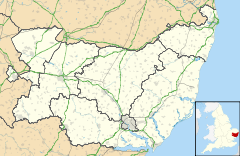
 Chillesford
Chillesford shown within SuffolkPopulation 130 Parish Chillesford District Suffolk Coastal Shire county Suffolk Region East Country England Sovereign state United Kingdom Post town Woodbridge EU Parliament East of England List of places: UK • England • Suffolk Chillesford is a village and a civil parish in the Suffolk Coastal District, in the English county of Suffolk. It is located on the B1084 road Hertfords Place, which runs east to west. Chillesford is 3 miles northwest of the small town of Orford. It is 5 miles southwest of Aldeburgh and 6 miles south of Saxmundham. Population of around 120 and 60 houses. The village was recorded in Domesday as "Cesefortda".
In 1258, Thomas Weyland bought the Manor of Chillesford.
Amy Bantoff used to run the village shop but now closed and Mr Pratt, ran the local farm.
Chillesford has a pub, The Froize Inn (east end of B1084), which used to be two cottages.
A church (west end of B1084 - OS grid TM3852) has a tower and various other local buildings are made from local red crag bricks.
The old brickyard was where a 20m skeleton of a whale was also once found.
Pedlars Lane (heads north from the centre of the village) to Tunstall Chapel. Mill Lane (heads south and then south-west) which leads to Butley, Suffolk.
Chillesford Lodge (OS grid TM3950) lies over a mile southeast from the village close to Sudbourne Park.
The first polo field to be irrigated in the UK, started in the area in 1936. Fred Warner based at Lion St, Ipswich did the work. The field was ploughed up during the second world war but used again afterwards. The polo field was finally closed after the owner of the field was trampled by horses in 1956.
References:
Towns Civil parishes Alderton · Aldringham cum Thorpe · Badingham · Bawdsey · Benhall · Blaxhall · Blythburgh · Boulge · Boyton · Bramfield · Brandeston · Bredfield · Brightwell · Bromeswell · Bruisyard · Bucklesham · Burgh · Butley · Campsea Ashe · Capel St Andrew · Charsfield · Chediston · Chillesford · Clopton · Cookley · Cransford · Cratfield · Cretingham · Culpho · Dallinghoo · Darsham · Debach · Dennington · Dunwich · Earl Soham · Easton · Eyke · Falkenham · Farnham · Foxhall · Framlingham · Friston · Gedgrave · Great Bealings · Great Glemham · Grundisburgh · Hacheston · Hasketon · Hemley · Heveningham · Hollesley · Hoo · Huntingfield · Iken · Kelsale cum Carlton · Kesgrave · Kettleburgh · Kirton · Knodishall · Letheringham · Levington · Linstead Magna · Linstead Parva · Little Bealings · Little Glemham · Marlesford · Martlesham · Melton · Middleton · Monewden · Nacton · Newbourne · Otley · Parham · Peasenhall · Pettistree · Playford · Purdis Farm · Ramsholt · Rendham · Rendlesham · Rushmere St Andrew · Saxtead · Shottisham · Sibton · Snape · Sternfield · Stratford St Andrew · Stratton Hall · Sudbourne · Sutton · Swefling · Swilland · Theberton · Thorington · Trimley St Martin · Trimley St Mary · Tuddenham St Martin · Tunstall · Ubbeston · Ufford · Walberswick · Waldringfield · Walpole · Wantisden · Wenhaston with Mells Hamlet · Westerfield · Westleton · Wickham Market · Witnesham · YoxfordOther settlements See also: Listed buildings · Local elections Categories:- Suffolk Coastal
- Villages in Suffolk
- Civil parishes in Suffolk
- Suffolk geography stubs

Wikimedia Foundation. 2010.