- Cretingham
-
Coordinates: 52°07′N 1°10′E / 52.11°N 1.16°E
Cretingham 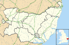
 Cretingham
Cretingham shown within SuffolkPopulation 200 OS grid reference TM2260 Parish Cretingham District Suffolk Coastal Shire county Suffolk Region East Country England Sovereign state United Kingdom Post town WOODBRIDGE Postcode district IP13 Dialling code 01728 EU Parliament East of England List of places: UK • England • Suffolk Cretingham is a village and a civil parish in the Suffolk Coastal District, in the English county of Suffolk. It is on the River Deben, 2 miles south off the A1120 road. It is four miles west from Framlingham and eight miles northwest from Woodbridge.
Contents
Location
It is based on a crossroad, The Street (north-south) and Framsden Road (west) and Brandeston Road (east).
Located in the old Hundred of Loes (hundred) and Domesday's name of Gretingeham" or "Gretingaham".
St Peter's church is half the way up the north part of The Street.
History
During renovation work on a hunting lodge near Aldeburgh in 1996, a carpenter uncovered a plank of wood revealing a chilling penciled message: "A fearful murder was committed the first day of this month (October 1887) at Cretingham. A curate cut the vicars throat at 12 oclock at night." Shiela Hardy wrote a book about it (ISBN 9780752448954)
The old Bell Inn is now a dwelling called Dial House. The new Bell pub opened in 1967 located at the crossroads and dates from 1620s and was formerly four cottages.
Cretingham Primary School closed in the early 1960s (Miss Last being the last teacher).
Present day
Cretingham has a pub, a church and a golf course (to the northeast of the village).
Several farms in the area, Bungalow Farm in the southwest, Corner Farm in the southeast, Duck's Farm to the west and Rookery Farm and Manor Farm to the north.
External links
References
Coordinates: 52°11′N 1°16′E / 52.183°N 1.267°E
Towns Civil parishes Alderton · Aldringham cum Thorpe · Badingham · Bawdsey · Benhall · Blaxhall · Blythburgh · Boulge · Boyton · Bramfield · Brandeston · Bredfield · Brightwell · Bromeswell · Bruisyard · Bucklesham · Burgh · Butley · Campsea Ashe · Capel St Andrew · Charsfield · Chediston · Chillesford · Clopton · Cookley · Cransford · Cratfield · Cretingham · Culpho · Dallinghoo · Darsham · Debach · Dennington · Dunwich · Earl Soham · Easton · Eyke · Falkenham · Farnham · Foxhall · Framlingham · Friston · Gedgrave · Great Bealings · Great Glemham · Grundisburgh · Hacheston · Hasketon · Hemley · Heveningham · Hollesley · Hoo · Huntingfield · Iken · Kelsale cum Carlton · Kesgrave · Kettleburgh · Kirton · Knodishall · Letheringham · Levington · Linstead Magna · Linstead Parva · Little Bealings · Little Glemham · Marlesford · Martlesham · Melton · Middleton · Monewden · Nacton · Newbourne · Otley · Parham · Peasenhall · Pettistree · Playford · Purdis Farm · Ramsholt · Rendham · Rendlesham · Rushmere St Andrew · Saxtead · Shottisham · Sibton · Snape · Sternfield · Stratford St Andrew · Stratton Hall · Sudbourne · Sutton · Swefling · Swilland · Theberton · Thorington · Trimley St Martin · Trimley St Mary · Tuddenham St Martin · Tunstall · Ubbeston · Ufford · Walberswick · Waldringfield · Walpole · Wantisden · Wenhaston with Mells Hamlet · Westerfield · Westleton · Wickham Market · Witnesham · YoxfordOther settlements See also: Listed buildings · Local electionsCategories:- Suffolk Coastal
- Villages in Suffolk
- Civil parishes in Suffolk
- Suffolk geography stubs

Wikimedia Foundation. 2010.