- Chillerton
-
Coordinates: 50°39′24″N 1°18′22″W / 50.656584°N 1.306129°W
Chillerton 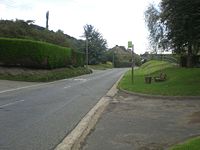
 Chillerton
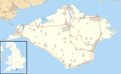
Chillerton shown within the Isle of WightOS grid reference SZ488392 Unitary authority Isle of Wight Ceremonial county Isle of Wight Region South East Country England Sovereign state United Kingdom Post town NEWPORT Postcode district PO30 Dialling code 01983 Police Hampshire Fire Isle of Wight Ambulance Isle of Wight EU Parliament South East England UK Parliament Isle of Wight List of places: UK • England • Isle of Wight Chillerton is a village between Newport and Chale on the Isle of Wight in southern England. Chillerton is in the middle of a farming community.[1]
The nearby Chillerton Down is the site of an unfinished Iron Age promontory fort[citation needed] and a 229-metre (751 ft) antenna for the Isle of Wight radio station broadcasting on 107.00 MHz, as well as several other stations.[2] It is the village's most prominent feature and can be seen from most parts of the island. It is known as the Chillerton Down transmitting station.[2] Chillerton Down is flown by Paragliders in a E to SE wind and on days with good thermals the top of the mast can be reached.
In 1907 a deal was signed by Charles Seely to ensure residents in properties older than 1907 in Chillerton and nearby Gatcombe are entitled to free water, while newer homes receive it at a reduced rate. However recently Southern Water have proposals for everyone to pay the same rate claiming that the initial pact has now run its course and the cost from the land used for the construction of water works has long since been paid off.[3]
Chillerton and Rookley Primary School is located on the High Street in Chillerton. It is a small village school with a total of 43 students on roll from local areas.[4] However, education changes look likely to see the school close in the near future. The school is likely to amalgamate with primary schools in Godshill and Wroxall to form one new school over two existing sites at Godshill and Wroxall.[5]
Public transport is provided by Southern Vectis bus route 6, which runs between Newport and Ventnor[6] and Wightbus route 36, running between Newport and Moortown.[7]
References
- ^ "Wightstay - Netguide to Chillerton on the Isle of Wight". www.wightstay.co.uk. http://www.wightstay.co.uk/context/chiller.html. Retrieved 2008-11-02.
- ^ a b tx.mb21.co.uk - Chillerton Down. Retrieved 26 March 2007.
- ^ "Villagers battle to keep free water". Isle of Wight County Press. http://www.iwcp.co.uk/news/news/villagers-battle-to-keep-free-water-25682.aspx. Retrieved 2009-04-17.
- ^ "EduWight - Isle of Wight School details - Chillerton and Rookley Primary School". www.eduwight.iow.gov.uk. http://eduwight.iow.gov.uk/schools/school.asp?frmSchId=922. Retrieved 2008-09-07.
- ^ "Isle of Wight County Press - School Reform Plans Revealed". www.iwcp.co.uk. http://www.iwcp.co.uk/News/SCHOOL_REFORM_PLANS_REVEALED.aspx. Retrieved 2008-09-07.[dead link]
- ^ "Southern Vectis bus route 6". www.islandbuses.info. 2008. http://www.islandbuses.info/r6.shtml. Retrieved 2007-10-24.
- ^ "Traveline south east - Wightbus route 36". www.travelinesoutheast.org.uk. 2008. http://www.travelinesoutheast.org.uk/se/XSLT_TTB_REQUEST?language=en&command=direct&net=set&line=08036&sup=A&project=y08&contentFilter=TIMINGPOINTS&outputFormat=0&itdLPxx_displayHeader=false. Retrieved 2008-04-30.
Ceremonial county of Isle of Wight Isle of Wight Portal Unitary authorities Major settlements Rivers Topics Categories:- Villages on the Isle of Wight


Wikimedia Foundation. 2010.