- Newchurch, Isle of Wight
-
Coordinates: 50°39′52″N 1°12′30″W / 50.66454°N 1.20834°W
Newchurch 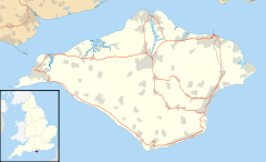
 Newchurch
Newchurch shown within the Isle of WightOS grid reference SZ560852 Parish Newchurch Unitary authority Isle of Wight Ceremonial county Isle of Wight Region South East Country England Sovereign state United Kingdom Post town SANDOWN Postcode district PO36 Dialling code 01983 Police Hampshire Fire Isle of Wight Ambulance Isle of Wight EU Parliament South East England UK Parliament Isle of Wight List of places: UK • England • Isle of Wight Newchurch is a village and civil parish[1] on the Isle of Wight. It is located between Sandown and Newport in the southeast of the island. Anthony Dillington, owner of the Knighton Gorges Manor in Newchurch wrote to his son Robert in 1574 that, "This is the very Garden of England, and we be privileged to work in it as Husbandmen......."
 Newchurch All Saints Church & Pointer Inn
Newchurch obtained its name from the new church built in 1087 by the Norman monks of Lyra. The Newchurch Parish for many centuries stretched from the north to south coasts of the Island; by the early Nineteenth Century the growing resort towns of Ventnor and Ryde were included within its boundaries. The present day parish includes Newchurch Village, Apse Heath, Winford, Whiteley Bank, Alverstone, Alverstone Garden Village, Queen's Bower, Princelett and Mersley.
Public transport is provided by Wightbus bus route 23, operating between Newport and Shanklin.[2] The Sustrans route 23 cycle route also runs through the village at the bottom of the Shute, allowing easy access to Cowes, Newport and Sandown. Between 1875 and 1956 Newchurch had the advantage of a railway station. There is a pub called "The Pointer Inn" and a sub-post office.
See also
- All Saints' Church, Newchurch
References
- ^ English Parishes & Welsh Communities N&C 2004
- ^ "Traveline – Wightbus route 23". www.traveline.org.uk. 2008. http://www.travelinesoutheast.org.uk/se/XSLT_TTB_REQUEST?language=en&command=direct&net=set&line=08023&sup=A&project=y08&contentFilter=TIMINGPOINTS&outputFormat=0&itdLPxx_displayHeader=false. Retrieved 4 May 2008.
External links
Ceremonial county of Isle of Wight Isle of Wight Portal Unitary authorities Major settlements Rivers Topics Categories:- Villages on the Isle of Wight
- Civil parishes in the Isle of Wight
- Isle of Wight geography stubs


Wikimedia Foundation. 2010.