- Newchurch (Isle of Wight) railway station
-
Newchurch 
The track bed near Newchurch Station is now a cycle path. Location Place Newchurch Area Isle of Wight Grid reference SZ577856 Operations Pre-grouping Isle of Wight and Newport Junction Railway (1868-inc; 1875-1887)
Isle of Wight Central Railway (1887 to 1923)Post-grouping Southern Railway (1923 to 1948)
Southern Region of British Railways (1948 to 1956)Platforms 1 History 1 February 1875 Opened 6 February 1956 Closed Disused railway stations in the United Kingdom Closed railway stations in Britain
A B C D–F G H–J K–L M–O P–R S T–V W–Z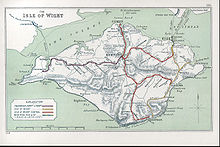
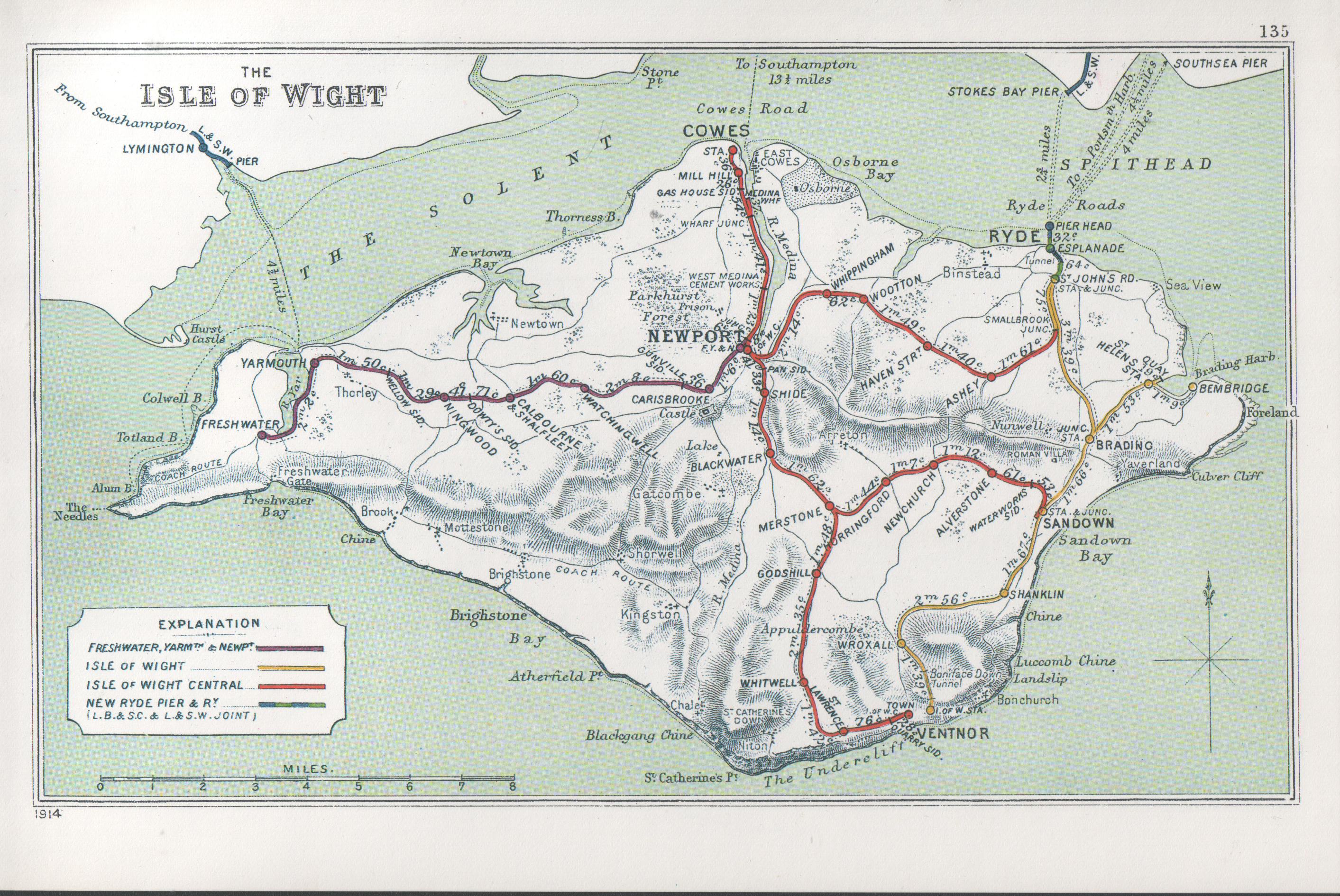
Newchurch railway station, was an intermediate station situated on the edge of Newchurch village [1] on the line from Newport to Sandown incorporated by the Isle of Wight and Newport Junction Railway in 1868,[2] opened in 1875 and closed 81 years later.[3] Despite its rural location a “respectable” [4] number of families alighted at the simple station, "little more than a wooden hut”.[5] The nearest location to the site is a bungalow, Newchurch Crossing.[6]
Preceding station Disused railways Following station Alverstone British Rail
Southern Region
IoW CR : Sandown to Newport lineHorringford See also
References
- ^ Pomeroy, C,A "Isle Of Wight Railways, Then and Now": Oxford,Past & Present Publishing, 1993, ISBN 0947971629
- ^ Bennett,A "Southern Holiday Lines in Hampshire and the Isle of Wight" Cheltenham, Runpast 1994 ISBN 187075431X
- ^ Hay,P "Steaming Through the Isle Of Wight",: Midhurst,Middleton, 1988 ISBN 0906520568
- ^ Britton,A "Once upon a line (Vol 4)" Oxford, OPC, 1994 ISBN 0860935132
- ^ Paye,P "Isle of Wight Railways remembered" : Oxford, OPC, 1984 ISBN 0860932191
- ^ Gammell C.J, "Southern Branch Lines", Oxford, OPC, 1997 ISBN 086093537X
External links
Ex stations on the Isle of Wight Alverstone · Bembridge · Blackwater · Calbourne & Shalfleet · Carisbrooke · Cement Mills Halt · Cowes · Freshwater · Godshill · Horringford · Medina Wharf · Merstone · Mill Hill · Newchurch · Newport FYN · Newport IWCR · Newport Pan Lane · Ningwood · Shide · St Helens · St Lawrence · Ventnor · Ventnor West · Watchingwell · Whippingham · Whitwell · Wroxall · Yarmouth
Coordinates: 50°40′11.8″N 1°12′29.41″W / 50.669944°N 1.2081694°W
Categories:- Disused railway stations on the Isle of Wight
- Former Isle of Wight Central Railway stations
- Railway stations opened in 1875
- Railway stations closed in 1956
- South East England railway station stubs

Wikimedia Foundation. 2010.