- Chambers Covered Bridge
-
Chambers Bridge

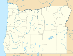

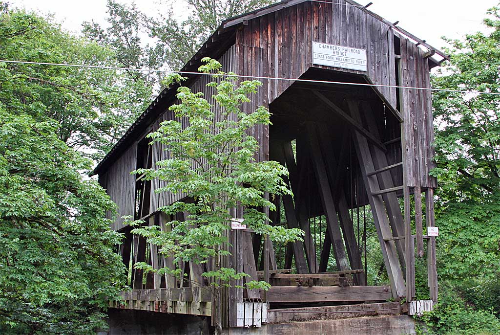
Location: S. River Rd., Cottage Grove, Oregon Coordinates: 43°47′34″N 123°4′7″W / 43.79278°N 123.06861°W Area: 0.1 acres (0.040 ha) Built: 1925 Architectural style: Howe Truss Governing body: Local MPS: Oregon Covered Bridges TR NRHP Reference#: 79002081[1] Added to NRHP: November 29, 1979 The Chambers Covered Bridge is a covered bridge located in Cottage Grove, Oregon, United States. It is 78 feet (24 m) long and spans the Coast Fork Willamette River. It was built in 1925 to carry rail traffic to the J.H. Chambers Mill,[2] a lumber mill which was located on an area which is now the Bohemia School baseball diamonds and adjacent empty fields. It is no longer in service. It is the only remaining covered rail bridge in Oregon.[3]
Contents
Construction
It is a Howe truss design.[2]
Preservation
In FY 2008, The National Historic Covered Bridge Preservation Program, administered by the Federal Highway Administration, awarded a grant of $1,315,370 to the City of Cottage Grove for the rehabilitation of the Chambers Covered Bridge, one of seven covered bridges in Oregon that received grants the same period.[4]
See also
References
- ^ "National Register Information System". National Register of Historic Places. National Park Service. 2009-03-13. http://nrhp.focus.nps.gov/natreg/docs/All_Data.html.
- ^ a b "Chambers Covered Bridge". City of Cottage Grove, Oregon. http://www.cottagegrove.org/chambers.html. Retrieved 2011-10-21.
- ^ "Chambers Covered Bridge". Lane County, Oregon. http://www.co.lane.or.us/About/Pages/Chambers.aspx. Retrieved 2011-10-21.
- ^ "National Historic Covered Bridge Preservation Program". http://www.fhwa.dot.gov/BRIDGE/nhcbp/090112a.cfm. Retrieved 2009-01-28.
External links
Coordinates: 43°47′22″N 123°04′11″W / 43.78937°N 123.06968°W
U.S. National Register of Historic Places Topics Lists by states Alabama • Alaska • Arizona • Arkansas • California • Colorado • Connecticut • Delaware • Florida • Georgia • Hawaii • Idaho • Illinois • Indiana • Iowa • Kansas • Kentucky • Louisiana • Maine • Maryland • Massachusetts • Michigan • Minnesota • Mississippi • Missouri • Montana • Nebraska • Nevada • New Hampshire • New Jersey • New Mexico • New York • North Carolina • North Dakota • Ohio • Oklahoma • Oregon • Pennsylvania • Rhode Island • South Carolina • South Dakota • Tennessee • Texas • Utah • Vermont • Virginia • Washington • West Virginia • Wisconsin • WyomingLists by territories Lists by associated states Other Categories:- Covered bridges in Lane County, Oregon
- Bridges completed in 1925
- Cottage Grove, Oregon
- Bridges on the National Register of Historic Places in Oregon
- Railroad bridges in Oregon
- Lane County, Oregon geography stubs

Wikimedia Foundation. 2010.