- Downtown Memphis, Tennessee
-
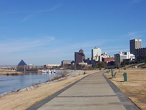
Downtown Memphis, Tennessee is the central business district of Memphis, Tennessee and is located along the Mississippi River between Interstate 40 to the north, Interstate 55 to the south and I-240 to the east, where it abuts Midtown Memphis.
It is home to the Memphis Redbirds, the AAA affiliate of the St. Louis Cardinals, and the Memphis Grizzlies NBA team.
Contents
History
Main article: History of Memphis, Tennessee The Memphis river landing (1906)
Downtown is the oldest part of the city and includes the riverfront and the bluffs overlooking the Mississippi river. The founders of Memphis dedicated the riverfront to the public "now and forever" as long as the public use continued. The land overlooking the riverfront was originally planned to become a "public promenade" to be called Mississippi Row. The upper riverfront became the site of the river landing where steamboats were loaded with cotton and other goods in the 19th and early 20th centuries. Between 1844 and 1886 the river landing was paved with limestone and granite cobblestones brought in from the upper Midwest. This created what is today the largest intact Mississippi River landing still in existence, and is listed on the National Register of Historic Places.[1] The explosion of the SS Sultana in 1865 near Memphis is one of the worst marine disasters in history.
There are several historic residences downtown, particularly in the Victorian Village neighborhood. Other historic homes include the Hunt-Phelan House (1830), the Magevney House (ca. 1835) and the Burkle Estate (1849). The Burkle home and the Hunt Phelan House (533 Beale Street) were reputed to have been part of the underground railroad by which escaped slaves made their way to freedom prior to the Civil War.[2]
Downtown Airport
In 1959, the Memphis Downtown Airport was opened on Mud Island, which at that time was called City Island. The one-runway airport could be reached by a pontoon-boat ferry and was used mostly by businessmen and shoppers. The Downtown Airport was closed in 1970.[3]
Overview
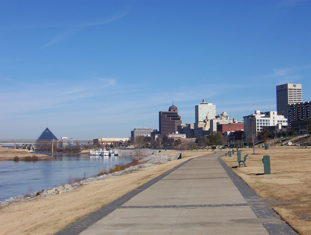
Buildings
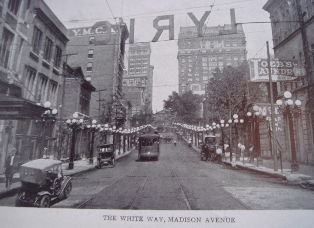
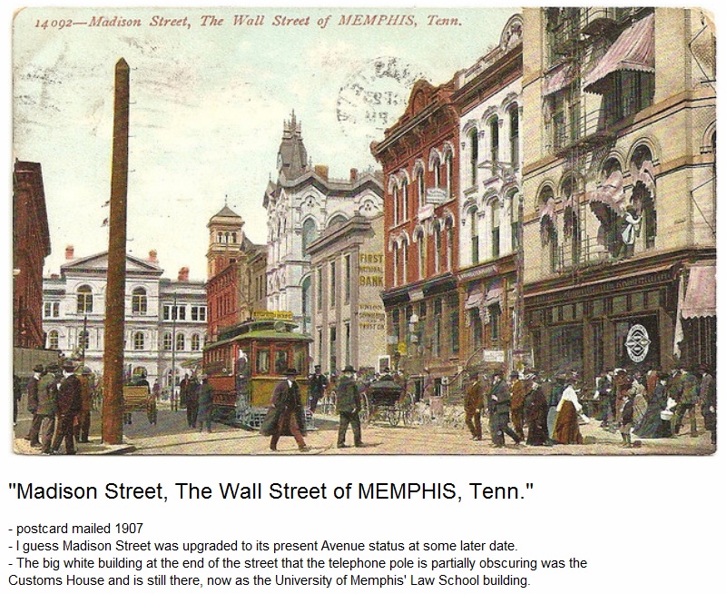
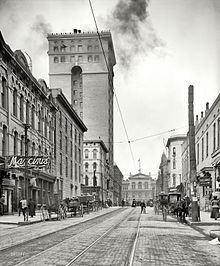 View west on Madison Avenue, ending with the Customs House (1906)
The Downtown Memphis skyline contains the tallest buildings in the city. The tallest building in Memphis, 100 North Main, is located at the heart of downtown along Main Street at Adams Ave and rises to 430 ft (131m). Some notable and/or historic downtown buildings are:
- 100 North Main
- One Commerce Square
- Sterick Building
- Exchange Building, Memphis
- Morgan Keegan Tower
- First Tennessee Bank Building
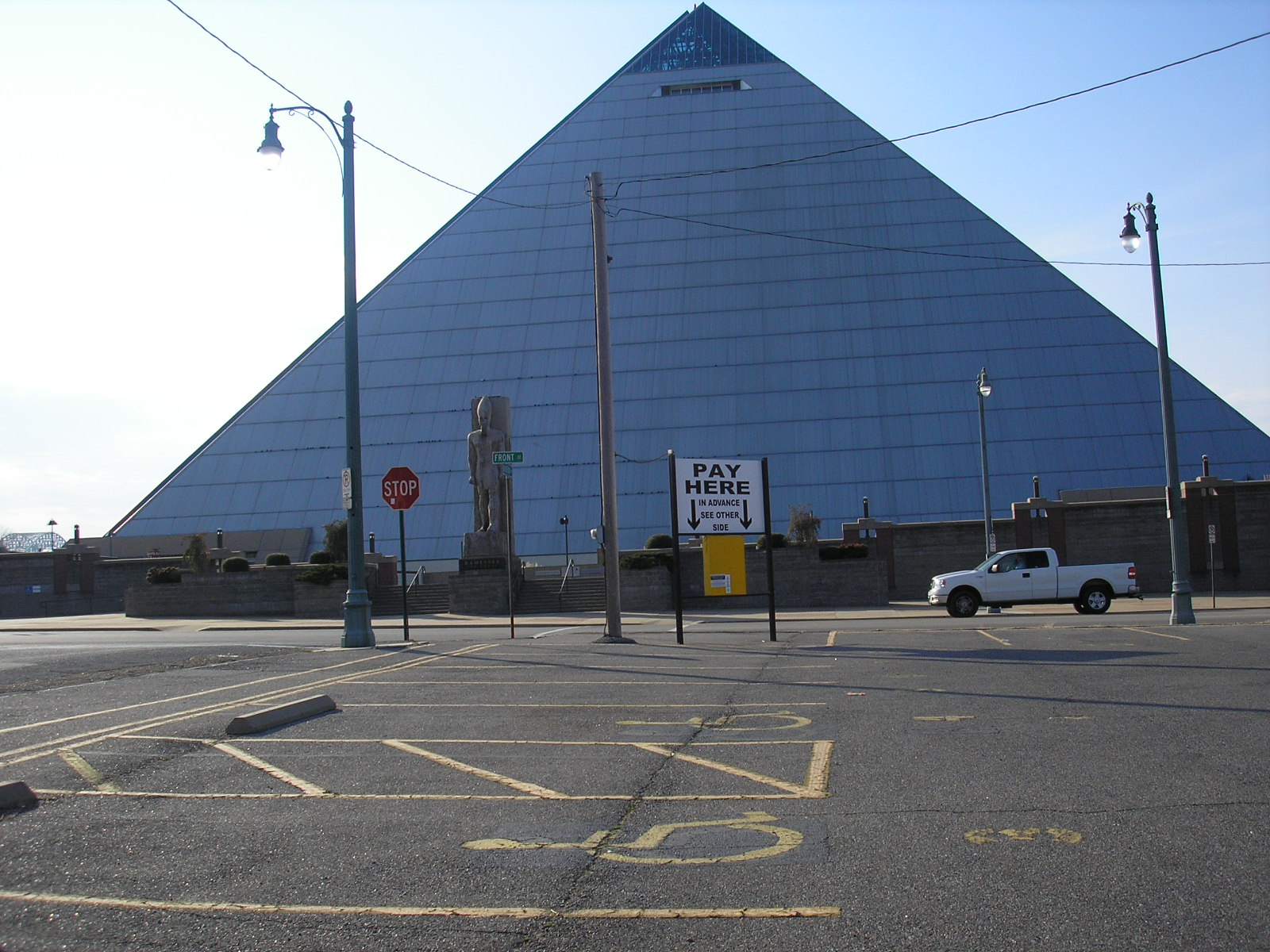
- Pyramid Arena
- Peabody Hotel
- Madison Hotel
- FedExForum
- Central Station
- 201 Poplar
Downtown Memphis consists of 8.4 million square feet (780,000 square meters) of office space, around 1 million square feet (93,000 square meters) of retail space, 3,456 hotel rooms, and 13,400 housing units.[4]
The administrative core of Memphis and Shelby County is also located in Downtown Memphis. These include the Memphis City Hall, and the Federal Building, located on North Main Street, in the Civic Center Plaza (corner of Main Street and Washington).
Districts and Neighborhoods
Downtown Core
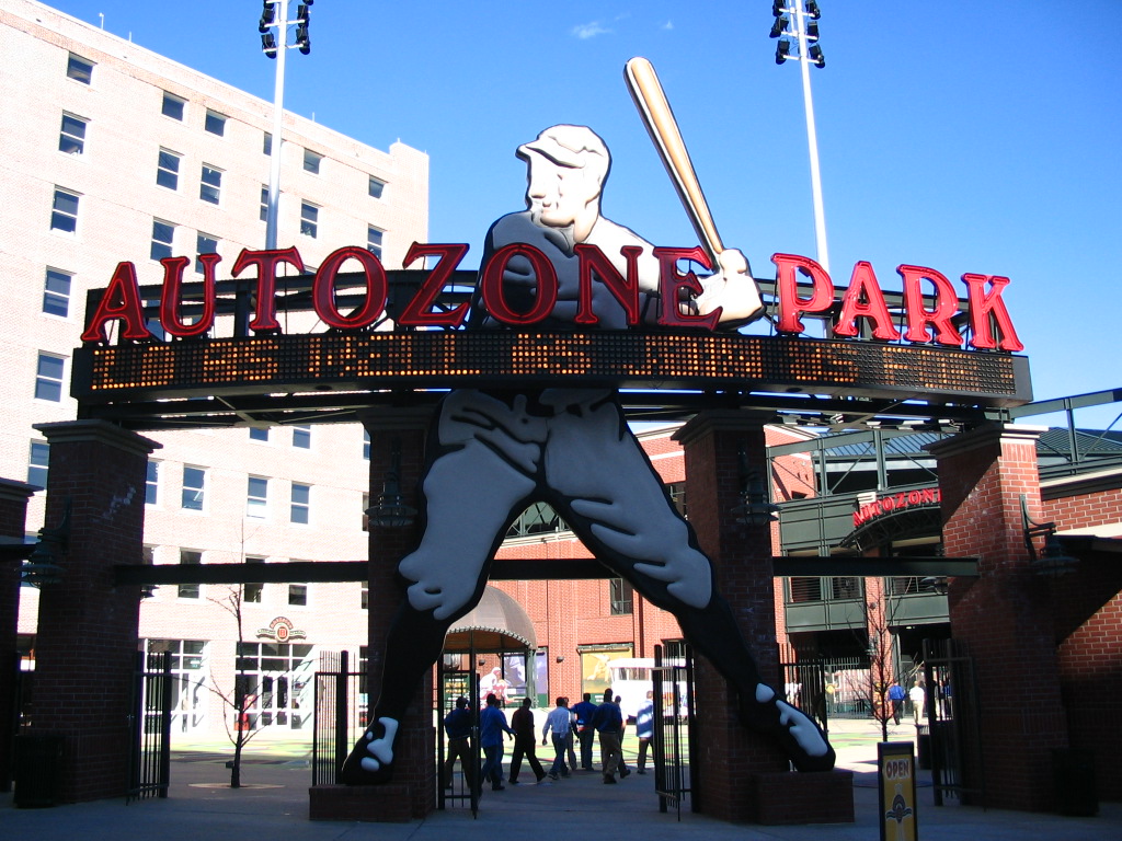
Downtown Core is the heart of the central business district and includes the majority of office space, retail, entertainment, and dining spaces.[5]. It is a popular regional destination for entertainment, dining, and tourism and includes attractions such as Beale Street, FedExForum, AutoZone Park, Peabody Place and The Peabody Hotel.
Districts
- South Main Arts District
- Medical District
- Pinch District
Neighborhoods
Schools
Downtown Memphis is zoned to the following Memphis City Schools campuses:
- Downtown Elementary School
- Vance Middle School
- Booker T. Washington High School
Transportation
Downtown is served by major highways and interstates, public bus and trolley service by MATA, commercial bus service by Greyhound, and passenger train service by Amtrak.
Interstates I-40, I-55, I-69 all run directly through downtown, providing direct access to the area from adjacent areas as well as the region as a whole. Downtown also serves as the western termination point for U.S. Route 78 as well as U.S. Route 72, and is directly located along U.S. Route 51, U.S. Route 64, U.S. Route 70, and U.S. Route 79.
MATA operates the North End Terminal, it's primary hub for Memphis public bus service, at the corner of Main Street and A.W. Willis Avenue.[6] The majority of fixed bus routes operates by MATA terminate at the North End Terminal, therefore bus accessibility in the area is very high.[7]
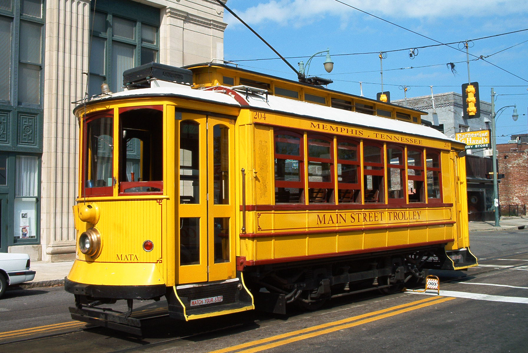
The MATA Trolley is a heritage streetcar system that operates three lines in downtown along Main Street, Riverside Drive, and Madison Avenue. It consists of twenty four stations and has a daily ridership of approximately 2500. Connections between MATA public bus and Main Street trolley line can be made at the North End Terminal.
Amtrak's City of New Orleans passenger train runs through Downtown Memphis twice a day, stopping at Central Station.
Gallery
-

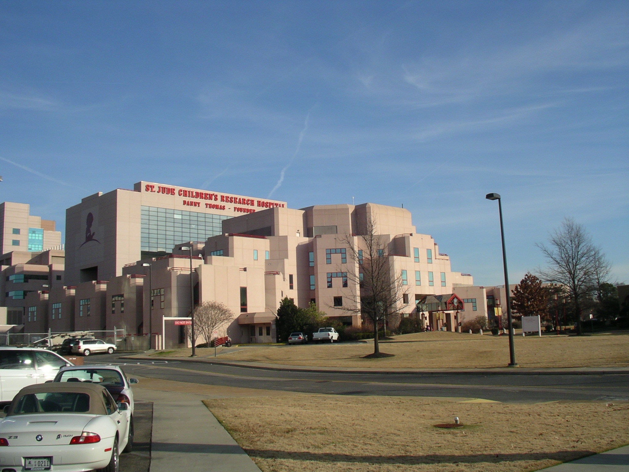
St. Jude Children's Research Hospital
-

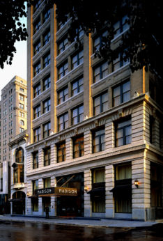
Madison Hotel
-

Intersection of G.E. Patterson and Main St in the South Main Arts District
-

View of University of Memphis, School of Law facing north
-
View of downtown Memphis, looking west on Madison Ave.
-
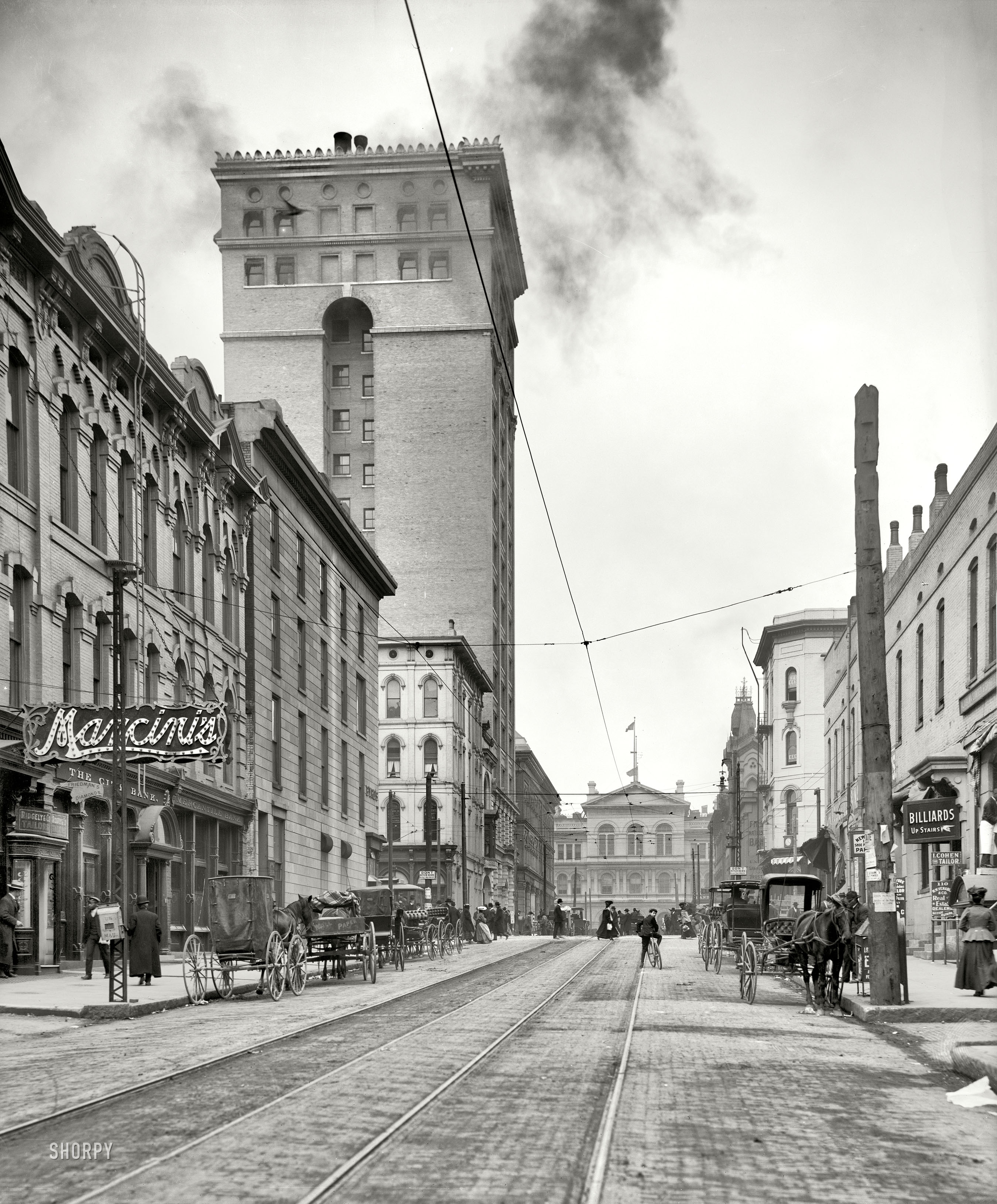
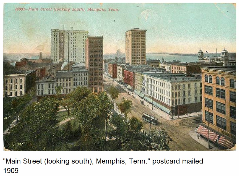
Downtown Memphis in 1909, overlooking Court Square.
-
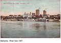
View of downtown Memphis in 1907 from the Mississippi River.
-
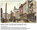
View of Madison Avenue, and Customs House and Post Office in 1907.
References
- ^ http://river.freshbits.com/library/2000/05/on-memphis-waterfront-master-plan-must.html Clubb, Deborah M. On the Memphis Waterfront: Master Plan Must Account for What the Founders Wanted: A Public Promenade Commercial Appeal, Sunday, May 21, 2000.
- ^ Hunt-Phelann House.
- ^ Bond, Beverly G.; Sherman, Janann (2003). Memphis: In Black & White. Memphis: Arcadia Publishing. p. 160. ISBN 0738524417. http://history.memphis.edu/faculty_books.html.
- ^ http://www.downtownmemphis.com/demographics.asp
- ^ http://www.downtownmemphis.com/demographics.asp
- ^ http://www.matatransit.com/routes.aspx
- ^ http://www.matatransit.com/uploadedFiles/Riding_Mata/MATASystemMap.pdf
External links
Coordinates: 35°08′20″N 90°03′27″W / 35.1389°N 90.0575°W
Categories:- Neighborhoods in Memphis, Tennessee
- Central business districts in the United States


Wikimedia Foundation. 2010.