- René Lévesque Boulevard
-
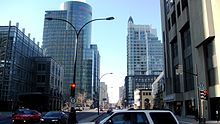
 Two newer buildings on Boulevard René-Lévesque, the Cité du commerce électronique (left) and the Crystal de la Montagne.
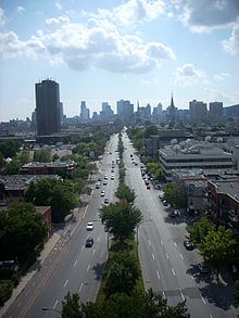
 René Lévesque Boulevard as seen from the Jacques Cartier Bridge
René Lévesque Boulevard (previously named "Dorchester Boulevard") is one of the main streets in Montreal, Quebec, Canada.
It is a main east-west thoroughfare passing through the downtown core in the borough of Ville-Marie. The street begins on the west at Atwater Avenue (though see below) and continues until it merges with Notre Dame Street East just east of Parthenais St. This boulevard is named after former sovereigntist Quebec Premier René Lévesque.
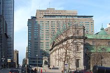
Much of René Lévesque Boulevard is lined with highrise office towers. Notable structures bordering René Lévesque Boulevard include, from west to east, the Montreal Children's Hospital, the Canadian Centre for Architecture, the Cité du commerce électronique, 1250 René-Lévesque, Tour CIBC, Mary, Queen of the World Cathedral, the Queen Elizabeth Hotel, Place Ville-Marie, Central Station, Tour Telus, St. Patrick's Basilica, Complexe Desjardins, Complexe Guy-Favreau, Hydro-Québec Building, UQAM and the Maison Radio-Canada. Former structures on the street include the Laurentian Hotel and a residential area razed to make way for the unbuilt Overdale residential project.
The street separates the adjacent Dorchester and Place du Canada squares.
Dorchester
From the time of its formal naming in 1844, the street was known as "Dorchester Boulevard" in honour of Guy Carleton, 1st Baron Dorchester (1724–1808), Governor of the Province of Quebec and Governor General of Canada.
Shortly after Jean Drapeau was elected mayor in 1954, his administration ordered the destruction of hundreds of buildings along Dorchester. In 1955, the street was widened into an eight-lane boulevard.[1]
The name was changed in 1987 after the death of Quebec premier René Lévesque. A portion of the thoroughfare located in the largely anglophone city of Westmount, between Clarke and Atwater, retains the name "Boulevard Dorchester", as does a portion in the mainly French-speaking Montréal-Est, where it is known as " Dorchester Street".
References
- ^ DeWolf, Christopher (2007-12-16). "The widening of Dorchester". URBAN PHOTO. http://www.urbanphoto.net/blog/2007/12/16/the-widening-of-dorchester/. Retrieved 2008-03-24.
Coordinates: 45°30′33″N 73°33′41″W / 45.509097°N 73.561318°W
Categories:- Streets in Montreal
Wikimedia Foundation. 2010.


