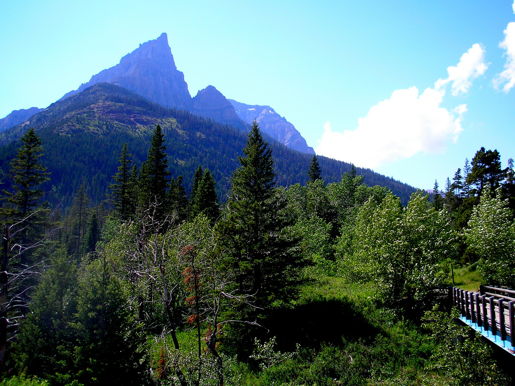
Mount Blakiston

Mount Blakiston
Mount Blakiston
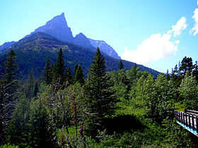
Elevation 2,910 m (9,547 ft) [1]
Prominence 1,149 m (3,770 ft) [2]
Location
Location Alberta, Canada
Range Flathead Range
Coordinates 49°05′39″N 114°02′06″W / 49.09417°N 114.035°W / 49.09417; -114.035Coordinates: 49°05′39″N 114°02′06″W / 49.09417°N 114.035°W / 49.09417; -114.035[2]
Topo map NTS 82G/01
Climbing
Easiest route Moderate scramble

Mount Blakiston is a mountain in the southwestern corner of Alberta, Canada and the highest point within Waterton Lakes National Park. The mountain is situated in the Clark Range, north of Lineham Creek and south of Blakiston Creek. The Lineham Creek hiking trail passes along the foot of the southern slopes of the mountain and for capable scramblers, Blakiston's rubbly but steep southern slopes provide a suitable line of ascent.

Blakiston's closest neighbours include Mount Hawkins 2,685 m (8,809 ft) directly to the west along a connecting ridge and Mount Lineham 2,728 m (8,950 ft) to the south.

The mountain was named in 1858 for Thomas Blakiston, a member of the Palliser Expedition.[1]

References

  1. ^ a b "Mount Blakiston". PeakFinder.com. http://peakfinder.com/peakfinder.asp?PeakName=Mount+Blakiston. Retrieved 2008-07-13. 
  2. ^ a b "Mount Blakiston". Bivouac.com. http://www.bivouac.com/MtnPg.asp?MtnId=746. Retrieved 2008-07-13. 


Wikimedia Foundation. 2010.

Игры ⚽ Нужно решить контрольную?

Look at other dictionaries:

  • Mount Galwey — Elevation 2,377 m (7,799 ft) Prominence 182 m (597 ft) …   Wikipedia

  • Blakiston, South Australia — Infobox Australian Place| type = town name = Blakiston state = sa caption = lga = District Council of Mount Barker postcode = 5250 est = pop = 697 pop footnotes= elevation= maxtemp = mintemp = rainfall = stategov = Kavel fedgov = Mayo dist1 = 36… …   Wikipedia

  • Mont Blakiston — Géographie Altitude 2 904 m[1] Massif …   Wikipédia en Français

  • District Council of Mount Barker — Mount Barker Council South Australia Population: 29,864(2009) …   Wikipedia

  • District de Mount Barker — 35° 03′ 50″ S 138° 51′ 29″ E / 35.06388, 138.85805 …   Wikipédia en Français

  • Clark Range (Canada) — For other uses, see Clark Range. Clark Range Range Mount Blakiston in southwest Alberta …   Wikipedia

  • List of mountains of Canada — Main article: Mountain peaks of Canada The vast majority of mountains in Canada lie in the western provinces of British Columbia and Alberta and the Yukon Territory. Mountains can be found all over British Columbia while those in Alberta are… …   Wikipedia

  • List of mountains in Canada — The vast majority of mountains in Canada lie in the western provinces of British Columbia and Alberta and the Yukon Territory. Mountains can be found all over British Columbia while those in Alberta are mainly concentrated on the eastern side of… …   Wikipedia

  • Waterton-Lakes-Nationalpark — Der Cameronsee im Waterton Lakes Nationalpark …   Deutsch Wikipedia

  • Waterton Lakes National Park — Infobox protected area name = Waterton Lakes National Park iucn category = II caption = Waterton Lakes National Park Location locator x = 57 locator y = 182 location = Alberta, Canada nearest city = Pincher Creek lat degrees = 49 lat minutes = 02 …   Wikipedia

Share the article and excerpts

Direct link
Do a right-click on the link above
and select “Copy Link”