- Mount Pleasant Historic District (Mt. Pleasant, Ohio)
-
Mount Pleasant Historic District
 Along Union Street in the district
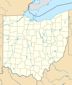

Location: Mount Pleasant, Ohio Coordinates: 40°10′28″N 80°47′55″W / 40.17444°N 80.79861°WCoordinates: 40°10′28″N 80°47′55″W / 40.17444°N 80.79861°W Architectural style: No Style Listed Governing body: Local NRHP Reference#: 74001536 Significant dates Added to NRHP: June 28, 1974[1] Designated NHLD: April 5, 2005[2] The town of Mount Pleasant was established in 1803 by Robert Carothers, an Irishman from Virginia, and Jesse Thomas, a Quaker from North Carolina. Some or all of the down is designated as Mount Pleasant Historic District, a U.S. National Historic Landmark District.
It is important for the role it played in the antislavery movement and the Underground Railroad. Incorporated in 1814, the town became a center for pork packing and shipping, and was also successful in the milling industry. The strong Quaker population in Mount Pleasant preached and practiced its abolitionist views and published antislavery literature, such as Benjamin Lundy's "Genius of Universal Emancipation." A station on the Underground Railroad, the town was a refuge for fugitive slaves and a welcome home for free blacks. Local residents built and administered a school for free black children, and in 1848 established a Free Labor Store which sold no products produced by slave labor.[2]
The district was listed on the National Register of Historic Districts in 1974,[1] and was designated a National Historic Landmark in 2005.[2]
References
- ^ a b "National Register Information System". National Register of Historic Places. National Park Service. 2008-04-15. http://nrhp.focus.nps.gov/natreg/docs/All_Data.html.
- ^ a b c "Mount Pleasant Historic District". National Historic Landmark summary listing. National Park Service. http://tps.cr.nps.gov/nhl/detail.cfm?ResourceId=80664599&ResourceType=District. Retrieved 2008-06-16.
U.S. National Register of Historic Places Topics Lists by states Alabama • Alaska • Arizona • Arkansas • California • Colorado • Connecticut • Delaware • Florida • Georgia • Hawaii • Idaho • Illinois • Indiana • Iowa • Kansas • Kentucky • Louisiana • Maine • Maryland • Massachusetts • Michigan • Minnesota • Mississippi • Missouri • Montana • Nebraska • Nevada • New Hampshire • New Jersey • New Mexico • New York • North Carolina • North Dakota • Ohio • Oklahoma • Oregon • Pennsylvania • Rhode Island • South Carolina • South Dakota • Tennessee • Texas • Utah • Vermont • Virginia • Washington • West Virginia • Wisconsin • WyomingLists by territories Lists by associated states Other Categories:- Historic districts in Ohio
- National Historic Landmarks in Ohio
- Geography of Jefferson County, Ohio
- Ohio Registered Historic Place stubs


Wikimedia Foundation. 2010.