- Nabua, Camarines Sur
-
Nabua — Municipality — 
SealMap of Camarines Sur showing the location of Nabua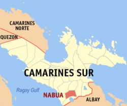 Location in the Philippines
 Nabua
NabuaCoordinates: 13°24′5″N 123°22′35″E / 13.40139°N 123.37639°ECoordinates: 13°24′5″N 123°22′35″E / 13.40139°N 123.37639°E Country Philippines Region Bicol Region (Region V) Province Camarines Sur District 4th district (Rinconada) Founded July 25, 1569 Barangays 42 Government - Mayor Delia Simbulan (Lakas-CMD) Area - Total 96.23 km2 (37.2 sq mi) Population (2007) - Total 75,422 - Density 783.8/km2 (2,029.9/sq mi) Time zone PST (UTC+8) ZIP code 4434 Dialing code 54 Income class 1st class municipality; partially urban Nabua is a 1st class municipality in the province of Camarines Sur, Philippines.[1] According to the 2007 census, it has a population of 75,422 people in 12,724 households.
Nabua is the mother town of Iriga City, Buhi, Bato, Balatan, Bula and Baao in Camarines Sur. Nabua has five districts: Antacudos, Binoyoan, Caobnan, Lupa and Sabang.
Nabua is home of the modern kuntaw,[2] and jota rojana.[3]
Contents
History
The Municipality of Nabua traces the historical origin of its name way back during the Spanish Colonization. It was said that in 1571, an Augustinian Friar named Fray Alonzo Gimenez reached one of the rancherias called Lupa which was then under Datu Panga from Borneo. The good friar found persons inside the said rancheria cutting coconuts. He was offered to partake the inside shoot of coconut which the natives called “BOA”. Immediately, the good friar tagged the place as “NABUA” pronounced with his Spanish Accent. From that time onwards this place become popularly known as NABUA.
In another version, a historian named Fray Felix Huerta claimed that the name came from the story that the original sitio of the town is in the shape of the “BOA”, young embryo of the coconut which was surrounded by five rancherias named Lupa, Antacodos, Sabang, Caobnan and Binoyoan. Other believe otherwise and said it was centrally located in the middle of said rancherias thus closely resembling a delicious “BOA” which children loved to eat. For a time, the town was called “NABOBOWA” but years of long usage shortened and corrupted it to the present name of NABUA.
In 1578, a group of Franciscan missionaries headed by Fray Pablo de Jesus and Fray Bartolome Ruiz put up a church in a place known as Antacodos and there they placed a big cross. These missionaries soon merged the villages of Lupa, Antacodos, Sabang and Binoyoan into one place, which at present is known as the town of Nabua. The name Nabua was originally a longer one, Naboboa, from boa, the word for a young coconut embryo.
In a research mission to Spain funded by the municipality, it was learned that Nabua was officially established as a municipality on July 25, 1569.
Geographical location
 Maharlika Highway
The municipality of Nabua is geographically located between 123 and 124 degrees longitude and 13 and 14 degrees latitude. It is bounded on the north by the municipality of Baao and Bula; on the south by the municipality of Bato; on the east by Iriga City; and on the west by the municipality of Balatan. The municipality is an established growth center in the southeast part of Camarines Sur Province or the mid-section of Bicol River Basin Area. Along the Legazpi-Iriga-Naga-Daet Growth Corridor or LINDGC, the municipality is located about 53 kilometers from Legazpi City which is the Regional Center; 37.0 kilometers from Naga City which is a major urban center; 135 kilometers from Daet which is a secondary Urban Center and only 2.0 kilometers from Iriga City which is a minor urban center.
Climate
The municipality of Nabua possesses a climate belonging to the 4th type wherein rainfalls are more or less evenly distributed throughout the years. Its rainfall is classified as TYPE B or HUMID characterized by rains well or evenly distributed throughout the year with at most three dry months. General wind direction prevailing the municipality is from northeast to southwest at an average velocity of eight knots.
The municipality has a dry, a cold, and a wet season. From June to November, the town experiences heavy rains. The cold season comes every December to February. Then, from March to May, the dry season commences.
Land
The municipality of Nabua is one land mass containing a total land area of 8,854.4193 hectares. This total land area distributed among the 42 barangays, nine of which are considered as urban barangays; namely, San Antonio (Poblacion), San Esteban, San Francisco, San Juan, San Luis, San Isidro, San Miguel, San Nicolas, San Roque (Poblacion) and 33 are considered as rural barangays. Among the urban barangays, San Antonio (Poblacion) has the biggest land area of 234.1798 hectares while San Luis has the least land area of 2.1746 hectares. In the rural barangays, La Purisima has the largest land area as well as in the entire municipality of 428.1501 hectares while San Roque Madawon has the smallest land area of 76.3228 hectares.
The municipality of Nabua given its land mass is entirely classified as alienable and disposable lands. Previous land classification has its slight share of forestlands but was absorbed by the adjacent municipality of Balatan which requires political solution.
Elevation and slope
The municipality of Nabua has about 8,803.0600 hectares or 99.42% very low elevation or less than 100 meters elevation and remaining 51.3593 hectares or 0.58% of low elevation or between 100–300 meters elevation. Its slope covers about 7,927.3616 hectares or 89.53% which are level to nearly level (0-3%) while the remaining 927.0577 hectares or 10.47% are rolling to moderately steep (18-30%)
As the dominantly alluvial plain, the municipality of Nabua has the prevalent soil types classified as either clay loam or sandy loam having silty texture. These soil types are very favorable for agricultural usage.
The geological characteristics for the municipality of Nabua consists of: Upper Pleistocene (Sandstone and shale), Pliocene Pleistocene (Volcanoclast alluvial fans), and Recent (Alluvium or rice terraces).
The natural drainage tributaries for the municipality of Nabua consist of numerous creeks interconnected with the three major rivers namely: Bicol River, Rawas River, and Barit River.
Demographic data
As one of the largest in the province of Camarines Sur, the municipality of Nabua has a total population of 75,422 persons based on the 2007 National Population Census. The municipality’s total population accounts for 4.6% of the total provincial population of Camarines Sur, ranked fifth behind much larger population sizes of Naga City, Iriga City, Libmanan and Pili.
Historically, the municipal population has experienced positive growth rate, beginning in Censal Year 1903 up to 1999. Municipal population records show only one exception in Censal Year 1970 where the municipal population decreased. This population shift in number can be attributed to migration patterns due to socio-economic reasons. Thus, from a mere population size of 18,893 in 1903, the current municipal population more than tripled in size for 1999.
Spread out among the 42 barangays of Nabua, there are 10,093 persons living in the urban barangays while 65,329 persons live in the rural barangays. Among urban barangays, San Antonio Poblacion has the largest population with 2,363 persons while San Luis has the smallest with 358 persons. For rural barangays, La Purisima has the largest population with 8,165 persons while Salvacion Que Gatos has the lowest with a population of 523 persons.
Population density for the entire municipality of Nabua is 75,422 persons spread over the total municipal land area of 8,854.4193 hectares, which is equivalent to 7.9482 persons per hectare or 794.82 persons per square kilometer.
Population literacy for the municipality of Nabua boasts of 96.54% literate persons over those who are deemed illiterate. Translated in terms of highest grade completed at least 24.342 persons have entered elementary schools over persons who have either not completed any grade 4.232 persons or 2,390 persons who have only attained pre-school education.[citation needed]
Language
The Philippine Archipelago is composed of over seven thousand islands and over 7,000 dialects. Almost every island or geographical grouping has their own local dialect or language. Even though an island or a regional group has a dialect or language, there are always variations of that dialect.
Nabua, for example, is not an exception. On the geographical level, the Nabua dialect can be considered having its base from the Bikol dialect. However, there are other smaller social groups within the Bicol region where Nabua derives the foundation of its dialect. The Rinconada area composed of Baao, Buhi, Bula, Balatan, Bato and Nabua shares the same “Rinconada” dialect that the local folks are still enriching up to this day. The local folks coming from the Rinconada “B” towns and Nabua can be easily recognized by the way they enunciate words or phrases when they talk or use the dialect.
Additionally, Spanish influences are frequently encountered in the languages of Nabuenos. Some examples of Spanish words embedded in the local dialect are:
“Abreya raw iton puertan.” This is a command statement, meaning “Open the door.” in English or “Buksan ang pintuan.” in the Filipino language.
“Abreya” is an inflection of the Spanish verb “abrir” (to open) and “puertan” is from the Spanish word “puerta”.
Other variations of Spanish words being used in the Nabua local dialect can be found, but many these words or terms due to usage over time do not follow proper Spanish language conjugations and grammar.
Customs and Practices
Nabua has a rich array of customs and colorful practices that are found up to the present day.
Pangarana
This is the Nabua version of “serenading”. When a man wants to show his intent to court a woman, the man (sometimes accompanied by his friends) armed with a guitar or possibly a karaoke machine shows up on the woman’s doorsteps unannounced late at night. The woman or her family have either the option to turn on the lights and acknowledge the serenaders or just ignore them. In some cases, the event turns into an unforgettable event as the woman’s family may come up with some unique ways to get the serenaders out of their property, such as throwing a bucketful of hot water or unleashing “bantay”, the household watch dog.
Pa-aurora
The local folks are religious in nature so it is common for them to make a religious promise or ‘panata’ expressing their exultation to God because of a bountiful harvest or they have a petition that they wish would be granted. This is manifested through the local practice of “Aurora”. On nine consecutive nights, they would decorate an improvised "carroza" for their local patron saint and then visit the households in the neighborhood with singing and prayers.
Pista sa mga Kalag
On November 1, nearly all citizens take a trip down to the cemetery. This is their practice of honoring and remembering departed loved ones. They would offer flowers and light candles in their tombstones, sarcophagus, or decorate the family mausoleum with flowers and food. The local cemetery comes alive the night of November 1 to commemorate All Saints Day until the early morning of November 2 for All Souls Day. Masses at the cemetery are often offered on both days.
Tang-gal kin Cuaresma
During the season of Lent, some of the prominent families in Nabua will sponsor a “Tang-gal”. Tang-gal is the re-enactment of Jesus Christ’s Passion and Death on the cross. After the passion of Christ is re-enacted, the “tang-gal” is concluded with “Ire-Helena”, the story of Helene and Constantine in search of the True Cross.
Pag-li-li
When a family member or loved one passes away, the family, friends and relatives of the dead offer nine days of prayers. This is the nine days of mourning where they go to the local church to attend Mass and then continue their novena prayers at the house of the deceased. Prayers are offered to help the soul of the deceased rest in peace and at the same time to console the grieving family.
Katapusan
After forty days of mourning, the family, friends and relatives of the dead celebrate the passage by hosting a feast and invite all those who consoled them in their time of grief. Once everyone invited are gathered, they say the litanies and pray the Rosary of the Most Blessed Virgin Mary. Local folks believes that the soul of their dearly departed have now passed the stage of “roaming” and ready to rest in eternal peace. This is the time to let go and as a symbolism, they can now wear other colors of clothing instead of the traditional all black or all white.
Dotoc
Before the baranggay fiesta, "DOTOC" is a custom of nabueñans in worshiping their patron saint through nine nights of thanksgiving.Economy
Primary Products
Agriculture contributes a major role to the economy of the municipality of Nabua given its vast alluvial plains. Its agricultural contribution consists of crop production, livestock, and fishery. Crop production is more intense rather than livestock and fishery.
Rice production, both irrigated and non-irrigated occupies about 87.26% of the total agricultural land devoted to crop production while corn and other types of crops occupies merely 7.96% and 4.78% respectively. However, crop production in the entire municipality represents only about 36.94% of the total municipal land area. Livestock production can be described as one merely that of backyard raising style despite the presence of at least two farms located at Inapatan with aggregate of only 1.00 hectare and only 22,000 animal heads. Likewise, inland fishing can hardly produce much-needed agricultural revenues both for the inland fishermen as well as for the benefit of the local government.
Trade
The Poblacion of the municipality of Nabua is strategic area for commercial development. Presently, its commercial area can be classified as a minor central business district which is reflective of being a tertiary urban growth corridor along the Legazpi-Iriga-Naga-Daet growth corridor.[4] It services the commercial needs of the neighboring municipalities of Bato and Balatan secondary only to Iriga City. Among the commercial establishments to be found within the Poblacion are wholesale trade, general merchandise, auto and motor supplies, school supplies, funeral parlor, groceries, insurance companies, banks, lending investors, pawnshops, drugstores, restaurant and sari-sari stores.
Several barangays outside of the Poblacion functions as neighborhood centers. Those rural barangays include Sto. Domingo, Malawag, La Purisima, La Opinion, Dolorosa and San Jose. Most common in about 30 rural barangays are the mushrooming of sari-sari stores.
Industry
The municipality of Nabua remains predominantly agriculturally-related in terms of industrial activities at present. The existing industrial establishment within Nabua consists mainly of rice mills with total industrial of about 3,000 square meters. Cottage industries generating household employment and incoe proliferate in rural barangays. Nabua has a potential for agro-industrial development. This is manifested by its: (1) proximity to both Balatan Port and Pantao Port (2) Inherent vast agricultural lands (3) As an urban growth center and, (4) suitable agro-industrial site.
Education
Nabua boats of a high literacy rate of 96.54% within the municipality. The people of Nabua put a premium on their education as their key to social and economic development. The present level of educational services within the municipality covers a number of teachers and classrooms vis-a-vis current and projected enrollments.
For elementary level, there are a total of 33 elementary schools divided into East and West Districts with a total current enrollment of 11,947 pupils. The secondary level of education is currently provided by Nabua National High School, La Purisima Nationalized High School, Malawag Nationalized High School, Sto. Domingo Institute, and Saint Jude Agro-Industrial College.
The Camarines Sur Polytechnic Colleges, a public school located in San Miguel, offers tertiary, post-graduate, as well as short–term courses, technical or vocational in nature.
Nabua is the site of large state-run and private educational institutions in Rinconada. Some of the leading schools in Nabua are:
- Camarines Sur Polytechnic Colleges
- St. Jude Agro-Industrial College
- Sto. Domingo Institute
- Ryden Technological Institute
- Nabua National High School
- La Purisima High School
- Malawag High School
- Victor Bernal High School
- Tandaay Provincial High School
- Holy Cross Parochial School( The Only Catholic School in Nabua)
- Nabua Central Pilot School
- Nabua Educational Learning Center
- Nabua Music Learning Center
- St. Jude Thaddeus Learning Center
- Montessori House of Learning
- Santiago Elementary School
- Don Telesforo Llorin Elementary School
Infrastructure and Utilities
Road Network
For the municipality of Nabua, transportation is very much important because of (1) its strategic location and membership in the Legazpi-Iriga-Naga-Daet growth corridor; and (2) preferred development strategy of agro-industrial commerce and tourism. Thus, enhancement of the municipal transport system would play crucial role in the attainment of the desired development.
Land transportation available are the various road systems and the Philippine National Railways (PNR) track facilities traversing the municipalities. Generally, the municipality has adequate road lengths based on the standards of 1.5 km. per 100 hectares of arable land.
Power and Electricity
The strategic location of Nabua along the Luzon grid makes it an ample recipient of power supply from NAPOCOR. Within the municipality itself, the Camarines Sur Electric Cooperative (CASURECO) as the exclusive provider retails supply of electricity. All barangays within the municipality are already energized both in urban and rural barangays.
Water Resources
There are three existing Level 3 water supply systems that provide potable water, namely: Nabua Water District, Duran Water System and Sagumay Water System.
Communication Facilities
Existing communication services and facilities includes cable television, telephone services, telegraph services and telegraphic transfer, cellphones, and postal services.
Shopping and accommodation
Some of the major shops, shopping centers, hotels and accommodations in Nabua:
- LCC Mall - Nat'l. Highway, Zone 1, San Roque Pob., Nabua,the first major shopping mall in Nabua and in Rinconada (5th District of Camarines Sur)
- Macagang Business Center is located in Barangay San Antonio along the Diversion Road, Maharlika Highway.
- Moraville Hotel,located at Barangay San Francisco
- Sampaguita Tourist Inn,located in Barangay San Roque in front of Shell Gas Station.
- Sampaguita Department Store is in front of Nabua Municipal Gymnasium.
- Jaan's Bread Delights (Peñales Bakery), the foremost bakery in Nabua is located at the Public Market
- United People's Mart is located at the town's Central Market.
- Nen and Nel Gift Shoppe
- Bookstreet Internet Cafe
- Alson's Trading
- 'Aqua Safe- First pure drinking Water in Nabua.
- NGS Internet Cafe,located at the 2nd Floor of Nabua Public Market.
- Kyla's Boutique is in Barangay San Francisco near the Moban Gas Station.
- Penafrancia Centrum Trading is located in Brgy. San Isidro Pob., Nabua.
- Annie's Resort in Sta. Lucia.
- Nabua Food Court beside Nabua Public Market.
- VSR internet cafe at the front of CSPC.
- Simbulan Pawnshop at the roadway.
- Moraville the Garden, hotel and resort at San Francisco,Nabua, Camarines Sur, Highway to Iriga City.
Tourism
The town of Nabua is known for having a large contingent of United States Navy servicemen. Most of the families of these servicemen can be found residing in Southern California, particularly in the San Diego area. During religious and special holidays, the Nabuenos now residing in the United States or in other parts of the world return to Nabua bringing with them their friends and spending their foreign earned money thus boosting the local economy and tourism.
Among the celebrations and local sites in the town includes:
- Nabua celebrates its fiesta with the Boa-Boahan Festival every May 2. The highlight of the festival is the reenactment of the traditional "Boa Feast", a 13th century rite where ancient Bicolanos offered chains of coconut embryos called boa to their deities, in the belief that this would make their life more prosperous throughout the year. The feast is enlivened with a display of colorful costumes.
- The over 400-year-old church of Nabua known as the Vicariate of the Holy Cross is a prominent landmark along the national diversion road connecting the municipality of Baao directly to this town without passing the city of Iriga.
- Starting from Palm Sunday to Easter Sunday, you will find 400-year-old religious customs and traditions being celebrated by the locals. Semana Sancta starts with the Palm Sunday procession and blessing of Palms. Then the Holy Wednesday and Good Friday Procession of 'Pasos' depicting Christ's Passion. To commemorate Christ's resurrection, the "Balo-balu" is celebrated the night of Black Saturday and then the "Ton-ton" at dawn on Easter Sunday after the "Salubong" procession.
- Existing local industries such as bamboo craft, handloom weaving, woodcraft and basketry derived from available raw materials.
Organizations
- The San Esteban Young Achievers Council (SEYAC) is the leading and the most active youth organization in Nabua. It is duly registered with the National Youth Commission National Registration Program.
- The Nabua Forum [1] is an online-based organization created for Nabuenos living in and out of the Philippines. Hosting not only the town's very first online community, it also has development progams in Nabua, one of which is its Istoryawan or storytelling sessions for Nabueno children. From year 2006, the Nabua Forum has also been active in advocating cultural preservation in the town.
- Patanim sa Angustia a small community project organized by a Filipino Canadian, Edwin Ani whose objective is to promote healthier community by cultivating household backyards to produce more fruits & vegetables. Free seeds are provided to each household of Angustia and training is conducted by the Department of Agriculture. On the 3rd day of May, top 2 from each of the 7 (seven) zones are chosen by each Kagawad to enter the competition. The top 3 winners are awarded 1st, 2nd and 3rd Places respectively while the ramaining 11 finalists receive consolation prizes. The Top 3 winners of the Patanim sa Angustia 2011 are: Lolita Beltran-First, Francia Baldago-second and Mario Bagasbas-Third.
Other organizations include:
- Zig Zag International Fraternity
- Zona Libre Fraternity
- Volvo Boys of Santiago Old
- Dangerouz Minds Society
- Authentic Society
- Honor Society
Barangays
Nabua is politically subdivided into 42 barangays.
Barangays Area
(km²)Population
(2007)Barangay Captain 1 Angustia (Inapatan) 1,699 Salvador Rabeje 2 Antipolo Old 1,822 Lilia B. Rebellon 3 Antipolo Young 737 Francisco Olivares 4 Aro-aldao 928 Rosita Quino 5 Bustrac 1,152 Clarito Atian 6 Dolorosa (Inapatan) 1,889 Antonio Lorzano 7 Duran 926 Joel A. Beltran 8 Inapatan (Del Rosario) 2,612 Clarita Quiapo 9 La Purisima (Agupit) 8,165 Sergio Beltran 10 Lourdes Old 1,020 Myrna Pecundo 11 Lourdes Young 2,915 Romulo R. Arales 12 La Opinion 4,625 Manuel Obis 13 Malawag (San Jose) 2,955 Virgilio Nillo 14 Paloyon Oriental 643 Jaime Brila 15 Paloyon Proper (Sagrada) 2,735 Honorio Parañal 16 Salvacion Que Gatos 523 Antero Servillon 17 San Antonio (Poblacion) 2,363 Ruben Pasion 18 San Antonio Ogbon 2,484 Dolores Lanuzo 19 San Esteban(Pob.) 1,818 Romeo J. Quidep 20 San Francisco (Poblacion) 645 Espiritu Priela Jr 21 San Isidro (Inapatan) 627 Joseph Fermante 22 San Isidro (Poblacion) 744 Loreto Simbulan 23 San Jose (Pangaraon) 1,509 Julian C. Ocampo 24 San Juan (Poblacion) 887 Rene Bachiller Sr 25 San Luis (Poblacion) 358 Sulieto Murillo 26 San Miguel (Poblacion) 1,678 Rolando Villaluz 27 San Nicolas (Poblacion) 746 Lydia Brina Docot 28 San Roque (Madawon) 594 Atanacio Balindan 29 San Roque (Poblacion) 854 Ruel Miguel Sarmiento 30 San Roque (Sagumay) 1,002 Jesus Abonita 31 San Vicente (Gorong-Gorong) 1,085 Diosdado Docot 32 San Vicente (Ogbon) 2,609 Orlando Paranal 33 Santa Barbara (Maliban) 1,077 Hermelina Sapinoso 34 Santa Cruz 1,594 Mariano Nierva 35 Santa Elena (Baras) 1,981 Aproniano Abala Jr 36 Santa Lucia (Baras) 1,750 Andres G. Valiente 37 Santiago Old 2,120 Zaldy Palenzuela 38 Santiago Young 2,190 Renair Ravalo 39 Santo Domingo 4,981 Nestor Soreta 40 Tandaay 1,473 Edgar Sabas 41 Topas Proper 1,836 Mario Reginales Sr 42 Topas Sogod 1,073 Jose Hosana References
- ^ http://www.nscb.gov.ph/activestats/psgc/municipality.asp?muncode=051723000®code=05&provcode=17
- ^ "Kuntaw History- Nabua". Archived from the original on 2008-07-31. http://web.archive.org/web/20080731122134/http://www.kuntaw.com/history.htm. Retrieved 2008-05-11.
- ^ "Jota Dances of the Philippines". http://www.upd.edu.ph/~chk/research/A%20comparative%20study%20of%20selected%20Jota%20Dances%20of%20the%20Philippines.pdf. Retrieved 2008-05-11.[dead link]
- ^ http://www.neda5.net/rdc/lindgcp/proj_background.htm
External links
- Municipality of Nabua
- Nabua Forum Non-profit Online Forum for Nabueno Communities Worldwide
- Virtual Gallery - Town of Nabua
- Town of Nabua Website
- Philippine Standard Geographic Code
- 2000 Philippine Census Information
- 2007 Philippine Census Information
- www.camarinessur.gov.ph
Municipalities Baao • Balatan • Bato • Bombon • Buhi • Bula • Cabusao • Calabanga • Camaligan • Canaman • Caramoan • Del Gallego • Gainza • Garchitorena • Goa • Lagonoy • Libmanan • Lupi • Magarao • Milaor • Minalabac • Nabua • Ocampo • Pamplona • Pasacao • Pili • Presentacion • Ragay • Sagñay • San Fernando • San Jose • Sipocot • Siruma • Tigaon • TinambacComponent city IrigaIndependent component city (Administratively independent from the province, but grouped under Camarines Sur by the National Statistics Office)Categories:- Municipalities of Camarines Sur


Wikimedia Foundation. 2010.