Mambajao, Camiguin

Mambajao, Camiguin
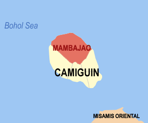
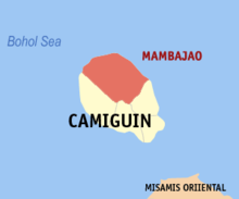
Map of Camiguin showing the location of Mambajao
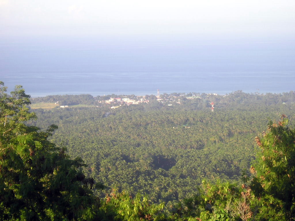
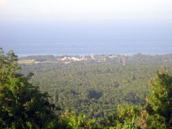
Mambajao, viewed from Hibok-hibok

Mambajao is a 3rd class[1] municipality in the province of Camiguin, Philippines. It is the capital municipality of Camiguin.[1] According to the 2000 census, it has a population of 30,806 people in 5,978 households.[2]

Contents

History

In 1942, the Japanese forces landed in the capital town of Mambajao, Camiguin.

In 1945, the Filipino forces of the 6th and 10th Infantry Division of the Philippine Commonwealth Army landed on the beaches of the capital town of Mambajao, Camiguin by the founded the battles attacked by the Japanese Imperial forces in World War II during the Battle of Camiguin.

Mambajao is celebrating its 153 founding anniversary Way back 1855 when it proclaims as a municipality

Barangays

Mambajao is politically subdivided into 15 barangays.[1][3]

  • Agoho
  • Anito
  • Balbagon
  • Baylao
  • Benhaan
  • Bug-ong
  • Kuguita
  • Magting
  • Naasag
  • Pandan
  • Poblacion
  • Soro-soro
  • Tagdo
  • Tupsan
  • Yumbing
  • Umycco

References

External links

Coordinates: 9°15′00″N 124°42′58″E / 9.250°N 124.716°E / 9.250; 124.716


Wikimedia Foundation. 2010.

Игры ⚽ Поможем решить контрольную работу

Look at other dictionaries:

  • Camiguin Volcan Beach Eco Retreat & Dive Resort — (Mambajao,Филиппины) Категория отеля: 3 звездочный отель Адре …   Каталог отелей

  • Camiguin — This is the article on the island province of Camiguin in the Philippines. There is a different Camiguin Island, part of the Babuyan Islands, also in the Philippines. Infobox Philippine province name = Camiguin sealfile = Ph seal camiguin.png… …   Wikipedia

  • Mambajao — es un municipio[1] de 3ª clase (clasificación por nivel de renta) de la provincia de Camiguín, Filipinas, y es capital de la misma. Según el censo de 2000, tiene una población de 30,806 habitantes distribuidos en 5,978 viviendas.[2] …   Wikipedia Español

  • Camiguin Airport — Infobox Airport name = Camiguin Airport nativename = Paliparan ng Camiguin Tugpahanan sa Camiguin IATA = CGM ICAO = RPMH type = Public operator = Air Transportation Office city served = Mambajao, Camiguin elevation f = 53 elevation m = 16… …   Wikipedia

  • Camiguin — Lage der Provinz Camiguin Karte mit Camiguin im südlichen Teil der Boholsee Camiguin ist e …   Deutsch Wikipedia

  • Mambajao — Municipality of Mambajao Lage von Mambajao in der Provinz Camiguin Basisdaten Bezirk …   Deutsch Wikipedia

  • Camiguin — 9° 10′ 00″ N 124° 43′ 01″ E / 9.16667, 124.717 …   Wikipédia en Français

  • Camiguín — Provincia de Camiguín Provincia de Filipinas Capital …   Wikipedia Español

  • Camiguin — ▪ island, Philippines       mountainous island in the Bohol (Mindanao) Sea, 6 miles (10 km) off the northern coast of Mindanao, Philippines. Located near Macajalar and Gingoog bays, the island is often considered the most beautiful of the… …   Universalium

  • Camiguín — ► Isla prov. de Filipinas, en el mar de Mindanao, entre las islas de Mindanao y Bohol; 230 km2 y 57 126 h. Cap., Mambajao …   Enciclopedia Universal

Share the article and excerpts

Direct link
Do a right-click on the link above
and select “Copy Link”