- Kabugao, Apayao
-
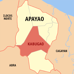
Kabugao — Municipality — Map of Apayao showing the location of Kabugao. Location in the Philippines
 Kabugao
Coordinates: 18°01′N 121°11′E / 18.017°N 121.183°ECoordinates: 18°01′N 121°11′E / 18.017°N 121.183°E Country  Philippines
Region Cordillera Administrative Region (CAR) Province Apayao District Lone District Founded 1950 Barangays 21 Government – Mayor Joseph C. Amid Area – Total 928.96 km2 (358.7 sq mi) Population (2010) – Total 17,796 – Density 19.2/km2 (49.6/sq mi) Time zone PST (UTC+8) ZIP code 3809 Income class 2nd class Population Census of Kabugao Census Pop. Rate 1995 12,710 — 2000 13,985 2.07% 2007 14,529 0.53% Kabugao is a municipality in the province of Apayao, Philippines. It is the capital municipality of Apayao. According to the latest census, it has a population of 14,529 people in 2,501 households.
Contents
Barangays
Kabugao is politically subdivided into 21 barangays.
- Badduat
- Baliwanan
- Bulu
- Dagara
- Dibagat
- Cabetayan
- Karagawan
- Kumao
- Laco
- Lenneng
- Lucab
- Luttuacan
- Madatag
- Madduang
- Magabta
- Maragat
- Musimut
- Nagbabalayan
- Poblacion
- Tuyangan
- Waga
Dibagat
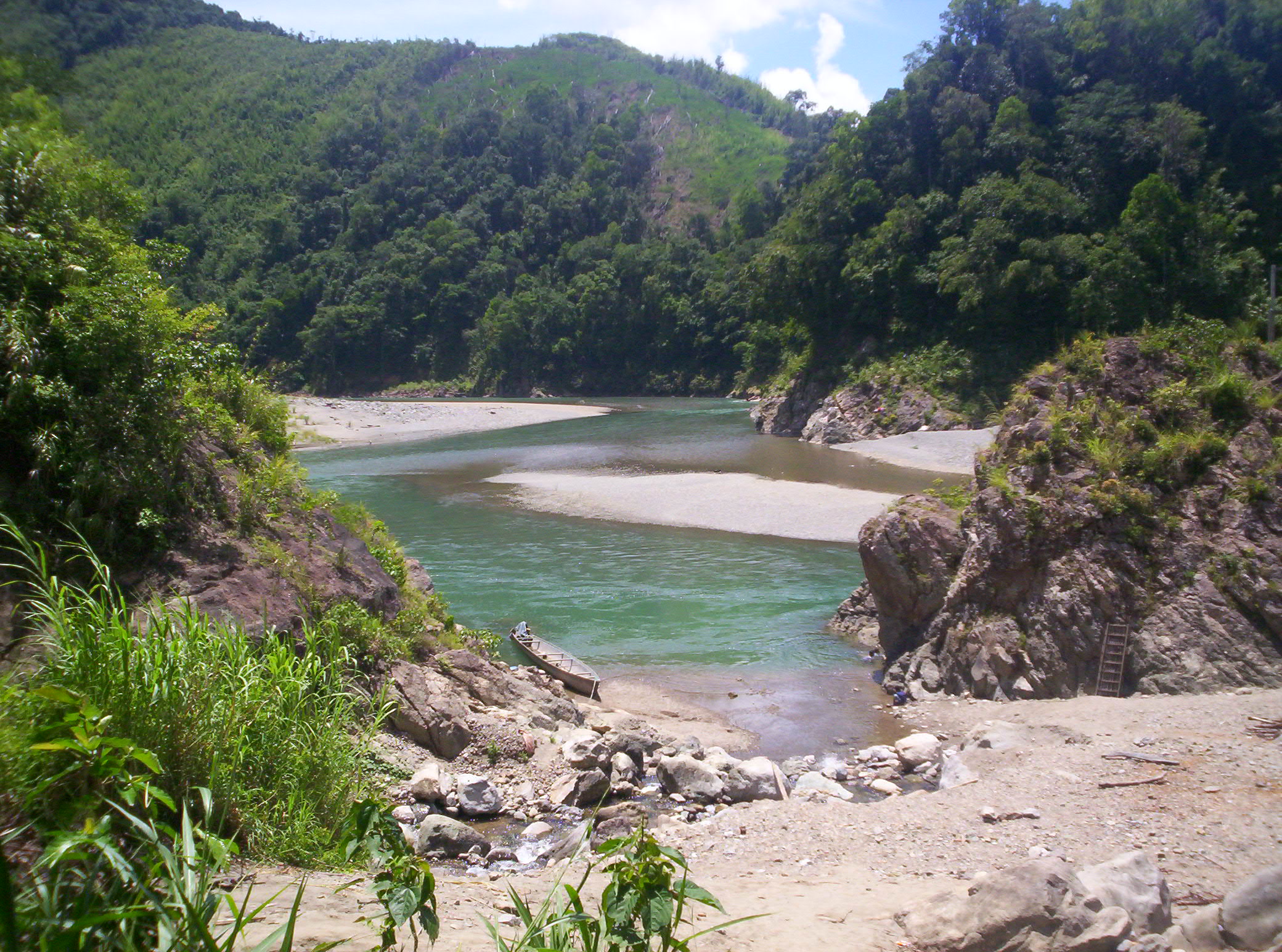
Dibagat is inhabited by the Isnag.[citation needed] There is a small grass airstrip built by SIL in 1985.[citation needed] Dibagat is accessible only by canoe or by specialized aircraft.[citation needed]
Galleries
-
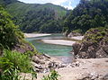
River which flows through Barangay Dibagat.
-
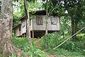
A typical home in Barangay Dibagat.
External links
- Philippine Standard Geographic Code
- 1995 Philippine Census Information
- 2000 Philippine Census Information
- 2007 Philippine Census Information
Municipalities Categories:- Municipalities of Apayao
- Philippines geography stubs


Wikimedia Foundation. 2010.