- La Trinidad, Benguet
Infobox Settlement
official_name = MUNICIPALITY OF LA TRINIDAD
other_name = Bayan ng La Trinidad
native_name = Ili ti La Trinidad
nickname = STRAWBERRY CAPITAL OF THE PHILIPPINES
settlement_type = Municipality
motto =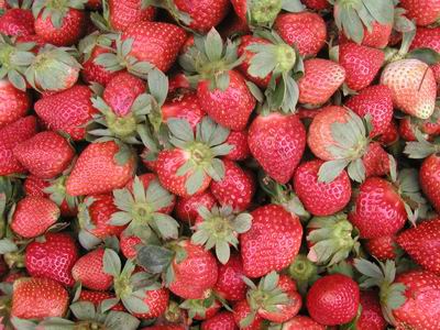
imagesize = 300px
image_caption = Strawberries of La Trinidad
flag_size =
image_
seal_size = 120px
image_shield =
shield_size =
city_
citylogo_size =
mapsize = 270px
map_caption = Map ofBenguet showing the location of La Trinidad
mapsize1 =
map_caption1 =
pushpin_
pushpin_label_position =
pushpin_map_caption =
pushpin_mapsize =
subdivision_type = Country
subdivision_name =Philippines
subdivision_type1 = Region
subdivision_name1 =Cordillera Administrative Region
subdivision_type2 = Districts
subdivision_name2 = Lone Congressional District of Benguet
subdivision_type3 =Barangays
subdivision_name3 = 16
subdivision_type4 =
subdivision_name4 =
government_type =
leader_title = Governor
leader_name = Nestor Fongwan
leader_title1 = Vice-Governor
leader_name1 = Crescensio Pacalso
leader_title2 = Mayor
leader_name2 = Artemio Galwan
leader_title3 =
leader_name3 =
leader_title4 =
leader_name4 =
established_title =
established_date =
established_title2 =
established_date2 =
established_title3 =
established_date3 =
area_magnitude =
unit_pref =
area_footnotes =
area_total_km2 =
area_land_km2 = 82.7380
area_water_km2 =
area_total_sq_mi =
area_land_sq_mi =
area_water_sq_mi =
area_water_percent =
area_urban_km2 =
area_urban_sq_mi =
area_metro_km2 =
area_metro_sq_mi =
population_as_of = 2000
population_footnotes =
population_note =
population_total = 67,963
population_density_km2 =
population_density_sq_mi =
population_metro =
population_density_metro_km2 =
population_density_metro_sq_mi =
population_urban =
population_density_urban_km2 =
population_density_urban_sq_mi =
timezone = PST
utc_offset = +8
timezone_DST =
utc_offset_DST =
latd= |latm= |lats= |latNS=
longd= |longm= |longs= |longEW=
elevation_footnotes =
elevation_m = 1300
elevation_ft =
postal_code_type = Zip Code
postal_code = 2601
area_code = 2
blank_name =
blank_info =
blank1_name =
blank1_info =
website = [http://www.latrinidad.gov.ph www.latrinidad.gov.ph]
footnotes = La Trinidad is a 1st class municipality in the province of Benguet,Philippines . It is the capital municipality of Benguet. According to the2000 census, it has a population of 67,963 people in 13,658 households.Geography and climate
La Trinidad is located 3 km north of
Baguio City and is 256 km north ofManila . It is bounded on the north by the municipality of Tublay, on the south by Baguio, and on the west by Sablan and Tuba.The municipality has a land area of 8273.80 hectares, representing 3.16% of the provincial land area. The terrain is generally mountainous with springs, rivers and creeks. La Trinidad's valley floor elevation is at 1300 meters above sea level. Elevation ranges from 500 to 1700 meters above sea level.
La Trinidad belongs under the Type I climate by the Coronas System of classification with distinct wet and dry seasons. The dry season is from November to April while the wet season occurs during the rest of the year. The climate is cool with temperatures ranging from 11.7 C during the month of December at its coldest and 23.2 C at its warmest during the months of March, April and May. The average daily temperature is 18.55 C. Wind velocity is 1.43. During the rainest month of August, the rainfall average is 850.70 mm.
The municipality is also the home of the following schools:
* science high school for the CAR region:Cordillera Regional Science High School
* the first university in the province of Benguet:Benguet State University
* established in the 1960's, its first Catholic School: San Jose High School.Barangays
La Trinidad is subdivided into 16
barangay s.
* Alapang
* Alno
* Ambiong
* Bahong
* Balili
* Beckel
* Bineng
* Betag
* Cruz
* Lubas
* Pico
* Poblacion
* Puguis
* Shilan
* Tawang
* WangalExternal links
* [http://www.benguet.gov.ph/index.php?option=com_content&task=view&id=32&Itemid=193 Province of Benguet - La Trinidad]
* [http://www.nscb.gov.ph/activestats/psgc/default.asp Philippine Standard Geographic Code]
* [http://www.t-macs.com/kiso/local/ 2000 Philippine Census Information]
Wikimedia Foundation. 2010.