- Northport, Washington
-
Northport, Washington — Town — Location of Northport, Washington
Coordinates: 48°54′52″N 117°46′56″W / 48.91444°N 117.78222°WCoordinates: 48°54′52″N 117°46′56″W / 48.91444°N 117.78222°W Country United States State Washington County Stevens Area – Total 0.6 sq mi (1.5 km2) – Land 0.6 sq mi (1.5 km2) – Water 0.0 sq mi (0.0 km2) Elevation 1,365 ft (416 m) Population (2010) – Total 295 – Density 491.7/sq mi (196.7/km2) Time zone Pacific (PST) (UTC-8) – Summer (DST) PDT (UTC-7) ZIP code 99157 Area code 509 FIPS code 53-50045[1] GNIS feature ID 1523920[2] Northport is a town in Stevens County, Washington, United States. The population was 295 at the 2010 census.
Contents
History
Northport was given its name since it was once the northernmost town on the Spokane Falls and Northern Railway.[3] It was officially incorporated on June 1, 1898 but has a history stretching back to the 1880s when it was a port and shipbuilding center for steamboat services running northwards into British Columbia during construction of the Canadian Pacific Railway, related to its location at a stretch of the Columbia known as the Little Dalles, a rapids and narrows that was a barrier to navigation and which also was an alternate name for Northport itself.[4][5][6]
Geography
Northport is located at 48°54′52″N 117°46′56″W / 48.91444°N 117.78222°W (48.914460, -117.782331).[7]
According to the United States Census Bureau, the town has a total area of 0.6 square miles (1.5 km²), all of it land.
Demographics
As of the census[1] of 2000, there were 336 people, 151 households, and 83 families residing in the town. The population density was 592.7 people per square mile (227.6/km²). There were 179 housing units at an average density of 315.8 per square mile (121.2/km²). The racial makeup of the town was 94.94% White, 0.60% Native American, 0.60% Asian, 0.30% Pacific Islander, 0.30% from other races, and 3.27% from two or more races. Hispanic or Latino of any race were 5.36% of the population.
There were 151 households out of which 22.5% had children under the age of 18 living with them, 47.0% were married couples living together, 5.3% had a female householder with no husband present, and 44.4% were non-families. 36.4% of all households were made up of individuals and 12.6% had someone living alone who was 65 years of age or older. The average household size was 2.23 and the average family size was 3.01.
In the town the age distribution of the population shows 25.0% under the age of 18, 5.7% from 18 to 24, 22.0% from 25 to 44, 30.1% from 45 to 64, and 17.3% who were 65 years of age or older. The median age was 43 years. For every 100 females there were 100.0 males. For every 100 females age 18 and over, there were 95.3 males.
The median income for a household in the town was $21,719, and the median income for a family was $26,875. Males had a median income of $28,929 versus $16,000 for females. The per capita income for the town was $11,679. About 15.9% of families and 27.7% of the population were below the poverty line, including 38.5% of those under age 18 and 17.4% of those age 65 or over.
References
- ^ a b "American FactFinder". United States Census Bureau. http://factfinder.census.gov. Retrieved 2008-01-31.
- ^ "US Board on Geographic Names". United States Geological Survey. 2007-10-25. http://geonames.usgs.gov. Retrieved 2008-01-31.
- ^ Majors, Harry M. (1975). Exploring Washington. Van Winkle Publishing Co. p. 58. ISBN 9780918664006. http://books.google.com/books?id=CoWrPQAACAAJ.
- ^ "Steamboats of the Columbia" article in Trails In Time website by Walter Volovsek
- ^ Mills, Randall V., Sternwheelers up Columbia, page 86, University of Nebraska, Lincoln 1947 ISBN 0-8032-5874-7
- ^ Turner, Robert D., Sternwheelers and Steam Tugs, page 1, Sono Nis Press, Victoria, BC 1984 ISBN 0-919203-15-9
- ^ "US Gazetteer files: 2010, 2000, and 1990". United States Census Bureau. 2011-02-12. http://www.census.gov/geo/www/gazetteer/gazette.html. Retrieved 2011-04-23.
Municipalities and communities of Stevens County, Washington Cities 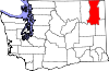
Towns Marcus | Northport | Springdale
Unincorporated
communitiesGhost towns Bossburg | Pinkney City
Steamboats of the Arrow Lakes Steamboats and tugs - Forty-Nine (1865)
- Kootenai (1885)
- Marcus WA
- Northport WA
- Ft. Colville WA
- Trail
- Castlegar
- Robson
- Edgewood
- Needles
- Fauquier
- Graham Landing
- Carrolls Landing
- Mackinson
- East Arrow Park
- Birds
- Arrow Park
- West Demars
- Burton
- Nakusp
- St. Leon
- Halcyon Hot Springs
- Galena Bay
- Beaton
- Comaplix
- Arrowhead
- Revelstoke
- Downie Creek
- La Porte
Steamboat lines - Columbia and Kootenay Steam Navigation Company
- Canadian Pacific Railway Lake and River Service
- Interior Tug & Transport Company
Geographic features Owners, captains and personnel - James W. Troup
- Gustavus Blin-Wright
- J.A. Mara
- Frank Barnard Jr.
- Selby Soules
Modern ferry lines Railway connections British Columbia steamboats - Upper Fraser, Nechako and Stuart Rivers
- Skeena River
- Arrow Lakes and Columbia River
- Slocan Lake
- Kootenay Lake
- Columbia Lake-East Kootenay
- Lakes Route (Seton, Anderson and Lillooet Lakes)
- Lake Okanagan
- Skaha Lake
- Thompson-Shuswap
- Stikine River
- Peace & Finlay Rivers
- Inside Passage
- Gulf of Georgia-Lower Fraser
Pacific Northwest steamboats - Columbia River
- Oregon Coast
- Willamette River
- Yaquina Bay and River
- Coquille River
- Cowlitz River
- Puget Sound
- Lake Washington
- Grays Harbor
- Chehalis River
- Hoquiam River
- Willapa Bay
- Columbia River (Wenatchee Reach)
- Lake Crescent
- Lower Kootenai River
- Upper Kootenai River
Categories:- Populated places in Stevens County, Washington
- Towns in Washington (state)
- Populated places on the Columbia River


Wikimedia Foundation. 2010.