- Kettle Falls, Washington
Infobox Settlement
official_name = Kettle Falls, Washington
settlement_type =City
nickname =
motto =
imagesize = 250px
image_caption = Welcome sign at the northern end of the city
image_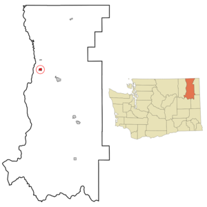
mapsize = 250px
map_caption = Location of Kettle Falls, Washington
mapsize1 =
map_caption1 =subdivision_type = Country
subdivision_name =United States
subdivision_type1 = State
subdivision_name1 =Washington
subdivision_type2 = County
subdivision_name2 = Stevensgovernment_footnotes =
government_type =
leader_title =
leader_name =
leader_title1 =
leader_name1 =
established_title =
established_date =unit_pref = Imperial
area_footnotes =area_magnitude =
area_total_km2 = 2.4
area_land_km2 = 2.4
area_water_km2 = 0.0
area_total_sq_mi = 0.9
area_land_sq_mi = 0.9
area_water_sq_mi = 0.0population_as_of = 2000
population_footnotes =
population_total = 1527
population_density_km2 = 629.8
population_density_sq_mi = 1631.1timezone = Pacific (PST)
utc_offset = -8
timezone_DST = PDT
utc_offset_DST = -7
elevation_footnotes =
elevation_m = 497
elevation_ft = 1631
latd = 48 |latm = 36 |lats = 21 |latNS = N
longd = 118 |longm = 3 |longs = 35 |longEW = Wpostal_code_type =
ZIP code s
postal_code = 99126, 99141
area_code = 509
blank_name = FIPS code
blank_info = 53-35485GR|2
blank1_name = GNIS feature ID
blank1_info = 1530955GR|3
website =
footnotes =Kettle Falls is a city in Stevens County,
Washington ,United States , named for the nearbyKettle Falls on theColumbia River , an ancient and important fishing site for Native Americans. The population of the city was 1,527 at the 2000 census.Geography
The original Kettle Falls was officially incorporated on
December 17 ,1891 on the bank of the Columbia. After it was flooded by theGrand Coulee Dam in 1940, city planners relocated the town at a community called Meyers Falls, near the railroad lines, helping to ensure its success as a trans-shipment point for the logging, agriculture, and paper industries. This is its present location, eight miles northwest of Colville and roughly 80 miles northwest of Spokane. It is 30 miles south of the Canadian border at Laurier and adjacent to Lake Roosevelt, the reservoir of theColumbia River . According to theUnited States Census Bureau , the city has a total area of 0.9square mile s (2.4km² ), all of it land.Demographics
The City conducts an internal census each Spring, using utility demographic data. The population in Spring 2004 was 1,591 people. In the Spring of 2006 the population was listed at 1,620.
As of the
census GR|2 of 2000, there were 1,527 people, 632 households, and 398 families residing in the city. Thepopulation density was 1,631.1 people per square mile (627.2/km²). There were 686 housing units at an average density of 732.8/sq mi (281.8/km²). The racial makeup of the city was 91.29% White, 0.07% African American, 3.86% Native American, 0.20% Asian, 0.07% Pacific Islander, 0.65% from other races, and 3.86% from two or more races. Hispanic or Latino of any race were 2.75% of the population.There were 632 households out of which 33.7% had children under the age of 18 living with them, 47.2% were married couples living together, 11.2% had a female householder with no husband present, and 37.0% were non-families. 31.8% of all households were made up of individuals and 14.4% had someone living alone who was 65 years of age or older. The average household size was 2.42 and the average family size was 3.05.
In the city the population was spread out with 29.4% under the age of 18, 8.3% from 18 to 24, 25.9% from 25 to 44, 20.5% from 45 to 64, and 15.8% who were 65 years of age or older. The median age was 34 years. For every 100 females there were 95.8 males. For every 100 females age 18 and over, there were 92.2 males.
The median income for a household in the city was $27,031, and the median income for a family was $34,375. Males had a median income of $33,750 versus $23,750 for females. The
per capita income for the city was $13,614. About 15.1% of families and 21.1% of the population were below thepoverty line , including 26.0% of those under age 18 and 12.9% of those age 65 or over.Notable Residents
*
Carolyn Suzanne Sapp ,Miss America 1992 andMiss Hawaii 1991 .Key geographic points in and near Kettle Falls
Reservoirs
*
Boise Cascade Mill Waste Pond
*Blue Gulch Reservoir
*Franklin D. Roosevelt Lake Dams
*
Blue Gulch Reservoir Dam chools
*
Kettle Falls School District
**Kettle Falls Elementary School (Grades K-4, enrollment 279 in October 2003, located at 48°36'27"N, 118°03'05"W)
**Kettle Falls Middle School
**Kettle Falls High School Campgrounds
*
Kettle Falls Campground See also
*
St. Paul Mission
*Fort Colville References
External links
* [http://www.kettlefalls.com Official City of Kettle Falls website]
* [http://www.scrldwiki.org/index.php/Kettle_Falls Kettle Falls] : a community wiki page of the [http://www.scrldwiki.org Stevens County Wiki Project]

Wikimedia Foundation. 2010.