- Toledo, Washington
-
Toledo, Washington — City — Location of Toledo, Washington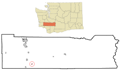
Coordinates: 46°26′21″N 122°50′53″W / 46.43917°N 122.84806°WCoordinates: 46°26′21″N 122°50′53″W / 46.43917°N 122.84806°W Country United States State Washington County Lewis Area – Total 0.3 sq mi (0.9 km2) – Land 0.3 sq mi (0.9 km2) – Water 0.0 sq mi (0.0 km2) Elevation 121 ft (37 m) Population (2010) – Total 725 – Density 1,947.3/sq mi (751.9/km2) Time zone Pacific (PST) (UTC-8) – Summer (DST) PDT (UTC-7) ZIP code 98591 Area code(s) 360 FIPS code 53-71785[1] GNIS feature ID 1512731[2] Toledo is a city in Lewis County, Washington, United States. The population was 725 at the 2010 census.
Contents
History
Toledo was officially incorporated on October 10, 1892. Toledo was named by Celeste Rochon after a pioneer side wheel paddle steamer operated by Captain Oren Kellogg of the Kellogg Transportation Company.[3] The boat traveled the Cowlitz River. A picture of the riverboat is hanging downtown next to the drugstore.
The first school in Toledo was called the OK School. It was a one room school house. Most of the kids that lived out of the town limits had to ride a boat across the river to and from school until the bridge was built.
The current Middle School was originally the High School until the new High School was built in the late 70s-early 80s. While the middle school was being remodeled in 1995 the children were relocated for the year to St. Mary's Church and School.
The Toledo Indian Tribe made a special Totem Pole for Toledo High School. The town has always used the "Indian" as the School's mascot (of course after receiving permission from the tribe). Recently, a painting was donated to the High School of "Old Ike" who was the last full blooded Indian to live in Toledo. His portrait still hangs within the halls of the High School.
Geography
Toledo is located at 46°26′21″N 122°50′53″W / 46.43917°N 122.84806°W (46.439283, -122.848191).[4]
According to the United States Census Bureau, the city has a total area of 0.3 square miles (0.9 km²), all of it land.
Demographics
Historical populations Census Pop. %± 1900 285 — 1910 375 31.6% 1920 324 −13.6% 1930 530 63.6% 1940 523 −1.3% 1950 602 15.1% 1960 499 −17.1% 1970 654 31.1% 1980 637 −2.6% 1990 586 −8.0% 2000 653 11.4% 2010 725 11.0% U.S. Decennial Census As of the census[1] of 2000, there were 653 people, 265 households, and 182 families residing in the city. The population density was 1,947.3 people per square mile (741.5/km²). There were 283 housing units at an average density of 843.9 per square mile (321.4/km²). The racial makeup of the city was 93.26% White, 0.61% African American, 2.30% Native American, 0.31% Asian, 1.53% from other races, and 1.99% from two or more races. Hispanic or Latino of any race were 4.90% of the population. 18.9% were of American, 13.7% German, 9.9% Irish, 8.0% English and 5.7% Dutch ancestry according to Census 2000. 97.5% spoke English and 2.5% Spanish as their first language.
There were 265 households out of which 32.8% had children under the age of 18 living with them, 51.3% were married couples living together, 12.8% had a female householder with no husband present, and 31.3% were non-families. 28.7% of all households were made up of individuals and 16.2% had someone living alone who was 65 years of age or older. The average household size was 2.46 and the average family size was 2.95.
In the city the population was spread out with 25.7% under the age of 18, 10.7% from 18 to 24, 24.3% from 25 to 44, 22.1% from 45 to 64, and 17.2% who were 65 years of age or older. The median age was 37 years. For every 100 females there were 85.5 males. For every 100 females age 18 and over, there were 83.7 males.
The median income for a household in the city was $29,271, and the median income for a family was $31,833. Males had a median income of $28,750 versus $19,271 for females. The per capita income for the city was $14,483. About 9.3% of families and 14.7% of the population were below the poverty line, including 21.6% of those under age 18 and 3.8% of those age 65 or over.
Politics
Toledo is a fairly Republican area, although less so than most of Lewis County; nearby "twin city" Vader voted for Democrat John F. Kerry. The results for the 2004 U.S. Presidential Election were as follows:
- George W. Bush (Republican) - 155 (58.27%)
- John F. Kerry (Democrat) - 107 (40.23%)
- Ralph Nader (Independent) - 3 (1.13%)
- Michael Peroutka (Constitution Party) - 1 (0.38%)
References
- ^ a b "American FactFinder". United States Census Bureau. http://factfinder.census.gov. Retrieved 2008-01-31.
- ^ "US Board on Geographic Names". United States Geological Survey. 2007-10-25. http://geonames.usgs.gov. Retrieved 2008-01-31.
- ^ "Toledo". Washington Place Names database. Tacoma Public Library. http://search.tpl.lib.wa.us/wanames/. Retrieved 2009-03-06.
- ^ "US Gazetteer files: 2010, 2000, and 1990". United States Census Bureau. 2011-02-12. http://www.census.gov/geo/www/gazetteer/gazette.html. Retrieved 2011-04-23.
Municipalities and communities of Lewis County, Washington Cities 
Town CDP Unincorporated
communitiesAdna | Ajlune | Alpha | Boistfort | Bunker | Carlson | Carriage Hill | Ceres | Cinebar | Claquato | Curtis | Doty | Dryad | Ethel | Evaline | Forest | Galvin | Glenoma | Guerrier | Harmony | Kalber | Klaber | Knab | Kosmos | Lacamas | Lindberg | Littell | Marys Corner | Mineral | Newaukum | Onalaska | Packwood | Randle | Saint Urbans | Salkum | Silver Creek | Waunch Prairie | Wildwood
Categories:- Cities in Washington (state)
- Populated places in Lewis County, Washington


Wikimedia Foundation. 2010.