- Cinebar, Washington
-
Cinebar, Washington — Unincorporated Community — Coordinates: 46°34′52″N 122°32′27″W / 46.581117°N 122.540697°W Country United States State Washington County Lewis Area – Total 14.2 sq mi (36.8 km2) – Land 14.1 sq mi (36.5 km2) – Water .1 sq mi (0.3 km2) Elevation 1,109 ft (338 m) Population (2000) – Total 517 – Density 36.5/sq mi (14.1/km2) Time zone Pacific (PST) (UTC-8) – Summer (DST) PDT (UTC-7) ZIP code 98533 Area code(s) 360 FIPS code GNIS feature ID Cinebar is an unincorporated community in Washington State between State Highway 508 and State Highway 12. Named for the cinnabar present in the mountains to the northeast,[1] Cinebar is a rural area with a post office and fire station on State Highway 508. Other towns near Cinebar include Salkum, Washington, which is the closest, as well as Morton, Onalaska and Centralia.
Nearby attractions and points of interest include the Cowlitz River, the Tilton River, Lake Mayfield, Lake Mayfield Park, Mayfield Resort, and Ike Kinswa State Park.
References
- ^ Majors, Harry M. (1975). Exploring Washington. Van Winkle Publishing Co. p. 122. ISBN 9780918664006. http://books.google.com/books?id=CoWrPQAACAAJ.
US CENSUS INFORMATION: [1]
Coordinates: 46°36′15″N 122°31′54″W / 46.60417°N 122.53167°W
Municipalities and communities of Lewis County, Washington Cities 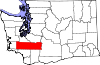
Town CDP Unincorporated
communitiesAdna | Ajlune | Alpha | Boistfort | Bunker | Carlson | Carriage Hill | Ceres | Cinebar | Claquato | Curtis | Doty | Dryad | Ethel | Evaline | Forest | Galvin | Glenoma | Guerrier | Harmony | Kalber | Klaber | Knab | Kosmos | Lacamas | Lindberg | Littell | Marys Corner | Mineral | Newaukum | Onalaska | Packwood | Randle | Saint Urbans | Salkum | Silver Creek | Waunch Prairie | Wildwood
Categories:- Washington (state) geography stubs
- Unincorporated communities in Washington (state)
- Populated places in Lewis County, Washington

Wikimedia Foundation. 2010.