- Napavine, Washington
-
Napavine, Washington — City — Location of Napavine, Washington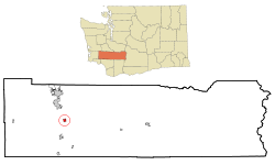
Coordinates: 46°34′45″N 122°54′39″W / 46.57917°N 122.91083°WCoordinates: 46°34′45″N 122°54′39″W / 46.57917°N 122.91083°W Country United States State Washington County Lewis Area – Total 0.8 sq mi (2.1 km2) – Land 0.8 sq mi (2.1 km2) – Water 0.0 sq mi (0.0 km2) Elevation 459 ft (140 m) Population (2010) – Total 1,766 – Density 1,702.5/sq mi (657.3/km2) Time zone Pacific (PST) (UTC-8) – Summer (DST) PDT (UTC-7) ZIP code 98565 Area code(s) 360 FIPS code 53-47980[1] GNIS feature ID 1506926[2] Website www.cityofnapavine.com Napavine is a city in Lewis County, Washington, United States. The population was 1,766 at the 2010 census.
Contents
History
Napavine was officially incorporated as a town on November 21, 1913. Settlers began arriving in the Cowlitz area in the early 1850s. In 1883 Scottish immigrant James Urquhart laid out the town naming it Napavine from the Indian world NAPAVOON meaning "small prairie".[3]
Geography
Napavine is located at 46°34′45″N 122°54′39″W / 46.579284°N 122.910935°W (46.579284, -122.910935).[4]
According to the United States Census Bureau, the city has a total area of 0.8 square miles (2.1 km2), all of it land.
Demographics
Historical populations Census Pop. %± 1920 340 — 1930 181 −46.8% 1940 220 21.5% 1950 242 10.0% 1960 314 29.8% 1970 377 20.1% 1980 611 62.1% 1990 745 21.9% 2000 1,361 82.7% 2010 1,766 29.8% U.S. Decennial Census As of the census[1] of 2000, there were 1,361 people, 444 households, and 349 families residing in the city. The population density was 1,702.5 people per square mile (656.9/km2). There were 474 housing units at an average density of 592.9 per square mile (228.8/km2). The racial makeup of the city was 93.02% White, 0.15% African American, 1.54% Native American, 0.15% Asian, 0.29% Pacific Islander, 3.31% from other races, and 1.54% from two or more races. Hispanic or Latino of any race were 5.73% of the population.
There were 444 households out of which 47.7% had children under the age of 18 living with them, 57.2% were married couples living together, 16.2% had a female householder with no husband present, and 21.2% were non-families. 16.4% of all households were made up of individuals and 6.1% had someone living alone who was 65 years of age or older. The average household size was 3.05 and the average family size was 3.45.
In the city the population was spread out with 37.0% under the age of 18, 7.0% from 18 to 24, 30.3% from 25 to 44, 17.0% from 45 to 64, and 8.7% who were 65 years of age or older. The median age was 29 years. For every 100 females there were 94.4 males. For every 100 females age 18 and over, there were 91.7 males.
The median income for a household in the city was $40,966, and the median income for a family was $41,250. Males had a median income of $38,750 versus $26,103 for females. The per capita income for the city was $16,275. About 12.7% of families and 13.0% of the population were below the poverty line, including 15.8% of those under age 18 and 11.0% of those age 65 or over.
Politics
Napavine is the most heavily Republican incorporated area in Lewis County, and among the most Republican in western Washington State. The results for the 2004 U.S. Presidential Election were as follows:
- George W. Bush (Republican) - 457 (72.54%)
- John F. Kerry (Democrat) - 167 (26.51%)
- Other candidates - 6 (0.65%)
January 2008 - At 22 years of age Nick Bozarth became the youngest mayor in the history of Napavine. Bozarth did not side-step his responsibilities but rather took them head on including banning city workers from taking their extended lunch breaks at a local restaurant and 86'd a controversial police chief. While his term as Mayor has been educational and beneficial Bozarth has already announced that he does not plan to run for re-election.[5]
References
- ^ a b "American FactFinder". United States Census Bureau. http://factfinder.census.gov. Retrieved 2008-01-31.
- ^ "US Board on Geographic Names". United States Geological Survey. 2007-10-25. http://geonames.usgs.gov. Retrieved 2008-01-31.
- ^ ""History of the Pacific Northwest Vol. II, pg 611-12, 1889, North Pacific History Company
- ^ "US Gazetteer files: 2010, 2000, and 1990". United States Census Bureau. 2011-02-12. http://www.census.gov/geo/www/gazetteer/gazette.html. Retrieved 2011-04-23.
- ^ ""Copyright © 2008 The Seattle Times Company[Full citation needed][verification needed]
Municipalities and communities of Lewis County, Washington Cities 
Town CDP Unincorporated
communitiesAdna | Ajlune | Alpha | Boistfort | Bunker | Carlson | Carriage Hill | Ceres | Cinebar | Claquato | Curtis | Doty | Dryad | Ethel | Evaline | Forest | Galvin | Glenoma | Guerrier | Harmony | Kalber | Klaber | Knab | Kosmos | Lacamas | Lindberg | Littell | Marys Corner | Mineral | Newaukum | Onalaska | Packwood | Randle | Saint Urbans | Salkum | Silver Creek | Waunch Prairie | Wildwood
Categories:- Cities in Washington (state)
- Populated places in Lewis County, Washington


Wikimedia Foundation. 2010.