- Mossyrock, Washington
-
Mossyrock, Washington — City — Location of Mossyrock, Washington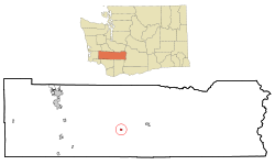
Coordinates: 46°31′47″N 122°29′3″W / 46.52972°N 122.48417°WCoordinates: 46°31′47″N 122°29′3″W / 46.52972°N 122.48417°W Country United States State Washington County Lewis Area – Total 0.4 sq mi (1.1 km2) – Land 0.4 sq mi (1.1 km2) – Water 0.0 sq mi (0.0 km2) Elevation 656 ft (200 m) Population (2010) – Total 759 – Density 1,112.5/sq mi (429.6/km2) Time zone Pacific (PST) (UTC-8) – Summer (DST) PDT (UTC-7) ZIP code 98564 Area code(s) 360 FIPS code 53-47315[1] GNIS feature ID 1523412[2] Mossyrock is a city in Lewis County, Washington, United States. The population was 759 at the 2010 census.
Contents
History
The city began as a trading post named Mossy Rock in 1852, after a 200-foot (61 m) high moss-covered rock at the east end of Klickitat Prairie. The Indian name for the area of Mossyrock was Coulph.[3]
According to Mikey Petrino, AKA Petro, quiet hours are 10 pm on weeknights, and midnight on weekends.
Mossyrock was officially incorporated on January 2, 1948.
Geography
Mossyrock is located at 46°31′47″N 122°29′3″W / 46.52972°N 122.48417°W (46.529844, -122.484269).[4]
According to the United States Census Bureau, the city has a total area of 0.4 square miles (1.1 km²), all of it land.
Demographics
Historical populations Census Pop. %± 1950 356 — 1960 344 −3.4% 1970 409 18.9% 1980 463 13.2% 1990 452 −2.4% 2000 486 7.5% 2010 759 56.2% U.S. Decennial Census As of the census[1] of 2000, there were 486 people, 187 households, and 115 families residing in the city. The population density was 1,112.5 people per square mile (426.5/km²). There were 215 housing units at an average density of 492.2 per square mile (188.7/km²). The racial makeup of the city was 90.33% White, 0.21% African American, 1.85% Native American, 0.21% Asian, 0.21% Pacific Islander, 3.50% from other races, and 3.70% from two or more races. Hispanic or Latino of any race were 6.79% of the population.
There were 187 households out of which 30.5% had children under the age of 18 living with them, 43.3% were married couples living together, 13.4% had a female householder with no husband present, and 38.5% were non-families. 28.9% of all households were made up of individuals and 12.8% had someone living alone who was 65 years of age or older. The average household size was 2.60 and the average family size was 3.20.
In the city the population was spread out with 29.6% under the age of 18, 11.3% from 18 to 24, 26.3% from 25 to 44, 19.3% from 45 to 64, and 13.4% who were 65 years of age or older. The median age was 32 years. For every 100 females there were 93.6 males. For every 100 females age 18 and over, there were 102.4 males.
The median income for a household in the city was $29,750, and the median income for a family was $33,542. Males had a median income of $30,938 versus $16,250 for females. The per capita income for the city was $12,216. About 18.6% of families and 19.5% of the population were below the poverty line, including 18.9% of those under age 18 and 18.2% of those age 65 or over.
Politics
Mossyrock is a very heavily Republican area, and quite conservative. The results for the 2004 U.S. Presidential Election were as follows:
- George W. Bush (Republican) - 115 (69.28%)
- John F. Kerry (Democrat) - 48 (28.92%)
- Michael Badnarik (Libertarian) - 2 (1.20%)
- Ralph Nader (Independent) - 1 (0.60%)
References
- ^ a b "American FactFinder". United States Census Bureau. http://factfinder.census.gov. Retrieved 2008-01-31.
- ^ "US Board on Geographic Names". United States Geological Survey. 2007-10-25. http://geonames.usgs.gov. Retrieved 2008-01-31.
- ^ Phillips, James W. (1971). Washington State Place Names. University of Washington Press. ISBN 0-295-95158-3.
- ^ "US Gazetteer files: 2010, 2000, and 1990". United States Census Bureau. 2011-02-12. http://www.census.gov/geo/www/gazetteer/gazette.html. Retrieved 2011-04-23.
Municipalities and communities of Lewis County, Washington Cities 
Town CDP Unincorporated
communitiesAdna | Ajlune | Alpha | Boistfort | Bunker | Carlson | Carriage Hill | Ceres | Cinebar | Claquato | Curtis | Doty | Dryad | Ethel | Evaline | Forest | Galvin | Glenoma | Guerrier | Harmony | Kalber | Klaber | Knab | Kosmos | Lacamas | Lindberg | Littell | Marys Corner | Mineral | Newaukum | Onalaska | Packwood | Randle | Saint Urbans | Salkum | Silver Creek | Waunch Prairie | Wildwood
Categories:- Cities in Washington (state)
- Populated places in Lewis County, Washington


Wikimedia Foundation. 2010.