- Morro Rock
-
Morro Rock 
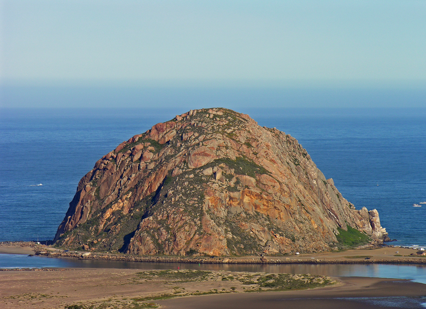
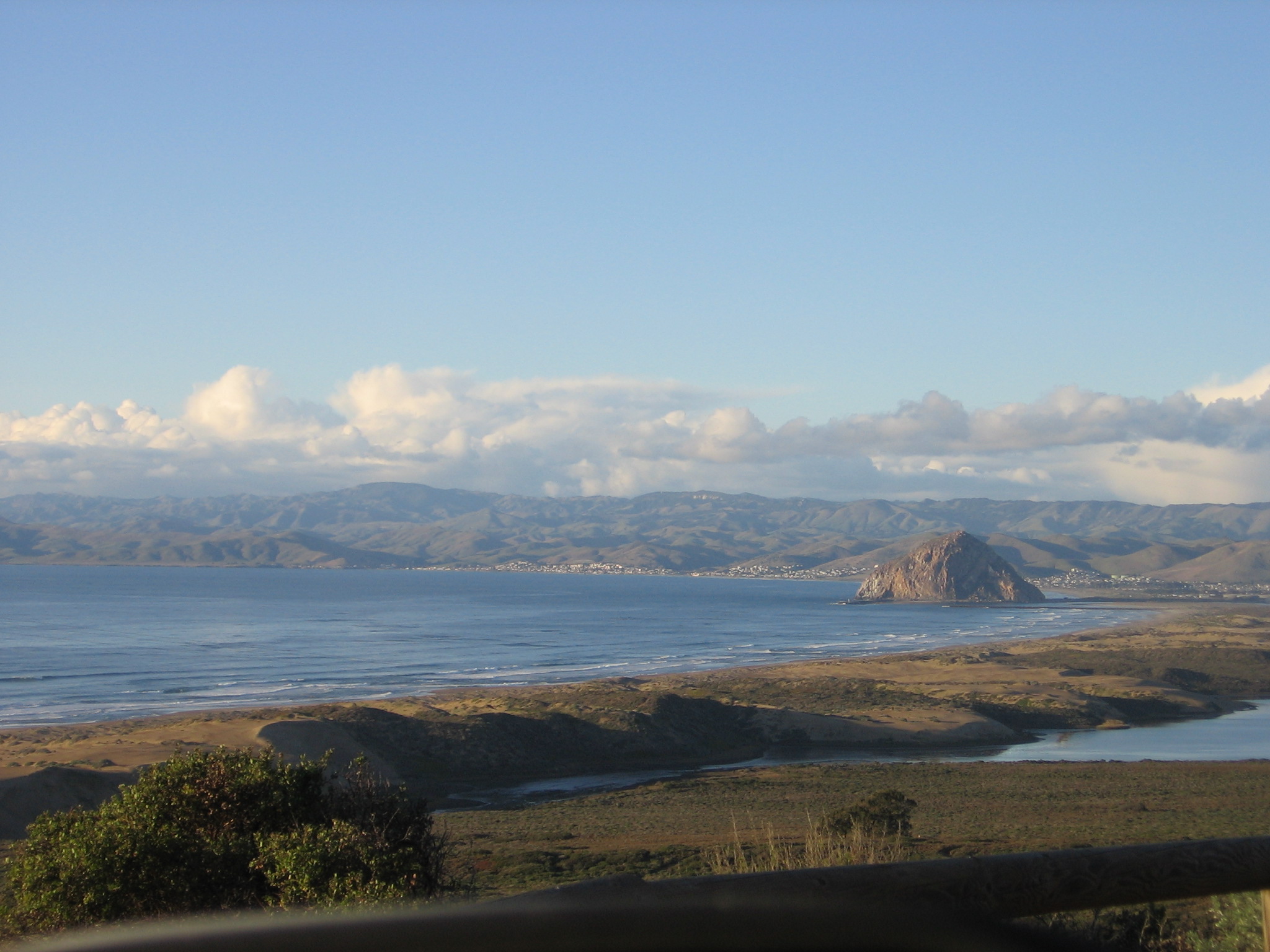
Morro Rock looking northwest.Elevation 581 ft (177 m) NAVD 88[1] Location Location Morro Bay, California Range Santa Lucia Range Coordinates 35°22′10″N 120°52′03″W / 35.369430653°N 120.867550139°WCoordinates: 35°22′10″N 120°52′03″W / 35.369430653°N 120.867550139°W[1] Topo map USGS Morro Bay South Geology Type Volcanic plug Age of rock 20 million years Volcanic arc/belt Reference #: 821[2] Morro Rock is a 581-foot (177 m)[1] volcanic plug located just offshore from Morro Bay, California, at the entrance to Morro Bay Harbor. A causeway connects it with the shore, effectively making it a tied island. The area surrounding the base of Morro Rock can be visited. The rock is protected as the Morro Rock State Preserve. Climbing on the rock or disturbing the bird life is forbidden by law.[3]
Contents
History
The rock was quarried on and off from 1889 to 1969, and provided material for the break water of Morro Bay and Port San Luis Harbor. In 1966, a new state law was adopted that transferred title to the State of California. In February 1968, the San Luis Obispo County Historical Society and the City of Morro Bay succeeded in having Morro Rock declared California Registered Historical Landmark number 821.[4]

Morro Rock was first charted in 1542 by Portuguese explorer Juan Rodriguez Cabrillo, who called it El Morro, the Spanish geographical term for a crown-shaped rock or hill ("the pebble").[5] Since then, it has become an important landmark to sailors and travelers.
The Salinan and Chumash tribes considered Morro Rock to be a sacred site. The Chumash had an important nearby prehistoric settlement at least as early as the Milling Stone Horizon (6500-2000 B.C.E.), and the village was near the mouth of Morro Creek. The right of the Chumash people to climb Morro Rock for their annual Solstice ceremony is now well established, but it is illegal for the general public to climb it.[6]
Despite protests by the Chumash, Salinan tribe members also have exemption to legally climb Morro Rock for an annual ceremony celebrating the time in legend when hawk and raven destroyed the two-headed serpent-monster Taliyekatapelta, as he wrapped his body around the base of the rock.[4]
The Rock, as locals call it, was previously surrounded by water. However, the northern channel's harbor was made from its sediment.
Morro Rock is the best known of the Nine Sisters of San Luis Obispo County, a series of ancient volcanic plugs that line the Los Osos Valley between the cities of Morro Bay and San Luis Obispo.
Flora and fauna
Birds
Several types of birds nest on Morro Rock, including three cormorant species and two gull species.[7] It presently serves as a reserve for peregrine falcons, which are locally endangered and cause most of the laws that prohibit intervention with avian life.
Mammals
Sea Lions and sea otters can be seen regularly in the water around the rock. Seals, however, are much more common in the nearby Morro Bay State Park, where they breed.
Other fauna
Other fauna include a wide selection of tide pool animals, like hermit crabs, small fish, starfish, sea cucumbers, mussels, bivalve mollusks, coral, and more.
Flora
On land few flora can survive the harsh, dry environment on the rock, but in the surrounding bay, kelp, sea grass, kelp forest plants, and tide pool plants can survive, and a few common grasses, mosses, lichens and weeds from the mainland take root on the rock itself.
Marine Protected Areas
Morro Bay State Marine Recreational Management Area and Morro Bay State Marine Reserve are marine protected areas offshore from Morro Bay. Like underwater parks, these marine protected areas help conserve ocean wildlife and marine ecosystems.
References
- ^ a b c "Morro 2 reset". NGS data sheet. U.S. National Geodetic Survey. http://www.ngs.noaa.gov/cgi-bin/ds_mark.prl?PidBox=FV1678. Retrieved 2009-06-13.
- ^ "Morro Rock". Office of Historic Preservation, California State Parks. http://ohp.parks.ca.gov/listed_resources/default.asp?num=821. Retrieved 2011-07-27.
- ^ "Morro Rock State Preserve". California State Parks. http://www.slostateparks.com/morro_rock/default.asp. Retrieved 2010-01-11.
- ^ a b Dillion, Angela H. (2008). "Preserving Nature and Culture at Morro Rock". http://morro-bay.com/morsels/dillon/.
- ^ Gudde, Erwin G. (1949). California Place Names. Berkeley: University of California Press. p. 225.
- ^ Hogan, C. Michael (2008). "Morro Creek ed. by A. Burnham". In A. Burnham. http://www.megalithic.co.uk/article.php?sid=18502.
- ^ Joan Easton Lentz and Don DesJardin (2006) Introduction to Birds of the Southern California Coast, University of California Press, 316 pages ISBN 0520243218
External links
- "Morro Rock". Geographic Names Information System, U.S. Geological Survey. http://geonames.usgs.gov/pls/gnispublic/f?p=gnispq:3:::NO::P3_FID:255643. Retrieved 2009-06-13.
- City of Morro Bay
- The Nine Sisters
Nine Sisters Bishop Peak · Black Hill · Cerro Cabrillo · Cerro Romauldo · Cerro San Luis Obispo · Chumash Peak · Hollister Peak · Islay Hill · Morro Rock
Categories:- Nine Sisters
- Rock formations in California
- Protected areas of San Luis Obispo County, California
- Volcanic plugs of California
- California State Reserves
Wikimedia Foundation. 2010.