- Cerro Cabrillo
-
Cerro Cabrillo 
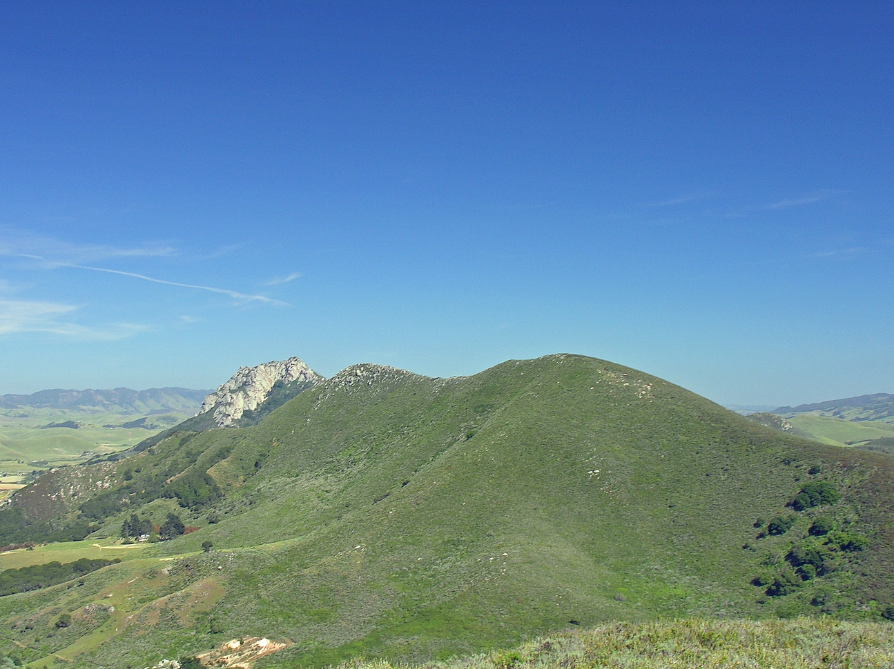
A picture of Cerro Cabrillo from Black Hill. A portion of Hollister Peak can be seen.Elevation 911 ft (278 m) NGVD 29[1] Location Location San Luis Obispo County, California Range Santa Lucia Range Coordinates 35°21′08″N 120°48′54″W / 35.3521964°N 120.8148997°WCoordinates: 35°21′08″N 120°48′54″W / 35.3521964°N 120.8148997°W[2] Topo map USGS Morro Bay South Geology Type Volcanic plug Age of rock 20 million years Volcanic arc/belt Nine Sisters Cerro Cabrillo, also known locally as Cabrillo Peak, is a rocky butte in Morro Bay State Park, California. The rock outcrop, composed mostly of rhyodacite, is a volcanic plug formed when magma welled up underneath a layer of softer rock and solidified. The softer overlying rock has since eroded away leaving the distinct rugged shape.[3] It is one, in a group of nine volcanic plugs in the area known as the Nine Sisters, which includes Morro Rock and Bishop Peak. It is named after Juan Rodríguez Cabrillo, an explorer, who was in the area around 1542.
The peak is popular with hikers and climbers. Its slopes support many wild flowers such as Gentian, Deer Weed, Soap Plant, and Mallow. On its east side is a rock formation called a tiki because of its resemblance to a Polynesian carving.
References
- ^ USGS. Morro Bay South quadrangle, California (Map). 1:24000, 7.5 Minute Topographic. http://www.topoquest.com/map.php?lat=35.3521964&lon=-120.8148997&datum=nad83&zoom=4&size=l. Retrieved 2009-12-17.
- ^ "Cerro Cabrillo". Geographic Names Information System, U.S. Geological Survey. http://geonames.usgs.gov/pls/gnispublic/f?p=gnispq:3:::NO::P3_FID:1660461. Retrieved 2009-12-17.
- ^ "The Nine Sisters of San Luis Obispo County". Santa Lucia Chapter, Sierra Club. http://santalucia.sierraclub.org/ninesis.html. Retrieved 2009-07-01.
Nine Sisters Bishop Peak · Black Hill · Cerro Cabrillo · Cerro Romauldo · Cerro San Luis Obispo · Chumash Peak · Hollister Peak · Islay Hill · Morro Rock
Categories:- Nine Sisters
- Buttes of the United States
- Mountains of San Luis Obispo County, California
- Volcanic plugs of California
Wikimedia Foundation. 2010.