- Cerro Romauldo
-
Cerro Romauldo 
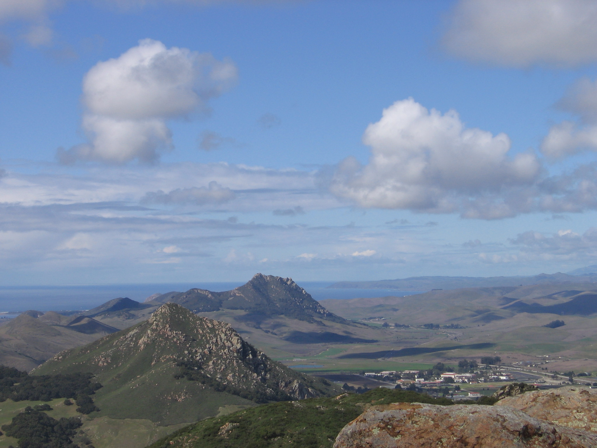
Cerro Romauldo pictured in the bottom left corner. The National Guard base can be seen to the right of it. The photograph is looking northwest from the top of Bishop Peak.Elevation 1,300 ft (396 m) NAVD 88[1] Translation Romauldo Hill (Spanish) Location Location San Luis Obispo, California Range Santa Lucia Range Coordinates 35°18′51″N 120°43′37″W / 35.314145367°N 120.726930578°WCoordinates: 35°18′51″N 120°43′37″W / 35.314145367°N 120.726930578°W[1] Topo map San Luis Obispo Geology Type Volcanic plug Age of rock 20 million years Volcanic arc/belt Nine Sisters Climbing Easiest route Not open to the public Cerro Romauldo is a 1,300 feet (396 m) hill in San Luis Obispo, California. The hill is the fifth in a series of volcanic plugs called the Nine Sisters. Until 1964 the hill was officially known as Romualdo Peak.[2]
The hill is named for a Chumash man who received the 117-acre (0.47 km2) Rancho Huerta de Romualdo Mexican land grant from Pío Pico, the last Mexican Governor of California. Huerta de Romauldo means Romauldo's kitchen garden or orchard in Spanish. He sold the land to Captain John Wilson in 1846.[3]
In the 1890s, rock from Cerro Romauldo was used in the construction of the Southern Pacific Railroad.
Cerro Romauldo is owned by the State of California, and is used by the California National Guard for fitness training.[4]
References
- ^ a b "Cerro Romauldo". NGS data sheet. U.S. National Geodetic Survey. http://www.ngs.noaa.gov/cgi-bin/ds_mark.prl?PidBox=FV1473. Retrieved 2009-07-04.
- ^ "Cerro Romauldo". Geographic Names Information System, U.S. Geological Survey. http://geonames.usgs.gov/pls/gnispublic/f?p=gnispq:3:::NO::P3_FID:255462. Retrieved 2009-12-19.
- ^ "United States v. Wilson". US Supreme Court Center. http://supreme.justia.com/us/66/267/case.html. Retrieved 2009-12-09.
- ^ "The Nine Sisters of San Luis Obispo County". Santa Lucia Chapter, Sierra Club. http://santalucia.sierraclub.org/ninesis.html. Retrieved 2009-07-01.
Nine Sisters Bishop Peak · Black Hill · Cerro Cabrillo · Cerro Romauldo · Cerro San Luis Obispo · Chumash Peak · Hollister Peak · Islay Hill · Morro Rock
Categories:- Nine Sisters
- Hills of California
- Volcanic plugs of California
Wikimedia Foundation. 2010.