- Chumash Peak
-
Chumash Peak 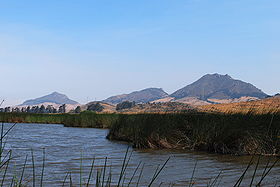
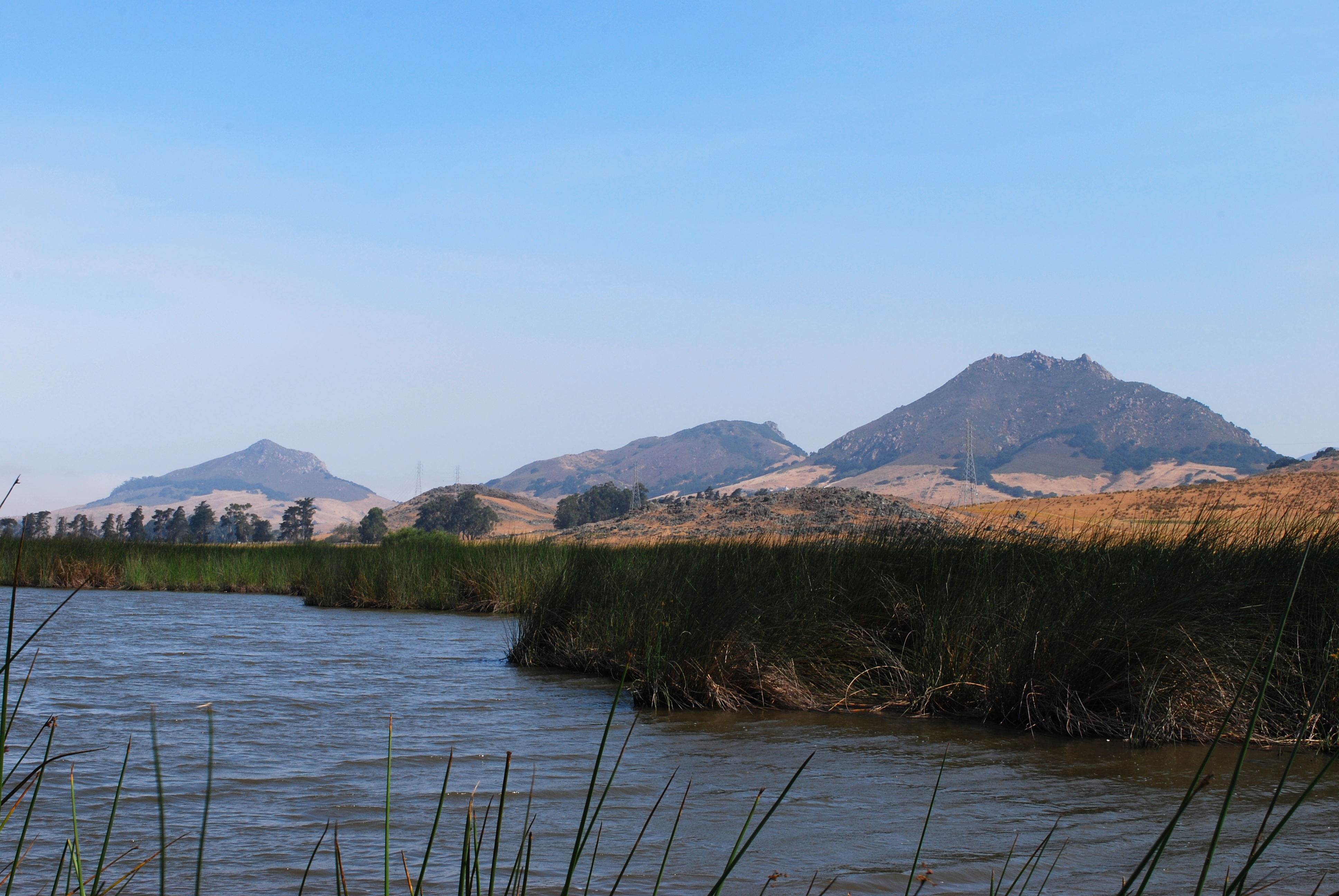
Chumash Peak is the middle of the three peaks.Elevation 1,268 ft (386 m) NGVD 29[1] Location Location San Luis Obispo, California Range Santa Lucia Range Coordinates 35°18′30″N 120°42′23″W / 35.30827°N 120.70632°WCoordinates: 35°18′30″N 120°42′23″W / 35.30827°N 120.70632°W [1] Topo map USGS San Luis Obispo Geology Type Volcanic plug Age of rock 20 million years Volcanic arc/belt Nine Sisters Chumash Peak is a 1,257 ft (383 m) hill in San Luis Obispo, California. The peak is the sixth in a series of volcanic plugs known as the Nine Sisters. In 1964 the hill was named in recognition of the Chumash Indians who lived in the area due to efforts by Louisiana Dart, curator of the San Luis Obispo County Museum.[2] Access to the peak is currently unavailable.[3]
The peak was recently quarried for the foundations of new Cuesta College buildings.[4]
References
- ^ a b USGS. San Luis Obispo quadrangle, California (Map). 1:24000. 7.5 Minute Topographic. http://www.topoquest.com/map.php?lat=35.30827&lon=-120.70632&datum=nad83&zoom=4&size=l. Retrieved 2009-12-20.
- ^ "The Nine Sisters of San Luis Obispo County". Santa Lucia Chapter, Sierra Club. http://santalucia.sierraclub.org/ninesis.html. Retrieved 2009-07-01.
- ^ "Chumash Peak". Climbing SLO. http://www.climbingslo.org/?q=node/205. Retrieved 2006-05-20.
- ^ "Nine Peaks". MorroBay.com. http://www.morrobay.com/whattodo/ninepeaks/. Retrieved 2009-12-20.
External links
- "Chumash Peak". Geographic Names Information System, U.S. Geological Survey. http://geonames.usgs.gov/pls/gnispublic/f?p=gnispq:3:::NO::P3_FID:255474. Retrieved 2009-12-20.
Nine Sisters Bishop Peak · Black Hill · Cerro Cabrillo · Cerro Romauldo · Cerro San Luis Obispo · Chumash Peak · Hollister Peak · Islay Hill · Morro Rock
Categories:- Nine Sisters
- Hills of California
Wikimedia Foundation. 2010.