- Muenster, Texas
-
Muenster, Texas — City — Location of Muenster, Texas
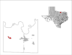
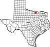
Coordinates: 33°39′3″N 97°22′32″W / 33.65083°N 97.37556°WCoordinates: 33°39′3″N 97°22′32″W / 33.65083°N 97.37556°W Country United States State Texas County Cooke Area – Total 1.3 sq mi (3.4 km2) – Land 1.3 sq mi (3.3 km2) – Water 0.0 sq mi (0.0 km2) Elevation 1,001 ft (305 m) Population (2000) – Total 1,556 – Density 1,209.3/sq mi (466.9/km2) Time zone Central (CST) (UTC-6) – Summer (DST) CDT (UTC-5) ZIP code 76252 Area code(s) 940 FIPS code 48-49932[1] GNIS feature ID 1363432[2] Muenster is a city in Cooke County, Texas, United States, along U.S. Route 82. The population was 1,556 at the 2000 census.
Contents
History
In 1887 the Missouri-Kansas-Texas Railroad constructed a line from Gainesville to Henrietta that passed through the site that would become Muenster. The town was subsequently founded in 1889 by German Catholic settlers Carl and Emil Flusche, who invited other German Catholics to join them. The town was originally to be called Westphalia, but since the name Westphalia, Texas was already taken, Muenster was selected instead in honor of Münster, the capital of Westphalia, but these cities are not sister-cities.
Many residents still spoke German in day-to-day life up until the First World War, after which the language was no longer taught in the schools and steadily declined in use.
With more than 90% of the population German Catholic, the town did manage to preserve many German customs, and still produces traditional foods at the local meat market and bäckerei. There is an annual festival in April, Germanfest, which includes lots of beer, BBQ, German food, music, and bike and footraces. A Christkindlmarkt is also held each year on Thanksgiving weekend.
Catholicism was so important to the early colonists that they built a school before a church was ever established. That school, Sacred Heart Catholic School still exists today (one of only four high schools in the Fort Worth Diocese), along with the public Muenster Independent School District.
Geography
Muenster is located at 33°39′03″N 97°22′32″W / 33.650937°N 97.375659°W.[3]
According to the United States Census Bureau, the city has a total area of 1.3 square miles (3.4 km2), of which, 1.3 square miles (3.4 km2) of it is land and 0.77% is water.
Demographics
As of the census[1] of 2000, there were 1,556 people, 588 households, and 401 families residing in the city. The population density was 1,209.3 people per square mile (465.7/km2). There were 628 housing units at an average density of 488.1 per square mile (188.0/km2). The racial makeup of the city was 97.62% White, 0.13% Native American, 0.51% Asian, 0.71% from other races, and 1.03% from two or more races. 2.19% of the population were Hispanic or Latino of any race.
There were 588 households out of which 35.5% had children under the age of 18 living with them, 57.1% were married couples living together, 7.7% had a female householder with no husband present, and 31.8% were non-families. 28.9% of all households were made up of individuals and 17.7% had someone living alone who was 65 years of age or older. The average household size was 2.57 and the average family size was 3.20.
In the city the population was spread out with 29.5% under the age of 18, 6.0% from 18 to 24, 26.9% from 25 to 44, 18.3% from 45 to 64, and 19.3% who were 65 years of age or older. The median age was 37 years. For every 100 females there were 88.1 males. For every 100 females age 18 and over, there were 83.8 males.
The median income for a household in the city was $39,125, and the median income for a family was $48,000. Males had a median income of $29,688 versus $22,697 for females. The per capita income for the city was $20,638. About 4.3% of families and 5.4% of the population were below the poverty line, including 5.7% of those under age 18 and 8.1% of those age 65 or over.
References
- ^ a b "American FactFinder". United States Census Bureau. http://factfinder.census.gov. Retrieved 2008-01-31.
- ^ "US Board on Geographic Names". United States Geological Survey. 2007-10-25. http://geonames.usgs.gov. Retrieved 2008-01-31.
- ^ "US Gazetteer files: 2010, 2000, and 1990". United States Census Bureau. 2011-02-12. http://www.census.gov/geo/www/gazetteer/gazette.html. Retrieved 2011-04-23.
External links
- Muenster from the Handbook of Texas Online
- Germanfest
- City of Muenster
Municipalities and communities of Cooke County, Texas Cities Callisburg | Gainesville | Muenster |
Towns CDP Unincorporated
communitiesBulcher | Era | Marysville | Myra | Rosston | Sivells Bend
Categories:- Towns in Texas
- Populated places in Cooke County, Texas
- Cities in Texas
- German-American history


Wikimedia Foundation. 2010.