- Lindsay, Cooke County, Texas
Infobox Settlement
official_name = Lindsay, Texas
settlement_type =City
nickname =
motto =
imagesize =
image_caption =
image_
mapsize = 250px
map_caption = Location of Lindsay, Texas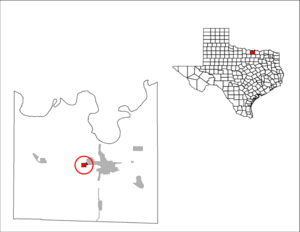
mapsize1 = 250px
map_caption1 =subdivision_type = Country
subdivision_name =United States
subdivision_type1 = State
subdivision_name1 =Texas
subdivision_type2 = County
subdivision_name2 = Cookegovernment_footnotes =
government_type =
leader_title =
leader_name =
leader_title1 =
leader_name1 =
established_title =
established_date =unit_pref = Imperial
area_footnotes =area_magnitude =
area_total_sq_mi = 1.1
area_land_sq_mi = 1.1
area_water_sq_mi = 0.0population_as_of = 2000
population_footnotes =
population_total = 788
population_density_km2 = 274.1
population_density_sq_mi = 708.2timezone = Central (CST)
utc_offset = -6
timezone_DST = CDT
utc_offset_DST = -5postal_code_type =
ZIP code
postal_code = 76250
area_code = 940
website =
footnotes =Lindsay is an incorporated city in Cooke County,
Texas ,United States , alongU.S. Route 82 . The population was 788 as of the 2000 census.History
In 1887 the
Missouri-Kansas-Texas Railroad constructed a line from Gainesville to Henrietta that passed through the site that would become Lindsay. The story of its founding closely resembles that of its neighbors along the railway such as Muenster. In 1891, Anton and August Flusche arranged for transfer of convert|9300|acre|km2 along the railway in order to found a new town, which they named after a local judge. They attracted several GermanCatholic settlers in the following years.The date of Lindsay's founding is officially recognized as March 25, 1892, when the first mass was held; however, Lindsay was not formally incorporated as a city until 1959.
The town of Lindsay has maintained some German traditions, including an annual
Oktoberfest . As is typical in the region, the main industries are farming, principally dairy farming, and oil production.Geography
Lindsay is located at coor dms|33|38|11|N|97|13|17|W|city (33.636318, -97.221297)GR|1.
According to the
United States Census Bureau , the town has a total area of 1.1square mile s (2.9km² ), all of it land.Demographics
As of the
census GR|2 of 2000, there were 788 people, 267 households, and 220 families residing in the town. Thepopulation density was 708.2 people per square mile (274.1/km²). There were 274 housing units at an average density of 246.3/sq mi (95.3/km²). The racial makeup of the town was 98.86% White, 0.13% Native American, 0.13% Asian, 0.89% from other races. Hispanic or Latino of any race were 1.40% of the population.There were 267 households out of which 49.4% had children under the age of 18 living with them, 69.7% were married couples living together, 9.4% had a female householder with no husband present, and 17.6% were non-families. 16.5% of all households were made up of individuals and 7.1% had someone living alone who was 65 years of age or older. The average household size was 2.95 and the average family size was 3.33.
In the town the population was spread out with 34.1% under the age of 18, 5.7% from 18 to 24, 28.9% from 25 to 44, 21.4% from 45 to 64, and 9.8% who were 65 years of age or older. The median age was 34 years. For every 100 females there were 94.6 males. For every 100 females age 18 and over, there were 91.5 males.
The median income for a household in the town was $52,000, and the median income for a family was $61,071. Males had a median income of $35,313 versus $26,083 for females. The
per capita income for the town was $18,852. About 2.7% of families and 4.1% of the population were below thepoverty line , including 4.2% of those under age 18 and 6.9% of those age 65 or over.Education
Lindsay is served by the
Lindsay Independent School District .References
External links
* [http://www.tsha.utexas.edu/handbook/online/articles/LL/hll44.html Handbook of Texas Online, Lindsay]

Wikimedia Foundation. 2010.