- Copperhill, Tennessee
-
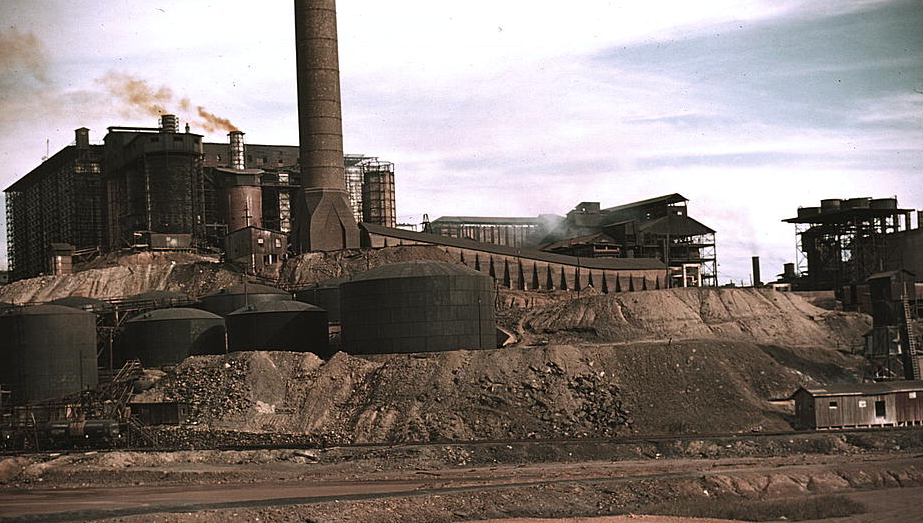
Copperhill, Tennessee — City — Copper mine and sulfuric acid plant, Copperhill, 1939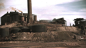 Location of Copperhill, Tennessee
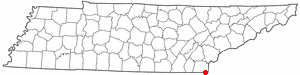
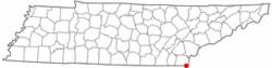
Coordinates: 34°59′32″N 84°22′27″W / 34.99222°N 84.37417°W Country United States State Tennessee County Polk Area – Total 1.9 sq mi (5.0 km2) – Land 1.9 sq mi (4.9 km2) – Water 0.0 sq mi (0.1 km2) Elevation 1,470 ft (448 m) Population (2000) – Total 511 – Density 271.9/sq mi (105.0/km2) Time zone Eastern (EST) (UTC-5) – Summer (DST) EDT (UTC-4) ZIP code 37317 Area code(s) 423 FIPS code 47-17000[1] GNIS feature ID 1281278[2] Copperhill is a city in Polk County, Tennessee, United States. The population was 511 at the 2000 census. It is included in the Cleveland, Tennessee Metropolitan Statistical Area.
Contents
Geography
Copperhill is located at 34°59′32″N 84°22′27″W / 34.99222°N 84.37417°W (34.992108, -84.374254)[3], situated in extreme southeast Tennessee, bordering northwest Georgia.
Its twin city is McCaysville, Georgia, with the two situated as a single town aligned along the northwestward-flowing river rather than the east/west state line, which cuts diagonally across streets (where it is marked with a blue line) and through buildings. The main street through town is Ocoee Street (Tennessee 68), which becomes Toccoa Street (Georgia 60) to the east-southeast in McCaysville. A truss bridge over the river at the state line links them to Blue Ridge Drive (Georgia 5) to the south-southwest.
Copperhill is the birthplace to the Ocoee River, and where the river changes names from the Toccoa River in Georgia to become the Ocoee in Tennessee. In 1990, a major flood struck the towns in the dark morning hours of February 16. Even after the flood recovery, the town still has a unique downtown business corridor that retains a flavor of yesteryear.
As a result of the state line, homes and businesses on the Copperhill side of town have area code 423, while those on the McCaysville side have area code 706.
According to the United States Census Bureau, the city has a total area of 1.9 square miles (4.9 km2), of which, 1.9 square miles (4.9 km2) of it is land and 0.04 square miles (0.10 km2) of it (2.08%) is water.
Demographics
As of the census[1] of 2000, there were 511 people, 239 households, and 146 families residing in the city. The population density was 271.9 people per square mile (104.9/km²). There were 274 housing units at an average density of 145.8 per square mile (56.3/km²). The racial makeup of the city was 97.46% White, 0.20% Native American, and 2.35% from two or more races. Hispanic or Latino of any race were 0.98% of the population.
There were 239 households out of which 20.9% had children under the age of 18 living with them, 46.4% were married couples living together, 10.5% had a female householder with no husband present, and 38.5% were non-families. 34.7% of all households were made up of individuals and 18.4% had someone living alone who was 65 years of age or older. The average household size was 2.14 and the average family size was 2.73.
In the city the population was spread out with 18.2% under the age of 18, 8.4% from 18 to 24, 23.7% from 25 to 44, 29.4% from 45 to 64, and 20.4% who were 65 years of age or older. The median age was 44 years. For every 100 females there were 79.3 males. For every 100 females age 18 and over, there were 79.4 males.
The median income for a household in the city was $25,313, and the median income for a family was $28,365. Males had a median income of $23,125 versus $18,542 for females. The per capita income for the city was $15,677. About 8.7% of families and 10.7% of the population were below the poverty line, including 5.3% of those under age 18 and 14.7% of those age 65 or over.
See also
- Burra Burra Mine (Ducktown, Tennessee)
References
- ^ a b "American FactFinder". United States Census Bureau. http://factfinder.census.gov. Retrieved 2008-01-31.
- ^ "US Board on Geographic Names". United States Geological Survey. 2007-10-25. http://geonames.usgs.gov. Retrieved 2008-01-31.
- ^ "US Gazetteer files: 2010, 2000, and 1990". United States Census Bureau. 2011-02-12. http://www.census.gov/geo/www/gazetteer/gazette.html. Retrieved 2011-04-23.
External links
Coordinates: 34°59′32″N 84°22′27″W / 34.992108°N 84.374254°W
Municipalities and communities of Polk County, Tennessee Cities Copperhill | Ducktown

Town Unincorporated
communitiesDelano | Farner | Ocoee | Old Fort | Reliance | Turtletown
Categories:- Cities in Tennessee
- Populated places in Polk County, Tennessee
- Cleveland, Tennessee metropolitan area
Wikimedia Foundation. 2010.