- Burning Mountain
-
For the Alfred Coppel science fiction novel, see The Burning Mountain.For the Larry Niven fantasy novel Burning Mountain, see Larry Niven.
Burning Mountain Mount Wingen 
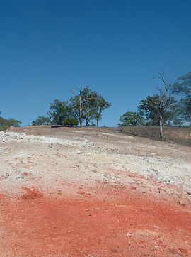
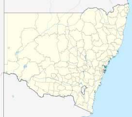
View of the summitElevation 520 m (1,706 ft) [1] Prominence 120 m (394 ft) [1] Location New South Wales, Australia Coordinates 31°51′54″S 150°54′04″E / 31.865°S 150.90111°ECoordinates: 31°51′54″S 150°54′04″E / 31.865°S 150.90111°E[2] Topo map Murrurundi 9034 (1:100000)
Murrurundi 90324N (1:25000)Climbing Easiest route walking track Burning Mountain, the common name for Mount Wingen, is a hill near Wingen, New South Wales, Australia, approximately 224 kilometres (139 mi) north of Sydney just off the New England Highway.[2] It takes its name from a smouldering coal seam running underground through the sandstone. Burning Mountain is contained within the Burning Mountain Nature Reserve, which is administered by the NSW National Parks and Wildlife Service (NPWS).[3][4]
A trail runs from the Park carpark to the site where smoke emanates from the ground and includes information panels.
The scientific estimate is that the fire has burned for approximately 6,000 years and is the oldest known coal fire.[5] Original explorers and settlers to the area believed that the smoke coming from the ground was volcanic in origin. The fire is moving in a generally southerly direction at a rate of about one metre per year.
See also
References
- ^ a b Topographic map MURRURUNDI 90324N
- ^ a b "Geographical Names Register Extract: Burning Mountain". Geographical Names Register (GNR) of NSW. Geographical Names Board of New South Wales. http://www.gnb.nsw.gov.au/name_search/extract?id=KWjLlMWAIt. Retrieved 30 January 2011.
- ^ "Geographical Names Register Extract: Burning Mountain Nature Reserve". Geographical Names Register (GNR) of NSW. Geographical Names Board of New South Wales. http://www.gnb.nsw.gov.au/name_search/extract?id=KWjLlMqbGH. Retrieved 30 January 2011.
- ^ "Burning Mountain Nature Reserve". Department of Environment, Climate Change & Water. http://www.environment.nsw.gov.au/nationalparks/parkHome.aspx?id=N0503. Retrieved 30 January 2011.
- ^ Krajick, Kevin (May 2005). "Fire in the hole". Smithsonian magazine (Smithsonian Institution): 54ff. http://www.smithsonianmag.com/issues/2005/may/firehole.php. Retrieved 24 October 2006.
Towns, suburbs and localities of Upper Hunter Shire | Hunter Region | New South Wales Towns, suburbs
& localitiesAberdeen • Belltrees • Blairmore • Blandford • Bow • Brawboy • Brushy Hill • Bunnan • Cassilis • Cliftlands • Crawney • Cuan • Dangarfield • Dartbrook • Dartbrook Upper • Davis Creek • Dry Creek • Ellerston • Glenbawn • Glenbawn Dam • Glenrock • Green Creek • Gundibri • Gundy • Gungal • Hunter Springs • Kars Springs • Kiernans Creek • Kingdom Ponds • Lake Glenbawn • Merriwa • Middle Brook • Moobi • Moonan Brook • Moonan Flat • Murrurundi • Murulla • Murulla North • Niangala • Omadale • Omadale Brook • Owens Gap • Pages Creek • Pages River • Parkville • Red Bank • Ridgelands • Rossgole • Rouchel • Rouchel Brook • Sandy Creek • Satur • Scone • Scotts Creek • Segenhoe • Sparks Creek • St Aubins • Stewarts Brook • Stirling Vale • Thompsons Creek • Thornthwaite • Timor • Tinagroo • Togar • Tomalla • Tooloogan • Turanville • Turill • Upper Rouchel • Waverley • Waverly • Wingen • Woolooma • Yarramoor
Other places &
points of interestBurning Mountain • Glenbawn Dam • Hunter River • Scone Airport • Towarri National Park
Significant places and items of interest in the Hunter Region of New South Wales Commerce and industry IndustryDarley Stud • Hunter Valley Coal Chain • Hunter Valley wine • Kia-Ora stud • Kooragang Island • Newcastle Port Corporation • Tomago aluminium smelterShoppingOtherEducation PrimarySecondaryAll Saints College, St Joseph's Campus • Avondale School • Hunter School of the Performing Arts • Hunter Valley Grammar School • Irrawang High School • Lambton High School • Maitland Grossmann High School • Maitland High School • Merewether High School • Newcastle Grammar School • Newcastle High School • Rutherford Technology High School • Tomaree High SchoolTertiaryEntertainment, sport & culture Broadmeadow Basketball Stadium • Dungog Film Festival • Hunter Valley Steamfest • Newcastle Civic Theatre • Newcastle Entertainment Centre • Newcastle International Sports Centre • Newcastle Number 1 Sports Ground • Newcastle Regional ShowGeography GeneralBroughton Island • Burning Mountain • Cape Hawke • Glenrock Lagoon • Lake Macquarie • Myall Lakes • Mount Royal Range • Mount Sugarloaf • Port Stephens • Stockton Beach • Tops to Myall Heritage TrailNational parksBarrington Tops National Park • Black Bulga State Conservation Area • Booti Booti National Park • Ghin-Doo-Ee National Park • Mount Royal National Park • Myall Lakes National Park • Tomaree National Park • Towarri National Park • Wallingat National Park • Watagans National Park • Werakata National ParkRiversAvon River • Barrington River • Chichester River • Gloucester River • Goulburn River • Hunter River • Karuah River • Manning River • Myall River • Pages River • Paterson River • Williams RiverHistorical Air transportDefenceEducationGeneralHistory of Newcastle, New South Wales • Hunter Valley cannabis infestation • Lake Macquarie Petrified Forest • Maitland Gaol • Nobbys Head • Royal Newcastle Hospital • Tahlee historic propertyIndustryCockle Creek Power Station • Cockle Creek Smelter • South Maitland coalfields • South Waratah Colliery • State Dockyard • Teralba Colliery • Walka Water Works • Wangi Power StationMaritimeNatural disasters1989 Newcastle earthquake • June 2007 Hunter Region and Central Coast storms • Seaham bushfires (1939)PeopleRailGeneralHunter Valley Railway Trust • Hunter Valley Steamfest • Murulla rail accidentRailway linesBelmont railway line • East Maitland – Morpeth railway line • Fernleigh Track • Richmond Vale Railway • South Maitland Railway • Toronto railway lineRailway stationsTramsWine makingWorld War IINo. 2 Fighter Sector RAAF • No. 208 Radar Station RAAF • HMAS Assault • Belmont Anti-Tank Ditch • Lake Macquarie anti-submarine boom • Newcastle Covering Force • RAAF Base Rathmines • Shelling of NewcastleInfrastructure TransportRoadBus routes in Newcastle, New South Wales • Bucketts Way • Golden Highway • Hunter Expressway • New England Highway • Newcastle Inner City Bypass • Pacific Highway • Putty Road • Sydney-Newcastle Freeway • Tea Gardens-Hawks Nest Bridge • Thunderbolts WayRailway linesHunter • Main North • Newcastle and Central CoastRailway stationsAberdeen • Adamstown • Awaba • Beresfield • Booragul • Branxton • Broadmeadow • Cardiff • Civic • Cockle Creek • Dora Creek • Dungog • East Maitland • Fassifern • Glendale • Greta • Hamilton • Hexham • High Street • Hilldale • Kotara • Lochinvar • Maitland • Martins Creek • Metford • Mindaribba • Morisset • Muswellbrook • Newcastle • Paterson • Sandgate • Scone • Singleton • Tarro • Telarah • Teralba • Thornton • Victoria Street • Wallarobba • Warabrook • Waratah • Wickham • Wirragulla • WyeeAirUtilitiesElectricity generationBayswater Power Station • Eraring Power Station • Lake Liddell • Liddell Power Station • Redbank Power Station • Teralba Colliery • Vales Point Power StationWater supplyMedia Other DefenceGeneralHospitalsCategories:- Geography of New South Wales
- Hunter Region, New South Wales
- Mountains of New South Wales
- Geology of New South Wales
Wikimedia Foundation. 2010.

