- Dellroy, Ohio
-
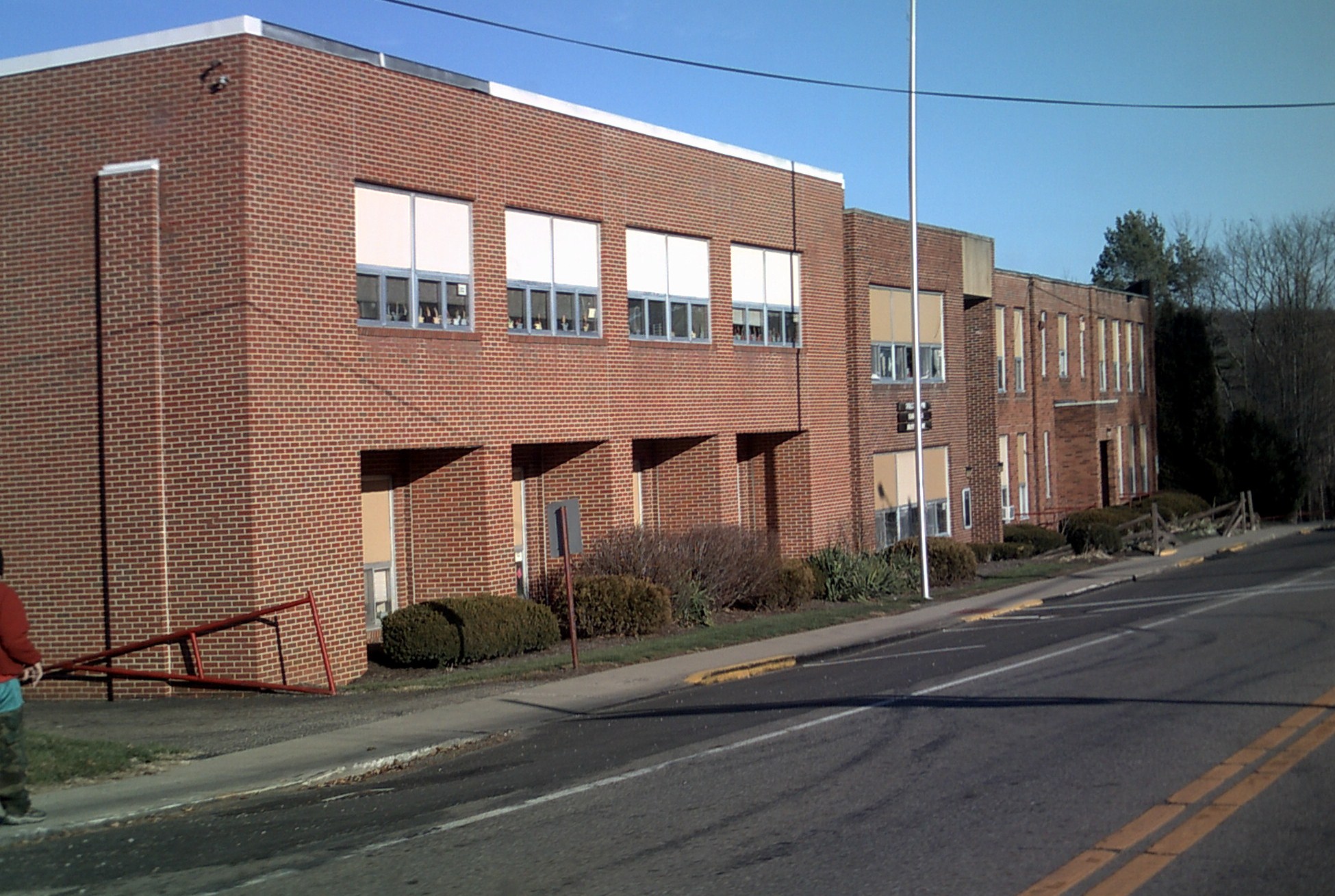
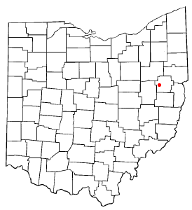
Dellroy, Ohio — Village — Dellroy Elementary serves the community.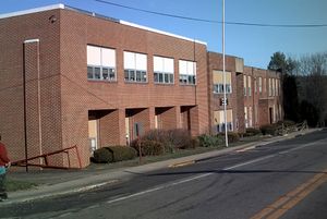 Location of Dellroy, Ohio
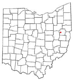
Coordinates: 40°33′19″N 81°11′58″W / 40.55528°N 81.19944°WCoordinates: 40°33′19″N 81°11′58″W / 40.55528°N 81.19944°W Country United States State Ohio County Carroll Area – Total 0.2 sq mi (0.5 km2) – Land 0.2 sq mi (0.4 km2) – Water 0.0 sq mi (0.1 km2) Elevation[1] 958 ft (292 m) Population (2000) – Total 294 – Density 1,714.8/sq mi (662.1/km2) Time zone Eastern (EST) (UTC-5) – Summer (DST) EDT (UTC-4) ZIP code 44620 Area code(s) 330 FIPS code 39-21560[2] GNIS feature ID 1064525[1] Dellroy is a village in Carroll County, Ohio, United States. The population was 294 at the 2000 census. It is part of the Canton–Massillon Metropolitan Statistical Area.
Contents
History
The village was established in 1849 as "Cannonsburg."[3] It was renamed around 1878 to Dellroy. The origin of the name "Dellroy" is disputed.
Geography
Dellroy is located at 40°33′19″N 81°11′58″W / 40.55528°N 81.19944°W (40.555227, -81.199436)[4].
According to the United States Census Bureau, the village has a total area of 0.2 square miles (0.52 km2), of which, 0.2 square miles (0.52 km2) of it is land and 0.04 square miles (0.10 km2) of it (19.05%) is water.
Dellroy lies at the junction of State Routes 39 and 542.
Demographics
As of the census[2] of 2000, there were 294 people, 121 households, and 83 families residing in the village. The population density was 1,714.8 people per square mile (667.7/km²). There were 130 housing units at an average density of 758.2 per square mile (295.3/km²). The racial makeup of the village was 99.32% White, 0.34% Native American and 0.34% Pacific Islander.
There were 121 households out of which 32.2% had children under the age of 18 living with them, 56.2% were married couples living together, 10.7% had a female householder with no husband present, and 30.6% were non-families. 28.9% of all households were made up of individuals and 12.4% had someone living alone who was 65 years of age or older. The average household size was 2.43 and the average family size was 3.00.
In the village the population was spread out with 26.2% under the age of 18, 7.1% from 18 to 24, 29.6% from 25 to 44, 19.0% from 45 to 64, and 18.0% who were 65 years of age or older. The median age was 38 years. For every 100 females there were 90.9 males. For every 100 females age 18 and over, there were 90.4 males.
The median income for a household in the village was $27,344, and the median income for a family was $31,875. Males had a median income of $27,292 versus $20,833 for females. The per capita income for the village was $15,149. About 8.8% of families and 9.1% of the population were below the poverty line, including 7.4% of those under the age of eighteen and 3.6% of those sixty five or over.
Government
Historical populations Census Pop. %± 1880 664 — 1890 511 −23.0% 1900 400 −21.7% 1910 373 −6.8% 1920 338 −9.4% 1930 342 1.2% 1940 335 −2.0% 1950 358 6.9% 1960 391 9.2% 1970 363 −7.2% 1990 314 — 2000 294 −6.4% 2010 356 21.1% [5] The current office holders and end of their terms are [6]
Mayor:
- Robert A. Smith December 31, 2011
Clerk-Treasurer
- Amy Graham March 31, 2012
Council
- R. Kenneth Shevlin December 31, 2009,
- Joe Mabie December 31, 2009,
- Christopher Modranski December 31, 2009,
- B. Kay Onstott December 31, 2009,
- Tim Barnhouse December 31, 2011,
- Michael E. Ruby December 31, 2011
Education
Students[7] attend the Carrollton Exempted Village School District including the Dellroy Elementary School.[8]
Notable natives and residents
- Vince Costello - former American football linebacker
References
- ^ a b "US Board on Geographic Names". United States Geological Survey. 2007-10-25. http://geonames.usgs.gov. Retrieved 2008-01-31.
- ^ a b "American FactFinder". United States Census Bureau. http://factfinder.census.gov. Retrieved 2008-01-31.
- ^ Dellroy History in Pictures, page 30, and Illustrated Historical Atlas of Carroll County, Ohio, from Recent and Actual Surveys and Records.
- ^ "US Gazetteer files: 2010, 2000, and 1990". United States Census Bureau. 2011-02-12. http://www.census.gov/geo/www/gazetteer/gazette.html. Retrieved 2011-04-23.
- ^ census data: 1880 : Howe, Henry (1907). Historical Collections of Ohio, The Ohio Centennial Edition. The State of Ohio. p. 365. http://books.google.com/books?id=OXIOAAAAIAAJ&pg=PA365. , 1890,1900 : Hunt, William C. (1901). Population of the United States by states and territories, counties, and minor Civil Divisions, as returned at the Twelfth Census: 1900. United States Census Printing Office. p. 306. http://books.google.com/books?id=Pnk9AAAAYAAJ&pg=PA306. , 1910, 1920, 1930 : 1930 page 40 , 1940, 1950 : 1950 page 14 , 1960 : 1960 page 16 , 1970 : 1970 page=124 , 1990: 1990 , 2000 : 2000, 2010 : [1]
- ^ Carroll County Website
- ^ PUC Ohio map of School Districts
- ^ Dellroy School website
External links
Municipalities and communities of Carroll County, Ohio Villages Carrollton | Dellroy | Leesville | Magnolia‡ | Malvern | Minerva‡ | Sherrodsville

Townships Unincorporated
communitiesAugusta | Harlem Springs | Kilgore | Leavittsville | Lindentree | Mechanicstown | Morges | New Harrisburg | Pattersonville | Petersburg | Scroggsfield | Wattsville
Footnotes ‡This populated place also has portions in an adjacent county or counties
Categories:- Villages in Ohio
- Populated places in Carroll County, Ohio
- Canton–Massillon metropolitan area

Wikimedia Foundation. 2010.